
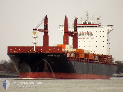
CAPE ALTIUS
Cargo
Current Trip
| Time Travelled | 5 days |
|---|---|
| Remaining Time | --- |
| Distance Travelled | 1503.02 nm |
| Remaining Distance | 3.66 nm |
| AVG Speed | 12.2 Knots |
| MAX Speed | 16.8 Knots |
| AVG Wind | 14.4 knots |
| MAX Wind | 41.1 knots |
| MIN Temp | 24.3°C / 75.74°F |
| MAX Temp | 28.8°C / 83.84°F |
| Draught | 10 m |
| Position Received | Now |
Current Position
| Longitude | -69.59479° |
|---|---|
| Latitude | 18.37877° |
| Status | Under way using engine |
| Speed | 0.7 Knots |
| Course | 64° |
| Area | Caribbean Sea |
| Station | T-AIS |
| Position Received | Now |
Info
Information
The current position of CAPE ALTIUS is in Caribbean Sea with coordinates 18.37877° / -69.59479° as reported on 2024-04-18 21:43 by AIS to our vessel tracker app. The vessel's current speed is 0.7 Knots and is heading at the port of BOCA CHIKA. The estimated time of arrival as calculated by MyShipTracking vessel tracking app is 2024-04-18 19:30 LT
The vessel CAPE ALTIUS (IMO: 9848730, MMSI: 209888000) is a Cargo It's sailing under the flag of [CY] Cyprus.
In this page you can find informations about the vessels current position, last detected port calls, and current voyage information. If the vessels is not in coverage by AIS you will find the latest position.
The current position of CAPE ALTIUS is detected by our AIS receivers and we are not responsible for the reliability of the data. The last position was recorded while the vessel was in Coverage by the Ais receivers of our vessel tracking app.
The current draught of CAPE ALTIUS as reported by AIS is 10 meters
Weather
| Temperature | 28.7°C / 83.66°F |
|---|---|
| Wind Speed | 10 knots |
| Direction | 36° NE |
| Pressure | 1011.2 hPa |
| Humidity | 57.3 % |
| Cloud Coverage | 96 % |
Featured Company
Last Port Calls
| Port | Arrival | Departure | Time In Port |
|---|---|---|---|
| 2024-04-12 14:19 | 2024-04-12 23:03 | 8 h | |
| 2024-04-08 13:47 | 2024-04-09 05:27 | 15 h | |
| 2024-04-04 08:17 | 2024-04-05 04:13 | 19 h | |
| 2024-04-01 07:00 | 2024-04-02 06:46 | 23 h | |
| 2024-03-21 01:37 | 2024-03-22 00:50 | 23 h | |
| 2024-03-19 13:30 | 2024-03-20 12:46 | 23 h | |
| 2024-03-17 01:16 | 2024-03-17 14:29 | 13 h | |
| 2024-03-15 05:03 | 2024-03-15 17:28 | 12 h | |
| 2024-03-13 16:18 | 2024-03-14 15:42 | 23 h | |
| 2024-02-29 13:19 | 2024-03-01 10:55 | 21 h |
Most Visited Ports (Last year)
| Port | Arrivals | |
|---|---|---|
| 9 | ||
| 6 | ||
| 5 | ||
| 5 | ||
| 5 | ||
| 5 |
Last Trips
| Origin | Departure | Destination | Arrival | Distance | |
|---|---|---|---|---|---|
| 2024-04-09 00:27 | 2024-04-12 09:19 | 449.76 nm | |||
| 2024-04-05 00:13 | 2024-04-08 08:47 | 1283.27 nm | |||
| 2024-04-02 03:46 | 2024-04-04 04:17 | 755.94 nm | |||
| 2024-03-22 01:50 | 2024-04-01 04:00 | 3541.34 nm | |||
| 2024-03-20 13:46 | 2024-03-21 02:37 | 106.00 nm | |||
| 2024-03-17 15:29 | 2024-03-19 14:30 | 336.03 nm | |||
| 2024-03-15 17:28 | 2024-03-17 02:16 | 426.92 nm | |||
| 2024-03-14 16:42 | 2024-03-15 05:03 | 180.84 nm | |||
| 2024-03-01 06:55 | 2024-03-13 17:18 | 4078.94 nm | |||
| 2024-02-23 21:20 | 2024-02-29 09:19 | 1467.92 nm |
Events
| Time | Event | Details | Position / Dest | Info |
|---|---|---|---|---|
| 2024-04-18 15:54 | Status Changed | Under way using engine Default |
18.33181 / -69.63034
DOCAU
|
Speed: 6 kn Course: 65° |
| 2024-04-18 15:42 | Status Changed | Default Under way using engine |
18.32167 / -69.64667
DOCAU
|
Speed: 5.9 kn Course: 65.4° |
| 2024-04-18 14:09 | ETA Changed | 2024/04/18 19:30 2024/04/18 16:30 |
18.25115 / -69.82130
DOCAU
|
Speed: 11.6 kn Course: 68.9° |
| 2024-04-18 13:04 | Draught Changed | 10 8.7 |
18.13853 / -70.01368
DOCAU
|
Speed: 12.7 kn Course: 58.2° |
| 2024-04-18 13:04 | Destination Changed | DOCAU CRMOB |
18.13853 / -70.01368
DOCAU
|
Speed: 12.7 kn Course: 58.2° |
| 2024-04-18 13:04 | ETA Changed | 2024/04/18 16:30 2024/04/15 01:00 |
18.13853 / -70.01368
DOCAU
|
Speed: 12.7 kn Course: 58.2° |
| 2024-04-18 13:02 | Change Sea Area | Domican Republic part of the Caribbean Sea Colombian part of the Caribbean Sea |
18.13355 / -70.02207
Caribbean Sea
|
Speed: 12.7 kn Course: 58.4° |
| 2024-04-18 13:00 | Status Changed | Under way using engine Default |
18.13072 / -70.02686
CRMOB
|
Speed: 12.9 kn Course: 58° |
| 2024-04-18 12:56 | IN Coverage |
18.13355 / -70.02207
Caribbean Sea
|
Speed: 12.7 kn Course: 58.4° |
|
| 2024-04-15 20:56 | START Moving | 0.4 nm, West of MOIN |
10.00584 / -83.08543
CRMOB
|
Speed: 3.2 kn Course: 279° |