
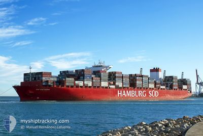
CAP SAN SOUNIO
Cargo
Current Trip
| Time Travelled | 6 days |
|---|---|
| Remaining Time | --- |
| Distance Travelled | 2719.17 nm |
| Remaining Distance | --- |
| AVG Speed | 18 Knots |
| MAX Speed | 19.1 Knots |
| AVG Wind | 10.2 knots |
| MAX Wind | 26.2 knots |
| MIN Temp | 21°C / 69.8°F |
| MAX Temp | 29.4°C / 84.92°F |
| Draught | 14.3 m |
| Position Received | 5 d ago |
Current Position
| Longitude | -42.32419° |
|---|---|
| Latitude | -23.49836° |
| Status | Under way using engine |
| Speed | 17.7 Knots |
| Course | 57.1° |
| Area | South Atlantic Ocean |
| Station | T-AIS |
| Position Received | 5 d ago |
Info
Information
The current position of CAP SAN SOUNIO is in South Atlantic Ocean with coordinates -23.49836° / -42.32419° as reported on 2024-04-18 20:31 by AIS to our vessel tracker app. The vessel's current speed is 17.7 Knots and is heading at the port of TANGER MED. The estimated time of arrival as calculated by MyShipTracking vessel tracking app is 2024-04-28 15:00 LT
The vessel CAP SAN SOUNIO (IMO: 9633953, MMSI: 372723000) is a Cargo It's sailing under the flag of [PA] Panama.
In this page you can find informations about the vessels current position, last detected port calls, and current voyage information. If the vessels is not in coverage by AIS you will find the latest position.
The current position of CAP SAN SOUNIO is detected by our AIS receivers and we are not responsible for the reliability of the data. The last position was recorded while the vessel was in Coverage by the Ais receivers of our vessel tracking app.
The current draught of CAP SAN SOUNIO as reported by AIS is 14.3 meters
Weather
| Temperature | 23.1°C / 73.58°F |
|---|---|
| Wind Speed | 9 knots |
| Direction | 21° NNE |
| Pressure | 1014.4 hPa |
| Humidity | 77.6 % |
| Cloud Coverage | 91 % |
Featured Company
Last Port Calls
| Port | Arrival | Departure | Time In Port |
|---|---|---|---|
| 2024-04-16 15:28 | 2024-04-18 05:18 | 1 d | |
| 2024-04-09 13:22 | 2024-04-10 17:45 | 1 d | |
| 2024-04-06 14:46 | 2024-04-07 16:50 | 1 d | |
| 2024-04-03 17:18 | 2024-04-04 15:50 | 22 h | |
| 2024-03-30 02:34 | 2024-03-31 05:05 | 1 d | |
| 2024-03-18 12:05 | 2024-03-19 13:53 | 1 d | |
| 2024-03-13 00:34 | 2024-03-14 22:11 | 1 d | |
| 2024-03-09 16:52 | 2024-03-10 20:56 | 1 d | |
| 2024-03-08 02:01 | 2024-03-09 06:33 | 1 d | |
| 2024-03-06 07:00 | 2024-03-06 22:19 | 15 h |
Most Visited Ports (Last year)
| Port | Arrivals | |
|---|---|---|
| 12 | ||
| 11 | ||
| 6 | ||
| 6 | ||
| 6 | ||
| 6 |
Last Trips
| Origin | Departure | Destination | Arrival | Distance | |
|---|---|---|---|---|---|
| 2024-04-10 14:45 | 2024-04-16 12:28 | 1048.85 nm | |||
| 2024-04-07 13:50 | 2024-04-09 10:22 | 148.51 nm | |||
| 2024-04-04 12:50 | 2024-04-06 11:46 | 791.19 nm | |||
| 2024-03-31 02:05 | 2024-04-03 14:18 | 193.03 nm | |||
| 2024-03-19 13:53 | 2024-03-29 23:34 | 4420.93 nm | |||
| 2024-03-14 23:11 | 2024-03-18 12:05 | 1422.79 nm | |||
| 2024-03-10 21:56 | 2024-03-13 01:34 | 371.19 nm | |||
| 2024-03-09 07:33 | 2024-03-09 17:52 | 136.18 nm | |||
| 2024-03-06 22:19 | 2024-03-08 03:01 | 434.38 nm | |||
| 2024-03-02 23:40 | 2024-03-06 07:00 | 254.89 nm |
Events
| Time | Event | Details | Position / Dest | Info |
|---|---|---|---|---|
| 2024-04-18 20:43 | Status Changed | Default Under way using engine |
-23.46467 / -42.26780
MAPTM
|
Speed: 17.7 kn Course: 57.1° |
| 2024-04-18 20:31 | Status Changed | Under way using engine Default |
-23.49836 / -42.32419
MAPTM
|
Speed: 17.7 kn Course: 58° |
| 2024-04-18 20:31 | OUT of Coverage |
-23.49836 / -42.32419
South Atlantic Ocean
MAPTM
|
Speed: 17.7 kn Course: 57.1° |
|
| 2024-04-18 19:55 | Status Changed | Default Under way using engine |
-23.59199 / -42.48614
MAPTM
|
Speed: 17.4 kn Course: 72.8° |
| 2024-04-18 19:32 | Status Changed | Under way using engine Default |
-23.64650 / -42.59348
MAPTM
|
Speed: 17.3 kn Course: 73° |
| 2024-04-18 19:16 | IN Coverage |
-23.64650 / -42.59348
South Atlantic Ocean
MAPTM
|
Speed: 17.4 kn Course: 72.8° |
|
| 2024-04-18 18:10 | Status Changed | Default Under way using engine |
-23.74334 / -43.00725
MAPTM
|
Speed: 17.5 kn Course: 73.9° |
| 2024-04-18 18:08 | OUT of Coverage |
-23.74587 / -43.01682
South Atlantic Ocean
MAPTM
|
Speed: 17.5 kn Course: 73.9° |
|
| 2024-04-18 18:06 | Status Changed | Under way using engine Default |
-23.74836 / -43.02659
MAPTM
|
Speed: 17.5 kn Course: 75° |
| 2024-04-18 17:58 | Status Changed | Default Under way using engine |
-23.76001 / -43.07138
MAPTM
|
Speed: 17.5 kn Course: 74.7° |