
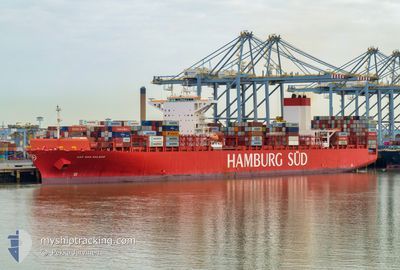
CAP SAN MALEAS
Container Ship
Current Trip
| Time Travelled | 10 days |
|---|---|
| Remaining Time | 2 h, 14 mins |
| Distance Travelled | 4374.79 nm |
| Remaining Distance | 40.92 nm |
| AVG Speed | 16.5 Knots |
| MAX Speed | 18.7 Knots |
| AVG Wind | 13.3 knots |
| MAX Wind | 36 knots |
| MIN Temp | 13.9°C / 57.02°F |
| MAX Temp | 29.8°C / 85.64°F |
| Draught | 11 m |
| Position Received | 7 h, 47 m ago |
Current Position
| Longitude | -43.64879° |
|---|---|
| Latitude | -23.92989° |
| Status | Under way using engine |
| Speed | 16.9 Knots |
| Course | 258.9° |
| Area | South Atlantic Ocean |
| Station | T-AIS |
| Position Received | 7 h, 47 m ago |
Info
Information
The current position of CAP SAN MALEAS is in South Atlantic Ocean with coordinates -23.92989° / -43.64879° as reported on 2024-04-19 13:06 by AIS to our vessel tracker app. The vessel's current speed is 16.9 Knots and is heading at the port of SANTOS. The estimated time of arrival as calculated by MyShipTracking vessel tracking app is 2024-04-19 23:08 LT
The vessel CAP SAN MALEAS (IMO: 9633941, MMSI: 353365000) is a Container Ship that was built in 2014 ( 10 years old ). It's sailing under the flag of [PA] Panama.
In this page you can find informations about the vessels current position, last detected port calls, and current voyage information. If the vessels is not in coverage by AIS you will find the latest position.
The current position of CAP SAN MALEAS is detected by our AIS receivers and we are not responsible for the reliability of the data. The last position was recorded while the vessel was in Coverage by the Ais receivers of our vessel tracking app.
The current draught of CAP SAN MALEAS as reported by AIS is 11 meters
Weather
| Temperature | 23.1°C / 73.58°F |
|---|---|
| Wind Speed | 7 knots |
| Direction | 124° SE |
| Pressure | 1018.2 hPa |
| Humidity | 66.5 % |
| Cloud Coverage | --- |
Featured Company
Last Port Calls
| Port | Arrival | Departure | Time In Port |
|---|---|---|---|
| 2024-04-08 09:07 | 2024-04-08 22:15 | 13 h | |
| 2024-02-19 04:16 | |||
| 2024-02-10 04:04 | 2024-02-19 03:36 | 8 d |
Most Visited Ports (Last year)
| Port | Arrivals | |
|---|---|---|
| 10 | ||
| 10 | ||
| 5 | ||
| 5 | ||
| 4 | ||
| 4 |
Events
| Time | Event | Details | Position / Dest | Info |
|---|---|---|---|---|
| 2024-04-19 13:26 | Status Changed | Default Under way using engine |
-23.95075 / -43.74517
BRSSZ
|
Speed: 16.9 kn Course: 258.9° |
| 2024-04-19 13:06 | OUT of Coverage |
-23.92989 / -43.64879
South Atlantic Ocean
BRSSZ
|
Speed: 16.9 kn Course: 258.9° |
|
| 2024-04-19 12:47 | Status Changed | Under way using engine Default |
-23.91049 / -43.55135
BRSSZ
|
Speed: 16.7 kn Course: 256° |
| 2024-04-19 12:24 | Status Changed | Default Under way using engine |
-23.88716 / -43.44076
BRSSZ
|
Speed: 16.7 kn Course: 251.5° |
| 2024-04-19 10:53 | Status Changed | Under way using engine Default |
-23.76823 / -43.00601
BRSSZ
|
Speed: 16.9 kn Course: 254° |
| 2024-04-19 10:50 | IN Coverage |
-23.77197 / -43.02006
South Atlantic Ocean
BRSSZ
|
Speed: 16.5 kn Course: 254.2° |
|
| 2024-04-19 09:35 | Status Changed | Default Under way using engine |
-23.64514 / -42.63994
BRSSZ
|
Speed: 16.2 kn Course: 246.3° |
| 2024-04-19 09:27 | Status Changed | Under way using engine Default |
-23.63184 / -42.60587
BRSSZ
|
Speed: 16.4 kn Course: 246° |
| 2024-04-19 09:27 | IN Coverage |
-23.63184 / -42.60587
South Atlantic Ocean
BRSSZ
|
Speed: 16.2 kn Course: 246.3° |
|
| 2024-04-19 09:27 | OUT of Coverage |
-23.63184 / -42.60587
South Atlantic Ocean
BRSSZ
|
Speed: 16.2 kn Course: 246.3° |