
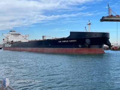
CAP CORPUS CHRISTI
Tanker
Current Trip
| Time Travelled | 23 days |
|---|---|
| Remaining Time | --- |
| Distance Travelled | 2928.06 nm |
| Remaining Distance | --- |
| AVG Speed | 7.6 Knots |
| MAX Speed | 14 Knots |
| AVG Wind | 15.3 knots |
| MAX Wind | 33.3 knots |
| MIN Temp | 5°C / 41°F |
| MAX Temp | 28.7°C / 83.66°F |
| Draught | 12.1 m |
| Position Received | 5 m ago |
Current Position
| Longitude | -93.60410° |
|---|---|
| Latitude | 29.39642° |
| Status | At anchor |
| Speed | |
| Course | 125° |
| Area | Gulf of Mexico |
| Station | T-AIS |
| Position Received | 5 m ago |
Info
Information
The current position of CAP CORPUS CHRISTI is in Gulf of Mexico with coordinates 29.39642° / -93.60410° as reported on 2024-04-19 14:35 by AIS to our vessel tracker app. The vessel's current speed is 0 Knots
The vessel CAP CORPUS CHRISTI (IMO: 9829813, MMSI: 241612000) is a Tanker It's sailing under the flag of [GR] Greece.
In this page you can find informations about the vessels current position, last detected port calls, and current voyage information. If the vessels is not in coverage by AIS you will find the latest position.
The current position of CAP CORPUS CHRISTI is detected by our AIS receivers and we are not responsible for the reliability of the data. The last position was recorded while the vessel was in Coverage by the Ais receivers of our vessel tracking app.
The current draught of CAP CORPUS CHRISTI as reported by AIS is 12.1 meters
Weather
| Temperature | 22.9°C / 73.22°F |
|---|---|
| Wind Speed | 7 knots |
| Direction | 159° SSE |
| Pressure | 1016.6 hPa |
| Humidity | 93.1 % |
| Cloud Coverage | 100 % |
Featured Company
Last Port Calls
| Port | Arrival | Departure | Time In Port |
|---|---|---|---|
| 2024-03-26 15:50 | 2024-03-27 00:56 | 9 h | |
| 2024-03-20 04:54 | 2024-03-21 05:30 | 1 d | |
| 2024-02-24 12:45 | 2024-02-26 15:37 | 2 d | |
| 2024-02-11 01:29 | 2024-02-13 02:47 | 2 d |
Most Visited Ports (Last year)
| Port | Arrivals | |
|---|---|---|
| 6 | ||
| 1 | ||
| 1 | ||
| 1 | ||
| 1 | ||
| 1 |
Last Trips
| Origin | Departure | Destination | Arrival | Distance | |
|---|---|---|---|---|---|
| 2024-03-21 03:00 | 2024-03-26 11:50 | 1050.88 nm | |||
| 2024-02-26 09:37 | 2024-03-20 02:24 | 4228.35 nm | |||
| 2024-02-12 20:47 | 2024-02-24 06:45 | 325.03 nm | |||
| 2024-01-28 08:27 | 2024-02-10 19:29 | 1328.17 nm |
Events
| Time | Event | Details | Position / Dest | Info |
|---|---|---|---|---|
| 2024-04-19 11:50 | Status Changed | At anchor Default |
29.39594 / -93.60430
USPOA
|
Speed: Course: 118° |
| 2024-04-19 11:47 | Status Changed | Default At anchor |
29.39595 / -93.60424
USPOA
|
Speed: Course: 120° |
| 2024-04-19 09:41 | Status Changed | At anchor Default |
29.39656 / -93.60429
USPOA
|
Speed: Course: 125° |
| 2024-04-19 09:38 | Status Changed | Default At anchor |
29.39650 / -93.60427
USPOA
|
Speed: Course: 124° |
| 2024-04-19 09:08 | Status Changed | At anchor Default |
29.39647 / -93.60429
USPOA
|
Speed: Course: 124° |
| 2024-04-19 09:05 | Status Changed | Default At anchor |
29.39646 / -93.60426
USPOA
|
Speed: Course: 125° |
| 2024-04-19 03:26 | Status Changed | At anchor Default |
29.39646 / -93.60431
USPOA
|
Speed: Course: 129° |
| 2024-04-19 03:20 | Status Changed | Default At anchor |
29.39654 / -93.60423
USPOA
|
Speed: Course: 131° |
| 2024-04-19 02:02 | Status Changed | At anchor Default |
29.39628 / -93.60429
USPOA
|
Speed: Course: 127° |
| 2024-04-19 01:56 | Status Changed | Default At anchor |
29.39628 / -93.60425
USPOA
|
Speed: Course: 120° |