
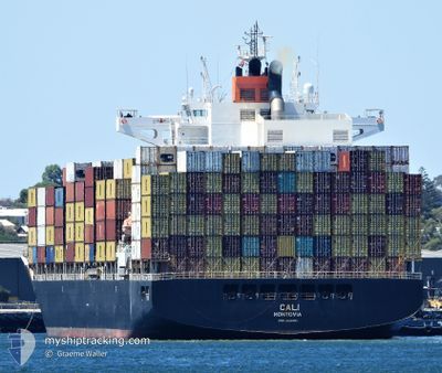
CALI
Cargo
Current Trip
| Time Travelled | 2 days |
|---|---|
| Remaining Time | 20 h, 8 mins |
| Distance Travelled | 1028.76 nm |
| Remaining Distance | 391.51 nm |
| AVG Speed | 17 Knots |
| MAX Speed | 20.1 Knots |
| AVG Wind | 11.2 knots |
| MAX Wind | 27.9 knots |
| MIN Temp | 14.5°C / 58.1°F |
| MAX Temp | 22.7°C / 72.86°F |
| Draught | 10.4 m |
| Position Received | 1 d ago |
Current Position
| Longitude | 118.95863° |
|---|---|
| Latitude | -35.54728° |
| Status | Under way using engine |
| Speed | 18.8 Knots |
| Course | 92° |
| Area | Indian Ocean |
| Station | T-AIS |
| Position Received | 1 d ago |
Info
Information
The current position of CALI is in Indian Ocean with coordinates -35.54728° / 118.95863° as reported on 2024-04-21 20:30 by AIS to our vessel tracker app. The vessel's current speed is 18.8 Knots and is heading at the port of ADELAIDE. The estimated time of arrival as calculated by MyShipTracking vessel tracking app is 2024-04-24 03:54 LT
The vessel CALI (IMO: 9631101, MMSI: 636015667) is a Cargo It's sailing under the flag of [LR] Liberia.
In this page you can find informations about the vessels current position, last detected port calls, and current voyage information. If the vessels is not in coverage by AIS you will find the latest position.
The current position of CALI is detected by our AIS receivers and we are not responsible for the reliability of the data. The last position was recorded while the vessel was in Coverage by the Ais receivers of our vessel tracking app.
The current draught of CALI as reported by AIS is 10.4 meters
Weather
| Temperature | 15°C / 59°F |
|---|---|
| Wind Speed | 21 knots |
| Direction | 194° SSW |
| Pressure | 1025.6 hPa |
| Humidity | 54.5 % |
| Cloud Coverage | 5 % |
Featured Company
Last Port Calls
| Port | Arrival | Departure | Time In Port |
|---|---|---|---|
| 2024-04-17 14:44 | 2024-04-20 21:13 | 3 d | |
| 2024-04-10 14:53 | 2024-04-11 02:13 | 11 h | |
| 2024-04-06 23:30 | 2024-04-08 08:22 | 1 d | |
| 2024-04-03 04:29 | 2024-04-04 06:45 | 1 d | |
| 2024-03-21 03:47 | 2024-03-22 23:21 | 1 d | |
| 2024-03-14 00:29 | 2024-03-15 15:49 | 1 d | |
| 2024-03-10 18:35 | 2024-03-12 18:21 | 1 d | |
| 2024-03-09 07:03 | 2024-03-10 01:51 | 18 h | |
| 2024-03-07 19:43 | 2024-03-08 21:08 | 1 d | |
| 2024-03-04 15:05 | 2024-03-05 23:23 | 1 d |
Most Visited Ports (Last year)
| Port | Arrivals | |
|---|---|---|
| 12 | ||
| 9 | ||
| 6 | ||
| 5 | ||
| 5 | ||
| 5 |
Last Trips
| Origin | Departure | Destination | Arrival | Distance | |
|---|---|---|---|---|---|
| 2024-04-11 09:13 | 2024-04-17 22:44 | 1844.20 nm | |||
| 2024-04-08 16:22 | 2024-04-10 21:53 | 595.90 nm | |||
| 2024-04-04 14:45 | 2024-04-07 07:30 | 99.70 nm | |||
| 2024-03-23 09:21 | 2024-04-03 12:29 | 3999.63 nm | |||
| 2024-03-16 04:49 | 2024-03-21 13:47 | 1772.43 nm | |||
| 2024-03-13 07:21 | 2024-03-14 13:29 | 222.62 nm | |||
| 2024-03-10 14:51 | 2024-03-11 07:35 | 175.05 nm | |||
| 2024-03-09 10:08 | 2024-03-09 20:03 | 129.91 nm | |||
| 2024-03-06 12:23 | 2024-03-08 08:43 | 651.23 nm | |||
| 2024-02-26 17:10 | 2024-03-05 04:05 | 1376.64 nm |
Events
| Time | Event | Details | Position / Dest | Info |
|---|---|---|---|---|
| 2024-04-21 20:34 | Status Changed | Default Under way using engine |
-35.54724 / 118.98668
AUADL
|
Speed: 18.8 kn Course: 92° |
| 2024-04-21 20:30 | OUT of Coverage |
-35.54728 / 118.95863
Indian Ocean
AUADL
|
Speed: 18.8 kn Course: 92° |
|
| 2024-04-21 15:10 | ETA Changed | 2024/04/24 06:30 2024/04/24 04:30 |
-35.55451 / 116.84912
AUADL
|
Speed: 20.2 kn Course: 81° |
| 2024-04-21 14:54 | Status Changed | Under way using engine Default |
-35.56985 / 116.74393
AUADL
|
Speed: 19.1 kn Course: 90° |
| 2024-04-21 14:47 | Status Changed | Default Under way using engine |
-35.57375 / 116.70251
AUADL
|
Speed: 19.1 kn Course: 91.7° |
| 2024-04-21 14:47 | Status Changed | Under way using engine Default |
-35.57372 / 116.69924
AUADL
|
Speed: 19.1 kn Course: 98° |
| 2024-04-21 14:36 | IN Coverage |
-35.57373 / 116.69989
Indian Ocean
AUADL
|
Speed: 19.1 kn Course: 91.7° |
|
| 2024-04-21 10:31 | Status Changed | Default Under way using engine |
-34.90020 / 115.40037
AUADL
|
Speed: 18.6 kn Course: 126.2° |
| 2024-04-21 10:25 | Status Changed | Under way using engine Default |
-34.88122 / 115.36671
AUADL
|
Speed: 18.6 kn Course: 123° |
| 2024-04-21 10:25 | OUT of Coverage |
-34.88122 / 115.36671
Indian Ocean
AUADL
|
Speed: 18.6 kn Course: 126.2° |