
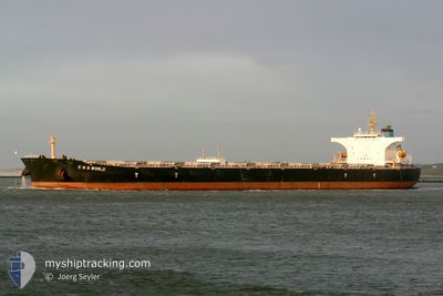
C H S WORLD
Bulk Carrier
Current Trip
BOFFA
| Time Travelled | 17 days |
|---|---|
| Remaining Time | --- |
| Distance Travelled | 4780.39 nm |
| Remaining Distance | --- |
| AVG Speed | 11 Knots |
| MAX Speed | 14.3 Knots |
| AVG Wind | 11.1 knots |
| MAX Wind | 26.3 knots |
| MIN Temp | 8.4°C / 47.12°F |
| MAX Temp | 30.3°C / 86.54°F |
| Draught | 9 m |
| Position Received | 7 d ago |
Current Position
| Longitude | 103.50315° |
|---|---|
| Latitude | 1.22140° |
| Status | Under way using engine |
| Speed | 13.3 Knots |
| Course | 285° |
| Area | Singapore Strait |
| Station | T-AIS |
| Position Received | 7 d ago |
Info
Information
The current position of C H S WORLD is in Singapore Strait with coordinates 1.22140° / 103.50315° as reported on 2024-04-15 16:04 by AIS to our vessel tracker app. The vessel's current speed is 13.3 Knots
The vessel C H S WORLD (IMO: 9369851, MMSI: 477087800) is a Bulk Carrier that was built in 2006 ( 18 years old ). It's sailing under the flag of [HK] Hong Kong.
In this page you can find informations about the vessels current position, last detected port calls, and current voyage information. If the vessels is not in coverage by AIS you will find the latest position.
The current position of C H S WORLD is detected by our AIS receivers and we are not responsible for the reliability of the data. The last position was recorded while the vessel was in Coverage by the Ais receivers of our vessel tracking app.
The current draught of C H S WORLD as reported by AIS is 9 meters
Weather
| Temperature | 27.9°C / 82.22°F |
|---|---|
| Wind Speed | 19 knots |
| Direction | 107° ESE |
| Pressure | 1009.6 hPa |
| Humidity | 76.7 % |
| Cloud Coverage | 100 % |
Featured Company
Last Port Calls
| Port | Arrival | Departure | Time In Port |
|---|---|---|---|
| 2024-04-04 02:23 | 2024-04-05 12:01 | 1 d | |
| 2024-04-02 15:25 | 2024-04-04 01:40 | 1 d | |
| 2024-02-13 07:56 | 2024-02-17 18:49 | 4 d |
Most Visited Ports (Last year)
| Port | Arrivals | |
|---|---|---|
| 2 | ||
| 2 | ||
| 2 | ||
| 1 | ||
| 1 | ||
| 1 |
Last Trips
| Origin | Departure | Destination | Arrival | Distance | |
|---|---|---|---|---|---|
| 2024-04-04 09:40 | 2024-04-04 10:23 | 5.99 nm | |||
| 2024-02-17 18:49 | 2024-04-02 23:25 | 8025.49 nm | |||
| 2024-01-03 07:55 | 2024-02-13 07:56 | 11325.46 nm |
Events
| Time | Event | Details | Position / Dest | Info |
|---|---|---|---|---|
| 2024-04-15 16:11 | Status Changed | Default Under way using engine |
1.22748 / 103.48045
BOFFA
|
Speed: 13.3 kn Course: 285° |
| 2024-04-15 16:04 | OUT of Coverage |
1.22140 / 103.50315
Singapore Strait
|
Speed: 13.3 kn Course: 285° |
|
| 2024-04-15 15:41 | Change Sea Area | Malaysian part of the Singapore Strait Indonesian part of the Singapore Strait |
1.19785 / 103.59040
Singapore Strait
|
Speed: 14 kn Course: 284° |
| 2024-04-15 15:10 | Change Sea Area | Indonesian part of the Singapore Strait Singaporean part of the Singapore Strait |
1.16625 / 103.68928
Singapore Strait
|
Speed: 11.4 kn Course: 299° |
| 2024-04-15 13:26 | Change Sea Area | Singaporean part of the Singapore Strait Indonesian part of the Singapore Strait |
1.25280 / 103.99055
Singapore Strait
|
Speed: 11.2 kn Course: 253° |
| 2024-04-15 12:59 | Change Sea Area | Indonesian part of the Singapore Strait Malaysian part of the Singapore Strait |
1.26987 / 104.06910
Singapore Strait
|
Speed: 7.6 kn Course: 259° |
| 2024-04-15 12:19 | START Moving | 2.92 nm, East of TANAH MERAH |
1.32675 / 104.06427
BOFFA
|
Speed: 3.2 kn Course: 104° |
| 2024-04-15 11:56 | Status Changed | Under way using engine At anchor |
1.32728 / 104.06065
BOFFA
|
Speed: 0.1 kn Course: 63° |
| 2024-04-15 07:42 | Status Changed | At anchor Default |
1.32783 / 104.06043
BOFFA
|
Speed: 0.1 kn Course: 89° |
| 2024-04-15 07:33 | Status Changed | Default At anchor |
1.32815 / 104.06046
BOFFA
|
Speed: 0.1 kn Course: 92° |