
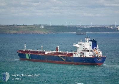
HAFNIA ZAMBESI
Oil Products Tanker
Current Trip
USCRP
| Time Travelled | 10 days |
|---|---|
| Remaining Time | --- |
| Distance Travelled | 2461.34 nm |
| Remaining Distance | --- |
| AVG Speed | 11.5 Knots |
| MAX Speed | 13.5 Knots |
| AVG Wind | 14.6 knots |
| MAX Wind | 27 knots |
| MIN Temp | 21.1°C / 69.98°F |
| MAX Temp | 27.9°C / 82.22°F |
| Draught | 9.5 m |
| Position Received | 17 h, 19 m ago |
Current Position
| Longitude | -60.45046° |
|---|---|
| Latitude | 14.72475° |
| Status | Under way using engine |
| Speed | 11.6 Knots |
| Course | 125.6° |
| Area | Caribbean Sea |
| Station | T-AIS |
| Position Received | 17 h, 19 m ago |
Info
Information
The current position of HAFNIA ZAMBESI is in Caribbean Sea with coordinates 14.72475° / -60.45046° as reported on 2024-04-18 21:20 by AIS to our vessel tracker app. The vessel's current speed is 11.6 Knots
The vessel HAFNIA ZAMBESI (IMO: 9393101, MMSI: 564368000) is a Oil Products Tanker that was built in 2010 ( 14 years old ). It's sailing under the flag of [SG] Singapore.
In this page you can find informations about the vessels current position, last detected port calls, and current voyage information. If the vessels is not in coverage by AIS you will find the latest position.
The current position of HAFNIA ZAMBESI is detected by our AIS receivers and we are not responsible for the reliability of the data. The last position was recorded while the vessel was in Coverage by the Ais receivers of our vessel tracking app.
The current draught of HAFNIA ZAMBESI as reported by AIS is 9.5 meters
Weather
| Temperature | 27.4°C / 81.32°F |
|---|---|
| Wind Speed | 11 knots |
| Direction | 108° ESE |
| Pressure | 1013.7 hPa |
| Humidity | 80.3 % |
| Cloud Coverage | 27 % |
Featured Company
Last Port Calls
| Port | Arrival | Departure | Time In Port |
|---|---|---|---|
| 2024-04-09 00:59 | 2024-04-09 01:38 | 39 m | |
| 2024-04-04 23:42 | 2024-04-08 04:54 | 3 d | |
| 2024-03-30 17:07 | 2024-04-03 04:02 | 3 d | |
| 2024-03-22 16:35 | 2024-03-22 23:07 | 6 h | |
| 2024-02-06 01:32 |
Last Trips
| Origin | Departure | Destination | Arrival | Distance | |
|---|---|---|---|---|---|
| 2024-04-07 23:54 | 2024-04-08 19:59 | 221.15 nm | |||
| 2024-04-02 23:02 | 2024-04-04 18:42 | 133.18 nm | |||
| 2024-03-22 18:07 | 2024-03-30 12:07 | 662.59 nm | |||
| 2024-02-06 07:02 | 2024-03-22 11:35 | 12772.27 nm |
Events
| Time | Event | Details | Position / Dest | Info |
|---|---|---|---|---|
| 2024-04-18 21:23 | Status Changed | Default Under way using engine |
14.71909 / -60.44232
USCRP
|
Speed: 11.6 kn Course: 125.6° |
| 2024-04-18 21:20 | Status Changed | Under way using engine Default |
14.72475 / -60.45046
USCRP
|
Speed: 11.8 kn Course: 125° |
| 2024-04-18 21:20 | OUT of Coverage |
14.72475 / -60.45046
Caribbean Sea
|
Speed: 11.6 kn Course: 125.6° |
|
| 2024-04-18 21:06 | IN Coverage |
14.72475 / -60.45046
Caribbean Sea
|
Speed: 11.6 kn Course: 125.6° |
|
| 2024-04-18 19:53 | Status Changed | Default Under way using engine |
14.89645 / -60.69470
USCRP
|
Speed: 11.9 kn Course: 127.1° |
| 2024-04-18 19:45 | OUT of Coverage |
14.91320 / -60.71824
Caribbean Sea
|
Speed: 11.9 kn Course: 127.1° |
|
| 2024-04-18 19:40 | Detected in Sea | Guadeloupe and Martinique part of the Caribbean Sea |
14.92150 / -60.72964
Caribbean Sea
|
Speed: 11.9 kn Course: 125° |
| 2024-04-18 19:40 | Status Changed | Under way using engine Default |
14.92150 / -60.72964
USCRP
|
Speed: 12 kn Course: 129° |
| 2024-04-18 19:40 | IN Coverage |
14.92150 / -60.72964
Caribbean Sea
|
Speed: 11.9 kn Course: 125° |
|
| 2024-04-10 20:32 | START Moving | 5.67 nm, West of CORPUS CHRISTI |
27.82544 / -97.48927
USCRP
|
Speed: 3.4 kn Course: 126° |