
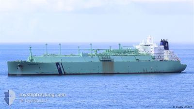
BW MAGNOLIA
Tanker D
Current Trip
| Time Travelled | 18 days |
|---|---|
| Remaining Time | --- |
| Distance Travelled | 6343.94 nm |
| Remaining Distance | --- |
| AVG Speed | 14.8 Knots |
| MAX Speed | 18.3 Knots |
| AVG Wind | 8.6 knots |
| MAX Wind | 28.8 knots |
| MIN Temp | 16.5°C / 61.7°F |
| MAX Temp | 30.2°C / 86.36°F |
| Draught | 11.5 m |
| Position Received | 3 d ago |
Current Position
| Longitude | 120.78186° |
|---|---|
| Latitude | 20.54630° |
| Status | Under way using engine |
| Speed | 16.2 Knots |
| Course | 48.2° |
| Area | South China Sea |
| Station | T-AIS |
| Position Received | 3 d ago |
Info
Information
The current position of BW MAGNOLIA is in South China Sea with coordinates 20.54630° / 120.78186° as reported on 2024-04-15 09:08 by AIS to our vessel tracker app. The vessel's current speed is 16.2 Knots and is heading at the port of KIMITSU. The estimated time of arrival as calculated by MyShipTracking vessel tracking app is 2024-04-19 15:00 LT
The vessel BW MAGNOLIA (IMO: 9850666, MMSI: 563092200) is a Tanker D It's sailing under the flag of [SG] Singapore.
In this page you can find informations about the vessels current position, last detected port calls, and current voyage information. If the vessels is not in coverage by AIS you will find the latest position.
The current position of BW MAGNOLIA is detected by our AIS receivers and we are not responsible for the reliability of the data. The last position was recorded while the vessel was in Coverage by the Ais receivers of our vessel tracking app.
The current draught of BW MAGNOLIA as reported by AIS is 11.5 meters
Weather
| Temperature | 16.4°C / 61.52°F |
|---|---|
| Wind Speed | 13 knots |
| Direction | 359° N |
| Pressure | 1003.9 hPa |
| Humidity | 81.5 % |
| Cloud Coverage | 14 % |
Featured Company
Last Port Calls
| Port | Arrival | Departure | Time In Port |
|---|---|---|---|
| 2024-03-30 09:07 | 2024-03-31 15:59 | 1 d | |
| 2024-02-22 00:51 | 2024-02-23 03:31 | 1 d | |
| 2024-02-07 10:54 | 2024-02-08 14:39 | 1 d |
Most Visited Ports (Last year)
| Port | Arrivals | |
|---|---|---|
| 3 | ||
| 2 | ||
| 2 | ||
| 1 | ||
| 1 | ||
| 1 |
Last Trips
| Origin | Departure | Destination | Arrival | Distance | |
|---|---|---|---|---|---|
| 2024-02-23 10:31 | 2024-03-30 12:07 | 8586.30 nm | |||
| 2024-02-08 18:39 | 2024-02-22 07:51 | 4323.93 nm | |||
| 2024-01-24 09:59 | 2024-02-07 14:54 | 5827.40 nm |
Events
| Time | Event | Details | Position / Dest | Info |
|---|---|---|---|---|
| 2024-04-15 09:13 | Status Changed | Default Under way using engine |
20.55986 / 120.79803
JPKZU
|
Speed: 16.2 kn Course: 48.2° |
| 2024-04-15 09:08 | OUT of Coverage |
20.54630 / 120.78186
South China Sea
JPKZU
|
Speed: 16.2 kn Course: 48.2° |
|
| 2024-04-15 09:02 | Status Changed | Under way using engine Default |
20.52809 / 120.75967
JPKZU
|
Speed: 16.6 kn Course: 49° |
| 2024-04-15 08:54 | Status Changed | Default Under way using engine |
20.50429 / 120.73012
JPKZU
|
Speed: 16.7 kn Course: 54.9° |
| 2024-04-15 08:46 | Status Changed | Under way using engine Default |
20.48176 / 120.69786
JPKZU
|
Speed: 16.3 kn Course: 54° |
| 2024-04-15 08:34 | Status Changed | Default Under way using engine |
20.44798 / 120.64832
JPKZU
|
Speed: 16.9 kn Course: 53.6° |
| 2024-04-15 08:31 | Change Sea Area | Philippines part of the South China Sea Malaysian part of the Singapore Strait |
20.43996 / 120.63656
South China Sea
JPKZU
|
Speed: 16.9 kn Course: 53.6° |
| 2024-04-15 08:31 | Status Changed | Under way using engine Default |
20.43940 / 120.63575
JPKZU
|
Speed: 17.1 kn Course: 54° |
| 2024-04-15 08:21 | IN Coverage |
20.43996 / 120.63656
South China Sea
JPKZU
|
Speed: 16.9 kn Course: 53.6° |
|
| 2024-04-11 03:10 | OUT of Coverage |
1.28479 / 104.30397
Singapore Strait
JPKZU
|
Speed: 12.8 kn Course: 82.9° |