
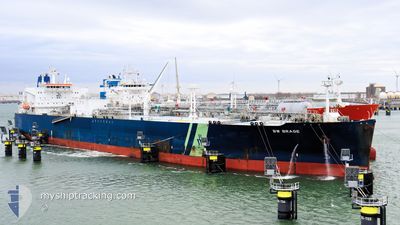
BW BRAGE
Tanker
Current Trip
| Time Travelled | --- |
|---|---|
| Remaining Time | 11 h, 11 mins |
| Distance Travelled | 17484.27 nm |
| Remaining Distance | 157.91 nm |
| AVG Speed | 14.5 Knots |
| MAX Speed | 19.7 Knots |
| AVG Wind | 14.8 knots |
| MAX Wind | 39 knots |
| MIN Temp | 2.4°C / 36.32°F |
| MAX Temp | 31°C / 87.8°F |
| Draught | 8.3 m |
| Position Received | 2 d ago |
Current Position
| Longitude | -84.56208° |
|---|---|
| Latitude | 20.43553° |
| Status | Under way using engine |
| Speed | 13.4 Knots |
| Course | 311.2° |
| Area | Caribbean Sea |
| Station | T-AIS |
| Position Received | 2 d ago |
Info
Information
The current position of BW BRAGE is in Caribbean Sea with coordinates 20.43553° / -84.56208° as reported on 2024-04-23 07:04 by AIS to our vessel tracker app. The vessel's current speed is 13.4 Knots and is heading at the port of HOUSTON. The estimated time of arrival as calculated by MyShipTracking vessel tracking app is 2024-04-25 21:00 LT
The vessel BW BRAGE (IMO: 9732539, MMSI: 538006837) is a Tanker It's sailing under the flag of [MH] Marshall Is.
In this page you can find informations about the vessels current position, last detected port calls, and current voyage information. If the vessels is not in coverage by AIS you will find the latest position.
The current position of BW BRAGE is detected by our AIS receivers and we are not responsible for the reliability of the data. The last position was recorded while the vessel was in Coverage by the Ais receivers of our vessel tracking app.
The current draught of BW BRAGE as reported by AIS is 8.3 meters
Weather
| Temperature | 23.7°C / 74.66°F |
|---|---|
| Wind Speed | 13 knots |
| Direction | 137° SE |
| Pressure | 1016.8 hPa |
| Humidity | 88.2 % |
| Cloud Coverage | 3 % |
Featured Company
Most Visited Ports (Last year)
| Port | Arrivals | |
|---|---|---|
| 4 | ||
| 2 | ||
| 2 | ||
| 1 | ||
| 1 | ||
| 1 |
Last Trips
| Origin | Departure | Destination | Arrival | Distance | |
|---|---|---|---|---|---|
| 2024-01-08 09:25 | 2024-02-13 09:33 | 11361.64 nm |
Events
| Time | Event | Details | Position / Dest | Info |
|---|---|---|---|---|
| 2024-04-23 07:07 | Status Changed | Default Under way using engine |
20.44167 / -84.57000
US HOU
|
Speed: 13.4 kn Course: 311.2° |
| 2024-04-23 07:04 | OUT of Coverage |
20.43553 / -84.56208
Caribbean Sea
US HOU
|
Speed: 13.4 kn Course: 311.2° |
|
| 2024-04-23 07:00 | Status Changed | Under way using engine Default |
20.42611 / -84.55064
US HOU
|
Speed: 13.4 kn Course: 311° |
| 2024-04-23 06:56 | Status Changed | Default Under way using engine |
20.41457 / -84.53680
US HOU
|
Speed: 13.4 kn Course: 311.2° |
| 2024-04-23 06:44 | Status Changed | Under way using engine Default |
20.38569 / -84.50198
US HOU
|
Speed: 13.4 kn Course: 312° |
| 2024-04-23 06:38 | Status Changed | Default Under way using engine |
20.37052 / -84.48365
US HOU
|
Speed: 13.3 kn Course: 311.3° |
| 2024-04-23 06:31 | Status Changed | Under way using engine Default |
20.35423 / -84.46394
US HOU
|
Speed: 13 kn Course: 311° |
| 2024-04-23 06:22 | Status Changed | Default Under way using engine |
20.33167 / -84.43667
US HOU
|
Speed: 13.3 kn Course: 311.1° |
| 2024-04-23 04:37 | Status Changed | Under way using engine Default |
20.08360 / -84.12035
US HOU
|
Speed: 13.3 kn Course: 307° |
| 2024-04-23 04:33 | Status Changed | Default Under way using engine |
20.07505 / -84.10819
US HOU
|
Speed: 13 kn Course: 306° |