
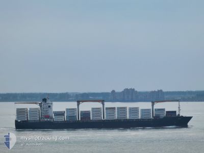
GARDINER
Container Ship
Current Trip
| Time Travelled | 13 days |
|---|---|
| Remaining Time | 1 day |
| Distance Travelled | 4663.09 nm |
| Remaining Distance | 991.43 nm |
| AVG Speed | 12.4 Knots |
| MAX Speed | 20.4 Knots |
| AVG Wind | 20.7 knots |
| MAX Wind | 39.8 knots |
| MIN Temp | 7.2°C / 44.96°F |
| MAX Temp | 25.3°C / 77.54°F |
| Draught | 9.6 m |
| Position Received | 19 h, 54 m ago |
Current Position
| Longitude | -79.59407° |
|---|---|
| Latitude | 25.32699° |
| Status | Under way using engine |
| Speed | 16.5 Knots |
| Course | 194.8° |
| Area | North Atlantic Ocean |
| Station | T-AIS |
| Position Received | 19 h, 54 m ago |
Info
Information
The current position of GARDINER is in North Atlantic Ocean with coordinates 25.32699° / -79.59407° as reported on 2024-04-17 18:55 by AIS to our vessel tracker app. The vessel's current speed is 16.5 Knots and is heading at the port of VERACRUZ. The estimated time of arrival as calculated by MyShipTracking vessel tracking app is 2024-04-20 07:12 LT
The vessel GARDINER (IMO: 9275048, MMSI: 636017520) is a Container Ship that was built in 2003 ( 21 years old ). It's sailing under the flag of [LR] Liberia.
In this page you can find informations about the vessels current position, last detected port calls, and current voyage information. If the vessels is not in coverage by AIS you will find the latest position.
The current position of GARDINER is detected by our AIS receivers and we are not responsible for the reliability of the data. The last position was recorded while the vessel was in Coverage by the Ais receivers of our vessel tracking app.
The current draught of GARDINER as reported by AIS is 9.6 meters
Weather
| Temperature | 25.1°C / 77.18°F |
|---|---|
| Wind Speed | 15 knots |
| Direction | 101° E |
| Pressure | 1015.5 hPa |
| Humidity | 67.7 % |
| Cloud Coverage | 43 % |
Featured Company
Last Port Calls
| Port | Arrival | Departure | Time In Port |
|---|---|---|---|
| 2024-04-04 10:47 | 2024-04-05 07:47 | 20 h | |
| 2024-04-03 01:43 | 2024-04-03 17:20 | 15 h | |
| 2024-03-30 20:49 | 2024-03-31 21:43 | 1 d | |
| 2024-03-26 08:33 | 2024-03-27 05:18 | 20 h | |
| 2024-03-24 12:06 | 2024-03-25 05:36 | 17 h | |
| 2024-03-23 07:08 | 2024-03-23 20:00 | 12 h | |
| 2024-03-18 03:57 | 2024-03-18 20:39 | 16 h | |
| 2024-03-13 21:01 | 2024-03-15 03:52 | 1 d |
Most Visited Ports (Last year)
| Port | Arrivals | |
|---|---|---|
| 5 | ||
| 5 | ||
| 3 | ||
| 3 | ||
| 2 | ||
| 1 |
Last Trips
| Origin | Departure | Destination | Arrival | Distance | |
|---|---|---|---|---|---|
| 2024-04-03 19:20 | 2024-04-04 12:47 | 271.16 nm | |||
| 2024-03-31 23:43 | 2024-04-03 03:43 | 52.32 nm | |||
| 2024-03-27 06:18 | 2024-03-30 21:49 | 107.61 nm | |||
| 2024-03-25 06:36 | 2024-03-26 09:33 | 344.02 nm | |||
| 2024-03-23 21:00 | 2024-03-24 13:06 | 245.21 nm | |||
| 2024-03-18 21:39 | 2024-03-23 08:08 | 35.82 nm | |||
| 2024-03-15 04:52 | 2024-03-18 04:57 | 1019.04 nm |
Events
| Time | Event | Details | Position / Dest | Info |
|---|---|---|---|---|
| 2024-04-17 19:05 | Status Changed | Default Under way using engine |
25.28258 / -79.60294
VERACRUZ
|
Speed: 16.5 kn Course: 194.8° |
| 2024-04-17 18:55 | OUT of Coverage |
25.32699 / -79.59407
North Atlantic Ocean
VERACRUZ
|
Speed: 16.5 kn Course: 194.8° |
|
| 2024-04-17 16:40 | ETA Changed | 2024/04/20 12:00 2024/04/18 12:00 |
25.93826 / -79.45518
VERACRUZ
|
Speed: 17.3 kn Course: 216.6° |
| 2024-04-17 16:16 | Status Changed | Under way using engine Default |
26.02774 / -79.37132
VERACRUZ
|
Speed: 17.7 kn Course: 220° |
| 2024-04-17 16:16 | IN Coverage |
26.02774 / -79.37132
North Atlantic Ocean
VERACRUZ
|
Speed: 17.6 kn Course: 220.2° |
|
| 2024-04-17 12:39 | Status Changed | Default Under way using engine |
26.05701 / -78.30315
VERACRUZ
|
Speed: 18.7 kn Course: 286.5° |
| 2024-04-17 12:29 | OUT of Coverage |
26.04100 / -78.24989
North Atlantic Ocean
VERACRUZ
|
Speed: 18.7 kn Course: 286.5° |
|
| 2024-04-17 12:26 | Status Changed | Under way using engine Default |
26.03684 / -78.23432
VERACRUZ
|
Speed: 18.7 kn Course: 285° |
| 2024-04-17 11:54 | Status Changed | Default Under way using engine |
25.99358 / -78.05995
VERACRUZ
|
Speed: 18.3 kn Course: 295.2° |
| 2024-04-17 11:49 | Change Sea Area | Bahamas part of the North Atlantic Ocean United Kingdom part of the English Channel |
25.98045 / -78.02997
North Atlantic Ocean
VERACRUZ
|
Speed: 18.3 kn Course: 295.2° |