
BRITISH SPONSOR
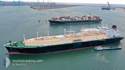
Tanker
Current Trip
| Time Travelled | 18 days |
|---|---|
| Remaining Time | --- |
| Distance Travelled | 5021.39 nm |
| Remaining Distance | --- |
| AVG Speed | 15.1 Knots |
| MAX Speed | 19.3 Knots |
| AVG Wind | 8.2 knots |
| MAX Wind | 17 knots |
| MIN Temp | 27.8°C / 82.04°F |
| MAX Temp | 33.3°C / 91.94°F |
| Draught | 11.6 m |
| Position Received | 3 d ago |
Current Position
| Longitude | 101.62665° |
|---|---|
| Latitude | 10.81581° |
| Status | Under way using engine |
| Speed | 15.4 Knots |
| Course | 163.5° |
| Area | Gulf of Thailand |
| Station | T-AIS |
| Position Received | 3 d ago |
Info
Information
The current position of BRITISH SPONSOR is in Gulf of Thailand with coordinates 10.81581° / 101.62665° as reported on 2024-04-14 15:36 by AIS to our vessel tracker app. The vessel's current speed is 15.4 Knots
The vessel BRITISH SPONSOR (IMO: 9766580, MMSI: 232006295) is a Tanker It's sailing under the flag of [GB] United Kingdom.
In this page you can find informations about the vessels current position, last detected port calls, and current voyage information. If the vessels is not in coverage by AIS you will find the latest position.
The current position of BRITISH SPONSOR is detected by our AIS receivers and we are not responsible for the reliability of the data. The last position was recorded while the vessel was in Coverage by the Ais receivers of our vessel tracking app.
The current draught of BRITISH SPONSOR as reported by AIS is 11.6 meters
Weather
| Temperature | 28°C / 82.4°F |
|---|---|
| Wind Speed | 5 knots |
| Direction | 161° SSE |
| Pressure | 1008 hPa |
| Humidity | 72.1 % |
| Cloud Coverage | 91 % |
Featured Company
Last Port Calls
| Port | Arrival | Departure | Time In Port |
|---|---|---|---|
| 2024-03-29 00:13 | 2024-03-30 04:31 | 1 d | |
| 2024-03-14 01:44 | 2024-03-15 02:41 | 1 d | |
| 2024-02-17 02:09 | 2024-02-18 02:38 | 1 d |
Most Visited Ports (Last year)
| Port | Arrivals | |
|---|---|---|
| 1 | ||
| 1 | ||
| 1 | ||
| 1 | ||
| 1 | ||
| 1 |
Last Trips
| Origin | Departure | Destination | Arrival | Distance | |
|---|---|---|---|---|---|
| 2024-03-15 10:41 | 2024-03-29 08:13 | 2250.04 nm | |||
| 2024-02-18 08:08 | 2024-03-14 09:44 | 8028.30 nm | |||
| 2024-01-16 14:37 | 2024-02-17 07:39 | 10803.18 nm |
Events
| Time | Event | Details | Position / Dest | Info |
|---|---|---|---|---|
| 2024-04-14 15:47 | Status Changed | Default Under way using engine |
10.77026 / 101.63989
TH MAT
|
Speed: 15.4 kn Course: 163.5° |
| 2024-04-14 15:36 | Status Changed | Under way using engine Default |
10.81581 / 101.62665
TH MAT
|
Speed: 15.4 kn Course: 152° |
| 2024-04-14 15:36 | IN Coverage |
10.81581 / 101.62665
Gulf of Thailand
|
Speed: 15.4 kn Course: 163.5° |
|
| 2024-04-14 15:36 | OUT of Coverage |
10.81581 / 101.62665
Gulf of Thailand
|
Speed: 15.4 kn Course: 163.5° |
|
| 2024-04-13 04:46 | START Moving | 2.84 nm, South West of MAP TA PHUT |
12.62140 / 101.11272
TH MAT
|
Speed: 4 kn Course: 119° |
| 2024-04-12 00:02 | STOP Moving | 2.79 nm, South West of MAP TA PHUT |
12.62828 / 101.10849
TH MAT
|
Speed: 0.3 kn Course: 231° |
| 2024-04-09 14:21 | Status Changed | Default Under way using engine |
11.39157 / 101.38193
TH MAT
|
Speed: 13.8 kn Course: 143.8° |
| 2024-04-09 14:17 | OUT of Coverage |
11.40248 / 101.37385
Gulf of Thailand
TH MAT
|
Speed: 13.8 kn Course: 143.8° |
|
| 2024-04-09 14:06 | Status Changed | Under way using engine Default |
11.43769 / 101.34956
TH MAT
|
Speed: 13.1 kn Course: 220° |
| 2024-04-09 13:47 | Status Changed | Default Under way using engine |
11.49102 / 101.37914
TH MAT
|
Speed: 13 kn Course: 272.7° |