
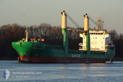
BREB COURTESY
General Cargo
Current Trip
| Time Travelled | 9 h, 57 mins |
|---|---|
| Remaining Time | --- |
| Distance Travelled | 81.81 nm |
| Remaining Distance | --- |
| AVG Speed | 9.3 Knots |
| MAX Speed | 10 Knots |
| AVG Wind | 8.2 knots |
| MAX Wind | 15 knots |
| MIN Temp | 11.8°C / 53.24°F |
| MAX Temp | 13.8°C / 56.84°F |
| Draught | 7 m |
| Position Received | 6 h, 30 m ago |
Current Position
| Longitude | 13.08909° |
|---|---|
| Latitude | 45.40463° |
| Status | Under way using engine |
| Speed | 9.2 Knots |
| Course | 225.3° |
| Area | Adriatic Sea |
| Station | T-AIS |
| Position Received | 6 h, 30 m ago |
Info
Information
The current position of BREB COURTESY is in Adriatic Sea with coordinates 45.40463° / 13.08909° as reported on 2024-04-19 18:01 by AIS to our vessel tracker app. The vessel's current speed is 9.2 Knots and is heading at the port of BEJAIA. The estimated time of arrival as calculated by MyShipTracking vessel tracking app is 2024-04-25 05:00 LT
The vessel BREB COURTESY (IMO: 9421130, MMSI: 255806044) is a General Cargo that was built in 2009 ( 15 years old ). It's sailing under the flag of [PT] Portugal.
In this page you can find informations about the vessels current position, last detected port calls, and current voyage information. If the vessels is not in coverage by AIS you will find the latest position.
The current position of BREB COURTESY is detected by our AIS receivers and we are not responsible for the reliability of the data. The last position was recorded while the vessel was in Coverage by the Ais receivers of our vessel tracking app.
The current draught of BREB COURTESY as reported by AIS is 7 meters
Weather
| Temperature | 13.8°C / 56.84°F |
|---|---|
| Wind Speed | 13 knots |
| Direction | 184° S |
| Pressure | 1009.3 hPa |
| Humidity | 46.1 % |
| Cloud Coverage | 40 % |
Featured Company
Last Trips
| Origin | Departure | Destination | Arrival | Distance | |
|---|---|---|---|---|---|
| 2024-04-13 15:41 | 2024-04-16 08:52 | 34.76 nm | |||
| 2024-04-08 21:02 | 2024-04-09 13:21 | 32.12 nm | |||
| 2024-01-30 07:58 | 2024-02-05 09:57 | 947.34 nm |
Events
| Time | Event | Details | Position / Dest | Info |
|---|---|---|---|---|
| 2024-04-19 18:01 | OUT of Coverage |
45.40463 / 13.08909
Adriatic Sea
DZ BJA
|
Speed: 9.2 kn Course: 225.3° |
|
| 2024-04-19 15:31 | Change Sea Area | Italian part of the Adriatic Sea Slovenian part of the Adriatic Sea |
45.62809 / 13.55880
Adriatic Sea
DZ BJA
|
Speed: 9.2 kn Course: 239.6° |
| 2024-04-19 14:54 | Draught Changed | 7 5.4 |
45.57504 / 13.66620
DZ BJA
|
Speed: 8.9 kn Course: 344.7° |
| 2024-04-19 14:35 | PORT DEPARTURE |
|
45.55909 / 13.71411
DZ BJA
|
Speed: 5.6 kn Course: 330° |
| 2024-04-19 14:29 | Destination Changed | DZ BJA SI KOP |
45.55294 / 13.72530
[SI] KOPER
|
Speed: 5.6 kn Course: 290° |
| 2024-04-19 14:29 | ETA Changed | 2024/04/25 05:00 2024/04/13 17:00 |
45.55294 / 13.72530
[SI] KOPER
|
Speed: 5.6 kn Course: 290° |
| 2024-04-19 14:24 | IN Coverage |
45.55194 / 13.73206
Adriatic Sea
[SI] KOPER
|
Speed: 5.9 kn Course: 267° |
|
| 2024-04-19 13:16 | OUT of Coverage |
45.55214 / 13.73810
Adriatic Sea
[SI] KOPER
|
Speed: Course: 293.3° |
|
| 2024-04-19 11:52 | IN Coverage |
45.55212 / 13.73807
Adriatic Sea
[SI] KOPER
|
Speed: Course: 234.5° |
|
| 2024-04-19 09:52 | OUT of Coverage |
45.55212 / 13.73808
Adriatic Sea
[SI] KOPER
|
Speed: Course: 302.9° |