
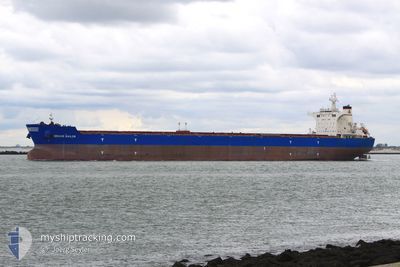
BRAVE SAILOR
Bulk Carrier
Current Trip
| Time Travelled | --- |
|---|---|
| Remaining Time | --- |
| Distance Travelled | --- |
| Remaining Distance | --- |
| AVG Speed | --- |
| MAX Speed | --- |
| AVG Wind | --- |
| MAX Wind | --- |
| MIN Temp | --- |
| MAX Temp | --- |
| Draught | 18.3 m |
| Position Received | 1 d ago |
Current Position
| Longitude | -40.62162° |
|---|---|
| Latitude | -21.88556° |
| Status | Under way using engine |
| Speed | 10 Knots |
| Course | 117.8° |
| Area | South Atlantic Ocean |
| Station | T-AIS |
| Position Received | 1 d ago |
Info
Information
The current position of BRAVE SAILOR is in South Atlantic Ocean with coordinates -21.88556° / -40.62162° as reported on 2024-04-18 12:25 by AIS to our vessel tracker app. The vessel's current speed is 10 Knots and is heading at the port of SINGAPORE. The estimated time of arrival as calculated by MyShipTracking vessel tracking app is 2024-05-26 00:01 LT
The vessel BRAVE SAILOR (IMO: 9457012, MMSI: 215150000) is a Bulk Carrier that was built in 2011 ( 13 years old ). It's sailing under the flag of [MT] Malta.
In this page you can find informations about the vessels current position, last detected port calls, and current voyage information. If the vessels is not in coverage by AIS you will find the latest position.
The current position of BRAVE SAILOR is detected by our AIS receivers and we are not responsible for the reliability of the data. The last position was recorded while the vessel was in Coverage by the Ais receivers of our vessel tracking app.
The current draught of BRAVE SAILOR as reported by AIS is 18.3 meters
Weather
| Temperature | 25°C / 77°F |
|---|---|
| Wind Speed | 9 knots |
| Direction | 192° SSW |
| Pressure | 1017.6 hPa |
| Humidity | 71.4 % |
| Cloud Coverage | 100 % |
Featured Company
Last Port Calls
Last Trips
| Origin | Departure | Destination | Arrival | Distance |
|---|
Events
| Time | Event | Details | Position / Dest | Info |
|---|---|---|---|---|
| 2024-04-18 12:28 | Status Changed | Default Under way using engine |
-21.88964 / -40.61326
SG SIN
|
Speed: 10 kn Course: 117.8° |
| 2024-04-18 12:25 | OUT of Coverage |
-21.88556 / -40.62162
South Atlantic Ocean
|
Speed: 10 kn Course: 117.8° |
|
| 2024-04-18 12:12 | Status Changed | Under way using engine Default |
-21.86821 / -40.65655
SG SIN
|
Speed: 10 kn Course: 117° |
| 2024-04-18 12:05 | Status Changed | Default Under way using engine |
-21.85967 / -40.67459
SG SIN
|
Speed: 9.9 kn Course: 116.9° |
| 2024-04-18 10:50 | Draught Changed | 18.3 8.8 |
-21.82340 / -40.87852
SG SIN
|
Speed: 10.2 kn Course: 105.5° |
| 2024-04-18 10:50 | Destination Changed | SG SIN PORT ACU BRAZL |
-21.82340 / -40.87852
SG SIN
|
Speed: 10.2 kn Course: 105.5° |
| 2024-04-18 10:50 | ETA Changed | 2024/05/26 00:01 2024/04/15 04:30 |
-21.82340 / -40.87852
SG SIN
|
Speed: 10.2 kn Course: 105.5° |
| 2024-04-18 10:26 | Status Changed | Under way using engine Default |
-21.80602 / -40.94427
PORT ACU BRAZL
|
Speed: 7.6 kn Course: 105° |
| 2024-04-18 10:19 | IN Coverage |
-21.80638 / -40.94297
South Atlantic Ocean
|
Speed: 8.7 kn Course: 106.3° |
|
| 2024-04-18 04:56 | OUT of Coverage |
-21.80835 / -40.98194
South Atlantic Ocean
|
Speed: Course: 55.5° |