
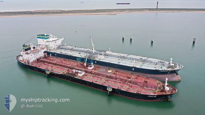
BOTAFOGO
Crude Oil Tanker
Current Trip
| Time Travelled | 6 days |
|---|---|
| Remaining Time | --- |
| Distance Travelled | 2154.31 nm |
| Remaining Distance | --- |
| AVG Speed | 10.6 Knots |
| MAX Speed | 16.4 Knots |
| AVG Wind | 8.8 knots |
| MAX Wind | 27 knots |
| MIN Temp | 13.9°C / 57.02°F |
| MAX Temp | 24.3°C / 75.74°F |
| Draught | 12.2 m |
| Position Received | 3 d ago |
Current Position
| Longitude | -79.71288° |
|---|---|
| Latitude | 29.25363° |
| Status | Under way using engine |
| Speed | 12.4 Knots |
| Course | 359.9° |
| Area | North Atlantic Ocean |
| Station | T-AIS |
| Position Received | 3 d ago |
Info
Information
The current position of BOTAFOGO is in North Atlantic Ocean with coordinates 29.25363° / -79.71288° as reported on 2024-04-16 09:57 by AIS to our vessel tracker app. The vessel's current speed is 12.4 Knots and is heading at the port of CORK. The estimated time of arrival as calculated by MyShipTracking vessel tracking app is 2024-04-27 20:00 LT
The vessel BOTAFOGO (IMO: 9395329, MMSI: 249575000) is a Crude Oil Tanker that was built in 2010 ( 14 years old ). It's sailing under the flag of [MT] Malta.
In this page you can find informations about the vessels current position, last detected port calls, and current voyage information. If the vessels is not in coverage by AIS you will find the latest position.
The current position of BOTAFOGO is detected by our AIS receivers and we are not responsible for the reliability of the data. The last position was recorded while the vessel was in Coverage by the Ais receivers of our vessel tracking app.
The current draught of BOTAFOGO as reported by AIS is 12.2 meters
Weather
| Temperature | 13.4°C / 56.12°F |
|---|---|
| Wind Speed | 18 knots |
| Direction | 73° ENE |
| Pressure | 1018.1 hPa |
| Humidity | 64.2 % |
| Cloud Coverage | 85 % |
Featured Company
Last Port Calls
| Port | Arrival | Departure | Time In Port |
|---|---|---|---|
| 2024-04-09 17:57 | 2024-04-12 11:58 | 2 d | |
| 2024-03-02 08:27 | 2024-03-03 17:09 | 1 d |
Most Visited Ports (Last year)
| Port | Arrivals | |
|---|---|---|
| 2 | ||
| 2 | ||
| 1 | ||
| 1 | ||
| 1 | ||
| 1 |
Last Trips
| Origin | Departure | Destination | Arrival | Distance | |
|---|---|---|---|---|---|
| 2024-03-03 18:09 | 2024-04-09 12:57 | 7468.13 nm | |||
| 2024-01-10 11:28 | 2024-03-02 09:27 | 2122.77 nm |
Events
| Time | Event | Details | Position / Dest | Info |
|---|---|---|---|---|
| 2024-04-16 09:59 | Status Changed | Default Under way using engine |
29.26167 / -79.71167
USBPT>USNSS>IEORK
|
Speed: 12.4 kn Course: 359.9° |
| 2024-04-16 09:57 | OUT of Coverage |
29.25363 / -79.71288
North Atlantic Ocean
USBPT>USNSS>IEORK
|
Speed: 12.4 kn Course: 359.9° |
|
| 2024-04-16 09:48 | Status Changed | Under way using engine Default |
29.21393 / -79.71249
USBPT>USNSS>IEORK
|
Speed: 15 kn Course: 359° |
| 2024-04-16 09:41 | Status Changed | Default Under way using engine |
29.18333 / -79.71167
USBPT>USNSS>IEORK
|
Speed: 15.5 kn Course: 359.1° |
| 2024-04-16 09:27 | Status Changed | Under way using engine Default |
29.12160 / -79.71179
USBPT>USNSS>IEORK
|
Speed: 15 kn Course: 357° |
| 2024-04-16 09:23 | Status Changed | Default Under way using engine |
29.10500 / -79.71000
USBPT>USNSS>IEORK
|
Speed: 15.6 kn Course: 359.8° |
| 2024-04-16 09:10 | Status Changed | Under way using engine Default |
29.04768 / -79.71038
USBPT>USNSS>IEORK
|
Speed: 15 kn Course: 357° |
| 2024-04-16 09:02 | Status Changed | Default Under way using engine |
29.01333 / -79.70834
USBPT>USNSS>IEORK
|
Speed: 15.5 kn Course: 359.2° |
| 2024-04-16 08:54 | Status Changed | Under way using engine Default |
28.97868 / -79.70919
USBPT>USNSS>IEORK
|
Speed: 15 kn Course: 359° |
| 2024-04-16 07:45 | OUT of Coverage |
28.68195 / -79.70112
North Atlantic Ocean
USBPT>USNSS>IEORK
|
Speed: 15.4 kn Course: 355.4° |