
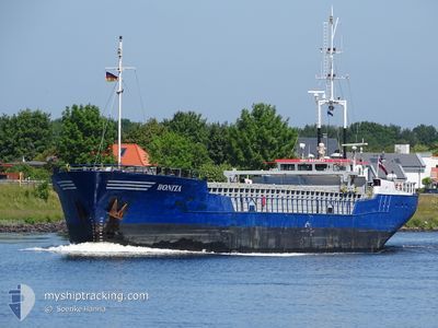
BONITA
General Cargo
Current Trip
| Time Travelled | 15 h, 12 mins |
|---|---|
| Remaining Time | 22 h, 55 mins |
| Distance Travelled | 87.47 nm |
| Remaining Distance | 195.30 nm |
| AVG Speed | 5.8 Knots |
| MAX Speed | 10.2 Knots |
| AVG Wind | 23.6 knots |
| MAX Wind | 28 knots |
| MIN Temp | 7°C / 44.6°F |
| MAX Temp | 10.2°C / 50.36°F |
| Draught | 3.7 m |
| Position Received | 1 m ago |
Current Position
| Longitude | 1.67466° |
|---|---|
| Latitude | 51.18532° |
| Status | Under way using engine |
| Speed | 9.9 Knots |
| Course | 229.3° |
| Area | North Sea |
| Station | T-AIS |
| Position Received | 1 m ago |
Info
Information
The current position of BONITA is in North Sea with coordinates 51.18532° / 1.67466° as reported on 2024-04-19 14:54 by AIS to our vessel tracker app. The vessel's current speed is 9.9 Knots and is heading at the port of GUERNSEY. The estimated time of arrival as calculated by MyShipTracking vessel tracking app is 2024-04-20 13:50 LT
The vessel BONITA (IMO: 8609931, MMSI: 275334000) is a General Cargo that was built in 1987 ( 37 years old ). It's sailing under the flag of [LV] Latvia.
In this page you can find informations about the vessels current position, last detected port calls, and current voyage information. If the vessels is not in coverage by AIS you will find the latest position.
The current position of BONITA is detected by our AIS receivers and we are not responsible for the reliability of the data. The last position was recorded while the vessel was in Coverage by the Ais receivers of our vessel tracking app.
The current draught of BONITA as reported by AIS is 3.7 meters
Weather
| Temperature | 9°C / 48.2°F |
|---|---|
| Wind Speed | 21 knots |
| Direction | 341° NNW |
| Pressure | 1015.8 hPa |
| Humidity | 76.7 % |
| Cloud Coverage | 100 % |
Featured Company
Last Port Calls
| Port | Arrival | Departure | Time In Port |
|---|---|---|---|
| 2024-04-17 21:10 | 2024-04-18 23:43 | 1 d | |
| 2024-04-17 04:43 | 2024-04-17 16:56 | 12 h | |
| 2024-04-14 08:31 | 2024-04-14 09:15 | 44 m | |
| 2024-04-12 03:49 | 2024-04-12 14:05 | 10 h | |
| 2024-04-09 19:06 | 2024-04-10 14:49 | 19 h | |
| 2024-03-30 18:27 | 2024-04-06 05:05 | 6 d | |
| 2024-03-28 08:07 | 2024-03-28 20:08 | 12 h | |
| 2024-03-25 02:10 | 2024-03-26 14:44 | 1 d | |
| 2024-03-19 20:42 | 2024-03-20 20:50 | 1 d | |
| 2024-03-14 21:05 |
Last Trips
| Origin | Departure | Destination | Arrival | Distance | |
|---|---|---|---|---|---|
| 2024-04-17 18:56 | 2024-04-17 23:10 | 22.70 nm | |||
| 2024-04-14 11:15 | 2024-04-17 06:43 | 400.46 nm | |||
| 2024-04-12 16:05 | 2024-04-14 10:31 | 352.15 nm | |||
| 2024-04-10 16:49 | 2024-04-12 05:49 | 199.72 nm | |||
| 2024-04-06 07:05 | 2024-04-09 21:06 | 726.23 nm | |||
| 2024-03-28 20:08 | 2024-03-30 19:27 | 374.50 nm | |||
| 2024-03-26 14:44 | 2024-03-28 08:07 | 282.71 nm | |||
| 2024-03-20 20:50 | 2024-03-25 02:10 | 727.67 nm | |||
| 2024-03-14 21:05 | 2024-03-19 20:42 | 527.39 nm | |||
| 2024-03-06 07:12 | 2024-03-07 09:46 | 222.08 nm |
Events
| Time | Event | Details | Position / Dest | Info |
|---|---|---|---|---|
| 2024-04-19 12:36 | Detected in Sea | United Kingdom part of the North Sea |
51.41469 / 1.99770
North Sea
GUERNSEY
|
Speed: 6.5 kn Course: 281.9° |
| 2024-04-19 12:36 | IN Coverage |
51.41469 / 1.99770
North Sea
GUERNSEY
|
Speed: 6.5 kn Course: 281.9° |
|
| 2024-04-19 09:45 | OUT of Coverage |
51.36406 / 2.39013
North Sea
GUERNSEY
|
Speed: 4 kn Course: 256.1° |
|
| 2024-04-19 07:13 | Destination Changed | GUERNSEY GG_STS |
51.38192 / 2.62801
GUERNSEY
|
Speed: 3.8 kn Course: 274° |
| 2024-04-19 06:33 | ETA Changed | 2024/04/20 15:00 2024/04/20 10:00 |
51.38194 / 2.69183
GG_STS
|
Speed: 4.2 kn Course: 279° |
| 2024-04-19 02:04 | Change Sea Area | Belgian part of the North Sea Dutch part of the North Sea |
51.40858 / 3.32576
North Sea
GG_STS
|
Speed: 8 kn Course: 274° |
| 2024-04-18 23:43 | PORT DEPARTURE |
|
51.34002 / 3.81166
GG_STS
|
Speed: 7.3 kn Course: 345° |
| 2024-04-18 23:36 | START Moving |
51.33075 / 3.81498
[NL] TERNEUZEN
|
Speed: 3.1 kn Course: 340° |
|
| 2024-04-18 23:27 | Status Changed | Under way using engine Moored |
51.32875 / 3.81664
[NL] TERNEUZEN
|
Speed: Course: 332° |
| 2024-04-18 23:18 | STOP Moving |
51.32870 / 3.81664
[NL] TERNEUZEN
|
Speed: Course: 332° |