
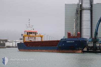
BONACIEUX
General Cargo
Current Trip
| Time Travelled | 2 days |
|---|---|
| Remaining Time | 21 h, 21 mins |
| Distance Travelled | 541.15 nm |
| Remaining Distance | 241.36 nm |
| AVG Speed | 8.2 Knots |
| MAX Speed | 12.6 Knots |
| AVG Wind | 10.8 knots |
| MAX Wind | 18.4 knots |
| MIN Temp | 1.7°C / 35.06°F |
| MAX Temp | 8.2°C / 46.76°F |
| Draught | 5 m |
| Position Received | 7 h, 30 m ago |
Current Position
| Longitude | 7.41729° |
|---|---|
| Latitude | 54.20076° |
| Status | Under way using engine |
| Speed | 9.2 Knots |
| Course | 271.9° |
| Area | North Sea |
| Station | T-AIS |
| Position Received | 7 h, 30 m ago |
Info
Information
The current position of BONACIEUX is in North Sea with coordinates 54.20076° / 7.41729° as reported on 2024-04-25 02:07 by AIS to our vessel tracker app. The vessel's current speed is 9.2 Knots and is heading at the port of IMMINGHAM. The estimated time of arrival as calculated by MyShipTracking vessel tracking app is 2024-04-26 06:58 LT
The vessel BONACIEUX (IMO: 9505297, MMSI: 236553000) is a General Cargo that was built in 2009 ( 15 years old ). It's sailing under the flag of [GI] Gibraltar.
In this page you can find informations about the vessels current position, last detected port calls, and current voyage information. If the vessels is not in coverage by AIS you will find the latest position.
The current position of BONACIEUX is detected by our AIS receivers and we are not responsible for the reliability of the data. The last position was recorded while the vessel was in Coverage by the Ais receivers of our vessel tracking app.
The current draught of BONACIEUX as reported by AIS is 5 meters
Weather
| Temperature | 6.3°C / 43.34°F |
|---|---|
| Wind Speed | 7 knots |
| Direction | 233° SW |
| Pressure | 1002.7 hPa |
| Humidity | 73.4 % |
| Cloud Coverage | 100 % |
Featured Company
Last Port Calls
| Port | Arrival | Departure | Time In Port |
|---|---|---|---|
| 2024-04-22 04:27 | 2024-04-22 17:09 | 12 h | |
| 2024-04-18 11:07 | 2024-04-19 16:39 | 1 d | |
| 2024-03-23 06:15 | 2024-03-25 18:11 | 2 d | |
| 2024-03-19 16:11 | 2024-03-20 11:51 | 19 h | |
| 2024-03-17 18:56 | 2024-03-17 23:46 | 4 h | |
| 2024-03-06 22:43 | 2024-03-15 13:56 | 8 d | |
| 2024-03-02 08:02 | |||
| 2024-02-22 22:25 | 2024-02-24 23:13 | 2 d | |
| 2024-02-19 13:46 | 2024-02-21 14:47 | 2 d | |
| 2024-02-16 03:57 | 2024-02-17 14:29 | 1 d |
Last Trips
| Origin | Departure | Destination | Arrival | Distance | |
|---|---|---|---|---|---|
| 2024-04-19 19:39 | 2024-04-22 06:27 | 576.99 nm | |||
| 2024-03-25 19:11 | 2024-04-18 14:07 | 4042.01 nm | |||
| 2024-03-20 12:51 | 2024-03-23 07:15 | 601.80 nm | |||
| 2024-03-18 00:46 | 2024-03-19 17:11 | 413.06 nm | |||
| 2024-03-15 13:56 | 2024-03-17 19:56 | 507.81 nm | |||
| 2024-02-24 23:13 | 2024-03-02 09:02 | 1305.27 nm | |||
| 2024-02-21 14:47 | 2024-02-22 22:25 | 273.24 nm | |||
| 2024-02-17 14:29 | 2024-02-19 13:46 | 403.89 nm | |||
| 2024-02-06 17:27 | 2024-02-16 03:57 | 1324.50 nm | |||
| 2024-01-31 16:55 | 2024-02-04 21:15 | 951.58 nm |
Events
| Time | Event | Details | Position / Dest | Info |
|---|---|---|---|---|
| 2024-04-25 02:17 | Status Changed | Default Under way using engine |
54.20019 / 7.37290
GB IMM
|
Speed: 9.2 kn Course: 271.9° |
| 2024-04-25 02:07 | OUT of Coverage |
54.20076 / 7.41729
North Sea
GB IMM
|
Speed: 9.2 kn Course: 271.9° |
|
| 2024-04-25 02:04 | Status Changed | Under way using engine Default |
54.20123 / 7.43071
GB IMM
|
Speed: 8.9 kn Course: 271° |
| 2024-04-25 01:42 | Status Changed | Default Under way using engine |
54.19952 / 7.52442
GB IMM
|
Speed: 8.4 kn Course: 301.4° |
| 2024-04-25 01:18 | Status Changed | Under way using engine Default |
54.17031 / 7.61594
GB IMM
|
Speed: 9 kn Course: 299° |
| 2024-04-25 01:03 | Status Changed | Default Under way using engine |
54.15206 / 7.67203
GB IMM
|
Speed: 9.9 kn Course: 297.2° |
| 2024-04-25 00:58 | Status Changed | Under way using engine Default |
54.14455 / 7.69527
GB IMM
|
Speed: 10 kn Course: 295° |
| 2024-04-25 00:42 | IN Coverage |
54.14608 / 7.69055
North Sea
GB IMM
|
Speed: 9.7 kn Course: 296.6° |
|
| 2024-04-24 23:10 | Status Changed | Default Under way using engine |
54.02305 / 8.09567
GB IMM
|
Speed: 8.4 kn Course: 280.4° |
| 2024-04-24 23:04 | OUT of Coverage |
54.02154 / 8.11571
North Sea
GB IMM
|
Speed: 8.4 kn Course: 280.4° |