
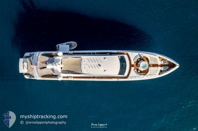
BON VIVANT
Pleasure Craft
Current Trip
ST THOMAS
| Time Travelled | 9 days |
|---|---|
| Remaining Time | --- |
| Distance Travelled | 2.11 nm |
| Remaining Distance | --- |
| AVG Speed | 3.8 Knots |
| MAX Speed | 4.7 Knots |
| AVG Wind | 16.1 knots |
| MAX Wind | 16.4 knots |
| MIN Temp | 26.3°C / 79.34°F |
| MAX Temp | 26.9°C / 80.42°F |
| Draught | 1.9 m |
| Position Received | 8 d ago |
Current Position
| Longitude | -64.95280° |
|---|---|
| Latitude | 18.33117° |
| Status | Moored |
| Speed | |
| Course | --- |
| Area | Caribbean Sea |
| Station | T-AIS |
| Position Received | 8 d ago |
Info
Information
The current position of BON VIVANT is in Caribbean Sea with coordinates 18.33117° / -64.95280° as reported on 2024-04-15 15:14 by AIS to our vessel tracker app. The vessel's current speed is 0 Knots
The vessel BON VIVANT (IMO: 9692181, MMSI: 229855000) is a Pleasure Craft It's sailing under the flag of [MT] Malta.
In this page you can find informations about the vessels current position, last detected port calls, and current voyage information. If the vessels is not in coverage by AIS you will find the latest position.
The current position of BON VIVANT is detected by our AIS receivers and we are not responsible for the reliability of the data. The last position was recorded while the vessel was in Coverage by the Ais receivers of our vessel tracking app.
The current draught of BON VIVANT as reported by AIS is 1.9 meters
Weather
| Temperature | 26.4°C / 79.52°F |
|---|---|
| Wind Speed | 16 knots |
| Direction | 113° ESE |
| Pressure | 1015.1 hPa |
| Humidity | 81.1 % |
| Cloud Coverage | 50 % |
Featured Company
Last Port Calls
| Port | Arrival | Departure | Time In Port |
|---|---|---|---|
| 2024-04-06 21:46 | 2024-04-14 12:04 | 7 d | |
| 2024-04-04 20:50 | 2024-04-06 19:57 | 1 d | |
| 2024-04-01 20:31 | 2024-04-04 20:41 | 3 d | |
| 2024-03-30 12:53 | 2024-03-31 16:26 | 1 d | |
| 2024-03-26 12:38 | 2024-03-26 14:17 | 1 h | |
| 2024-03-22 15:46 | 2024-03-24 13:28 | 1 d | |
| 2024-03-19 19:37 | 2024-03-20 16:00 | 20 h | |
| 2024-03-18 13:19 | 2024-03-18 13:43 | 23 m | |
| 2024-03-08 14:41 | 2024-03-15 20:26 | 7 d | |
| 2024-03-08 12:20 |
Most Visited Ports (Last year)
| Port | Arrivals | |
|---|---|---|
| 8 | ||
| 6 | ||
| 4 | ||
| 3 | ||
| 2 | ||
| 2 |
Last Trips
| Origin | Departure | Destination | Arrival | Distance | |
|---|---|---|---|---|---|
| 2024-04-06 15:57 | 2024-04-06 17:46 | 23.82 nm | |||
| 2024-04-04 16:41 | 2024-04-04 16:50 | 0.14 nm | |||
| 2024-03-31 12:26 | 2024-04-01 16:31 | 52.80 nm | |||
| 2024-03-26 10:17 | 2024-03-30 08:53 | 104.07 nm | |||
| 2024-03-24 09:28 | 2024-03-26 08:38 | 115.62 nm | |||
| 2024-03-20 12:00 | 2024-03-22 11:46 | 25.00 nm | |||
| 2024-03-18 09:43 | 2024-03-19 15:37 | 49.24 nm | |||
| 2024-03-15 16:26 | 2024-03-18 09:19 | 99.58 nm | |||
| 2024-03-08 08:20 | 2024-03-08 10:41 | 16.98 nm | |||
| 2024-02-05 10:39 | 2024-02-09 13:06 | 103.63 nm |
Events
| Time | Event | Details | Position / Dest | Info |
|---|---|---|---|---|
| 2024-04-15 15:14 | OUT of Coverage |
18.33117 / -64.95280
Caribbean Sea
|
Speed: Course: 511° |
|
| 2024-04-15 01:37 | IN Coverage |
18.33118 / -64.95283
Caribbean Sea
|
Speed: Course: 511° |
|
| 2024-04-14 17:12 | OUT of Coverage |
18.33066 / -64.95287
Caribbean Sea
|
Speed: Course: 217° |
|
| 2024-04-14 13:56 | Status Changed | Moored Under way using engine |
18.33065 / -64.95288
ST THOMAS
|
Speed: Course: 511° |
| 2024-04-14 13:30 | STOP Moving | 1.51 nm, West of ST THOMAS |
18.33051 / -64.95436
ST THOMAS
|
Speed: Course: 511° |
| 2024-04-14 13:23 | START Moving | 1.3 nm, West of ST THOMAS |
18.33031 / -64.95071
ST THOMAS
|
Speed: 4 kn Course: 224° |
| 2024-04-14 13:00 | ETA Changed | 2024/04/14 12:30 2024/04/06 21:45 |
18.33109 / -64.94986
ST THOMAS
|
Speed: 0.4 kn Course: 511° |
| 2024-04-14 12:18 | STOP Moving | 1.14 nm, West of ST THOMAS |
18.33269 / -64.94780
ST THOMAS
|
Speed: Course: 511° |
| 2024-04-14 12:04 | PORT DEPARTURE |
|
18.32026 / -64.92953
ST THOMAS
|
Speed: 7 kn Course: 211° |
| 2024-04-14 11:56 | START Moving |
18.33265 / -64.92541
[VI] ST THOMAS
|
Speed: 4.1 kn Course: 231° |