
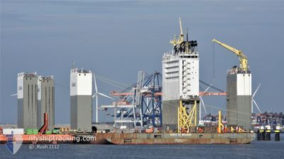
BOKA VANGUARD
Heavy Lift Vessel
Current Trip
EAST OPL
| Time Travelled | --- |
|---|---|
| Remaining Time | --- |
| Distance Travelled | 6374.19 nm |
| Remaining Distance | --- |
| AVG Speed | 8.4 Knots |
| MAX Speed | 10.7 Knots |
| AVG Wind | 13.9 knots |
| MAX Wind | 29 knots |
| MIN Temp | 11.8°C / 53.24°F |
| MAX Temp | 28.2°C / 82.76°F |
| Draught | 8.8 m |
| Position Received | 2 d ago |
Current Position
| Longitude | 104.93949° |
|---|---|
| Latitude | 3.27866° |
| Status | At anchor |
| Speed | |
| Course | 80° |
| Area | South China Sea |
| Station | T-AIS |
| Position Received | 2 d ago |
Info
Information
The current position of BOKA VANGUARD is in South China Sea with coordinates 3.27866° / 104.93949° as reported on 2024-04-16 19:53 by AIS to our vessel tracker app. The vessel's current speed is 0 Knots
The vessel BOKA VANGUARD (IMO: 9618783, MMSI: 306039000) is a Heavy Lift Vessel that was built in 2013 ( 11 years old ). It's sailing under the flag of [CW] Curacao.
In this page you can find informations about the vessels current position, last detected port calls, and current voyage information. If the vessels is not in coverage by AIS you will find the latest position.
The current position of BOKA VANGUARD is detected by our AIS receivers and we are not responsible for the reliability of the data. The last position was recorded while the vessel was in Coverage by the Ais receivers of our vessel tracking app.
The current draught of BOKA VANGUARD as reported by AIS is 8.8 meters
Weather
| Temperature | 29.1°C / 84.38°F |
|---|---|
| Wind Speed | 8 knots |
| Direction | 107° ESE |
| Pressure | 1007.6 hPa |
| Humidity | 76.2 % |
| Cloud Coverage | 100 % |
Featured Company
Last Port Calls
Most Visited Ports (Last year)
| Port | Arrivals | |
|---|---|---|
| 2 | ||
| 1 | ||
| 1 |
Last Trips
| Origin | Departure | Destination | Arrival | Distance |
|---|
Events
| Time | Event | Details | Position / Dest | Info |
|---|---|---|---|---|
| 2024-04-16 20:02 | Status Changed | Default At anchor |
3.27833 / 104.93833
EAST OPL
|
Speed: Course: 80° |
| 2024-04-16 19:53 | Change Sea Area | Indonesian part of the South China Sea Malaysian part of the South China Sea |
3.27866 / 104.93949
South China Sea
|
Speed: Course: 199.7° |
| 2024-04-16 19:53 | Status Changed | At anchor Default |
3.27866 / 104.93949
EAST OPL
|
Speed: Course: -1° |
| 2024-04-16 19:53 | IN Coverage |
3.27866 / 104.93949
South China Sea
|
Speed: Course: 199.7° |
|
| 2024-04-16 19:53 | OUT of Coverage |
3.27866 / 104.93949
South China Sea
|
Speed: Course: 199.7° |
|
| 2024-04-14 00:56 | STOP Moving |
3.27833 / 104.93833
EAST OPL
|
Speed: Course: -1° |
|
| 2024-04-13 15:32 | START Moving |
1.99500 / 104.66833
EAST OPL
|
Speed: 5 kn Course: 11° |
|
| 2024-04-13 15:08 | STOP Moving |
1.98333 / 104.66833
EAST OPL
|
Speed: Course: -1° |
|
| 2024-04-13 06:23 | START Moving |
3.25333 / 104.93833
EAST OPL
|
Speed: 8 kn Course: 183° |