
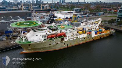
BOKA ATLANTIS
Diving Support Vessel
Current Trip
TERN FIELD
| Time Travelled | 37 days |
|---|---|
| Remaining Time | --- |
| Distance Travelled | 350.77 nm |
| Remaining Distance | --- |
| AVG Speed | 6.6 Knots |
| MAX Speed | 12.4 Knots |
| AVG Wind | 14.4 knots |
| MAX Wind | 27 knots |
| MIN Temp | 4.7°C / 40.46°F |
| MAX Temp | 9.5°C / 49.1°F |
| Draught | 6.4 m |
| Position Received | 1 d ago |
Current Position
| Longitude | 0.73379° |
|---|---|
| Latitude | 61.25225° |
| Status | Restricted manoeuverability |
| Speed | 0.4 Knots |
| Course | 244° |
| Area | Norwegian Sea |
| Station | T-AIS |
| Position Received | 1 d ago |
Info
Information
The current position of BOKA ATLANTIS is in Norwegian Sea with coordinates 61.25225° / 0.73379° as reported on 2024-04-17 02:50 by AIS to our vessel tracker app. The vessel's current speed is 0.4 Knots
The vessel BOKA ATLANTIS (IMO: 9441221, MMSI: 538003646) is a Diving Support Vessel that was built in 2011 ( 13 years old ). It's sailing under the flag of [MH] Marshall Is.
In this page you can find informations about the vessels current position, last detected port calls, and current voyage information. If the vessels is not in coverage by AIS you will find the latest position.
The current position of BOKA ATLANTIS is detected by our AIS receivers and we are not responsible for the reliability of the data. The last position was recorded while the vessel was in Coverage by the Ais receivers of our vessel tracking app.
The current draught of BOKA ATLANTIS as reported by AIS is 6.4 meters
Weather
| Temperature | 6°C / 42.8°F |
|---|---|
| Wind Speed | 17 knots |
| Direction | 52° NE |
| Pressure | 1011.5 hPa |
| Humidity | 79.5 % |
| Cloud Coverage | 82 % |
Featured Company
Most Visited Ports (Last year)
| Port | Arrivals | |
|---|---|---|
| 4 | ||
| 3 | ||
| 3 | ||
| 2 | ||
| 2 | ||
| 1 |
Events
| Time | Event | Details | Position / Dest | Info |
|---|---|---|---|---|
| 2024-04-17 02:50 | OUT of Coverage |
61.25225 / .73379
Norwegian Sea
|
Speed: 0.4 kn Course: 343.1° |
|
| 2024-04-17 00:57 | IN Coverage |
61.25229 / .73377
Norwegian Sea
|
Speed: 0.4 kn Course: 45.7° |
|
| 2024-04-12 01:00 | OUT of Coverage |
61.24766 / .72606
Norwegian Sea
|
Speed: 0.8 kn Course: 154° |
|
| 2024-04-11 23:53 | IN Coverage |
61.24740 / .72601
Norwegian Sea
|
Speed: 0.5 kn Course: 56° |
|
| 2024-04-11 19:57 | OUT of Coverage |
61.24747 / .72584
Norwegian Sea
|
Speed: 0.5 kn Course: 145.8° |
|
| 2024-04-11 19:27 | Draught Changed | 6.4 6.5 |
61.24756 / .72605
TERN FIELD
|
Speed: 0.5 kn Course: 231° |
| 2024-04-11 19:27 | ETA Changed | 2024/04/08 20:00 2024/04/03 20:00 |
61.24756 / .72605
TERN FIELD
|
Speed: 0.5 kn Course: 231° |
| 2024-04-11 15:41 | STOP Moving |
61.24747 / .72574
TERN FIELD
|
Speed: 0.3 kn Course: 240° |
|
| 2024-04-11 14:22 | IN Coverage |
61.24756 / .72569
Norwegian Sea
|
Speed: 0.8 kn Course: 17.2° |
|
| 2024-04-11 08:17 | OUT of Coverage |
61.24754 / .72589
Norwegian Sea
|
Speed: 0.8 kn Course: 10.9° |