
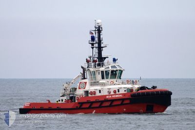
BOA HEIMDAL
Tug
Current Trip
SN DKR
| Time Travelled | 9 h, 13 mins |
|---|---|
| Remaining Time | --- |
| Distance Travelled | 1.05 nm |
| Remaining Distance | --- |
| AVG Speed | 7.3 Knots |
| MAX Speed | 7.3 Knots |
| AVG Wind | 16.3 knots |
| MAX Wind | 17 knots |
| MIN Temp | 24.3°C / 75.74°F |
| MAX Temp | 24.7°C / 76.46°F |
| Draught | 5.8 m |
| Position Received | 18 h, 15 m ago |
Current Position
| Longitude | -17.52026° |
|---|---|
| Latitude | 14.54405° |
| Status | Under way using engine |
| Speed | 8.2 Knots |
| Course | 98.6° |
| Area | North Atlantic Ocean |
| Station | T-AIS |
| Position Received | 18 h, 15 m ago |
Info
Information
The current position of BOA HEIMDAL is in North Atlantic Ocean with coordinates 14.54405° / -17.52026° as reported on 2024-04-18 10:11 by AIS to our vessel tracker app. The vessel's current speed is 8.2 Knots
The vessel BOA HEIMDAL (IMO: 9551909, MMSI: 259088000) is a Tug that was built in 2010 ( 14 years old ). It's sailing under the flag of [NO] Norway.
In this page you can find informations about the vessels current position, last detected port calls, and current voyage information. If the vessels is not in coverage by AIS you will find the latest position.
The current position of BOA HEIMDAL is detected by our AIS receivers and we are not responsible for the reliability of the data. The last position was recorded while the vessel was in Coverage by the Ais receivers of our vessel tracking app.
The current draught of BOA HEIMDAL as reported by AIS is 5.8 meters
Weather
| Temperature | 22.6°C / 72.68°F |
|---|---|
| Wind Speed | 17 knots |
| Direction | 25° NNE |
| Pressure | 1009.3 hPa |
| Humidity | 75.5 % |
| Cloud Coverage | --- |
Featured Company
Last Trips
| Origin | Departure | Destination | Arrival | Distance | |
|---|---|---|---|---|---|
| 2024-03-19 10:50 | 2024-04-18 14:52 | 647.07 nm | |||
| 2024-02-10 17:32 | 2024-03-18 23:41 | 81.72 nm | |||
| 2024-02-10 14:00 | 2024-02-10 14:36 | 2.89 nm | |||
| 2024-02-09 22:44 | 2024-02-09 23:28 | 2.43 nm | |||
| 2023-12-23 11:39 | 2024-02-09 16:24 | 1420.46 nm |
Events
| Time | Event | Details | Position / Dest | Info |
|---|---|---|---|---|
| 2024-04-18 22:41 | STOP Moving | 1.48 nm, North East of DAKAR |
14.69538 / -17.40668
SN DKR
|
Speed: 0.1 kn Course: 35° |
| 2024-04-18 22:07 | START Moving | 0.73 nm, North East of DAKAR |
14.68967 / -17.41874
SN DKR
|
Speed: 7.3 kn Course: 130° |
| 2024-04-18 19:13 | PORT DEPARTURE |
|
14.69329 / -17.42162
SN DKR
|
Speed: Course: 12° |
| 2024-04-18 14:52 | PORT ARRIVAL |
|
14.68021 / -17.42062
[SN] DAKAR
|
Speed: 8.1 kn Course: 175° |
| 2024-04-18 12:56 | STOP Moving | 1.43 nm, North East of DAKAR |
14.69477 / -17.40743
SN DKR
|
Speed: 0.1 kn Course: 347° |
| 2024-04-18 10:25 | Status Changed | Default Under way using engine |
14.53932 / -17.48842
SN DKR
|
Speed: 8.2 kn Course: 98.6° |
| 2024-04-18 10:11 | OUT of Coverage |
14.54405 / -17.52026
North Atlantic Ocean
|
Speed: 8.2 kn Course: 98.6° |
|
| 2024-04-18 10:06 | Detected in Sea | Senegalese part of the North Atlantic Ocean |
14.54539 / -17.52997
North Atlantic Ocean
|
Speed: 8.2 kn Course: 95.6° |
| 2024-04-18 10:06 | Status Changed | Under way using engine Default |
14.54539 / -17.52997
SN DKR
|
Speed: 8 kn Course: 96° |
| 2024-04-18 10:00 | IN Coverage |
14.54539 / -17.52997
North Atlantic Ocean
|
Speed: 8.2 kn Course: 95.6° |