
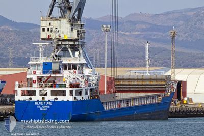
BLUE TUNE
General Cargo
Current Trip
Current Position
| Longitude | 9.83999° |
|---|---|
| Latitude | 44.10560° |
| Status | Moored |
| Speed | |
| Course | 179° |
| Area | Tyrrhenian Sea |
| Station | T-AIS |
| Position Received | 6 m ago |
Info
Information
The current position of BLUE TUNE is in Tyrrhenian Sea with coordinates 44.10560° / 9.83999° as reported on 2024-04-18 23:53 by AIS to our vessel tracker app. The vessel's current speed is 0 Knots and is currently inside the port of LA SPEZIA.
The vessel BLUE TUNE (IMO: 9491927, MMSI: 305566000) is a General Cargo that was built in 2010 ( 14 years old ). It's sailing under the flag of [AG] Antigua Barbuda.
In this page you can find informations about the vessels current position, last detected port calls, and current voyage information. If the vessels is not in coverage by AIS you will find the latest position.
The current position of BLUE TUNE is detected by our AIS receivers and we are not responsible for the reliability of the data. The last position was recorded while the vessel was in Coverage by the Ais receivers of our vessel tracking app.
The current draught of BLUE TUNE as reported by AIS is 6.1 meters
Weather
| Temperature | 11.9°C / 53.42°F |
|---|---|
| Wind Speed | 16 knots |
| Direction | 7° N |
| Pressure | 1014.1 hPa |
| Humidity | 62.7 % |
| Cloud Coverage | 100 % |
Featured Company
Last Port Calls
| Port | Arrival | Departure | Time In Port |
|---|---|---|---|
| 2024-04-17 10:11 | |||
| 2024-04-11 12:52 | 2024-04-11 16:30 | 3 h | |
| 2024-04-04 09:19 | 2024-04-07 13:27 | 3 d | |
| 2024-04-02 13:46 | 2024-04-03 13:44 | 23 h | |
| 2024-03-27 20:46 | 2024-03-29 01:22 | 1 d | |
| 2024-03-25 23:24 | 2024-03-27 20:28 | 1 d | |
| 2024-03-24 04:54 | 2024-03-25 18:27 | 1 d | |
| 2024-03-20 00:02 | 2024-03-22 23:27 | 2 d | |
| 2024-03-16 18:37 | 2024-03-18 21:33 | 2 d | |
| 2024-03-10 21:57 | 2024-03-13 13:28 | 2 d |
Last Trips
| Origin | Departure | Destination | Arrival | Distance | |
|---|---|---|---|---|---|
| 2024-04-11 18:30 | 2024-04-17 12:11 | 885.72 nm | |||
| 2024-04-07 15:27 | 2024-04-11 14:52 | 806.38 nm | |||
| 2024-04-03 15:44 | 2024-04-04 11:19 | 183.19 nm | |||
| 2024-03-29 02:22 | 2024-04-02 15:46 | 845.22 nm | |||
| 2024-03-27 21:28 | 2024-03-27 21:46 | 0.36 nm | |||
| 2024-03-25 19:27 | 2024-03-26 00:24 | 49.65 nm | |||
| 2024-03-22 23:27 | 2024-03-24 05:54 | 256.69 nm | |||
| 2024-03-18 22:33 | 2024-03-20 00:02 | 257.84 nm | |||
| 2024-03-13 13:28 | 2024-03-16 19:37 | 678.16 nm | |||
| 2024-03-10 09:37 | 2024-03-10 21:57 | 123.10 nm |
Events
| Time | Event | Details | Position / Dest | Info |
|---|---|---|---|---|
| 2024-04-17 17:35 | Status Changed | Moored Default |
44.10555 / 9.83993
[IT] LA SPEZIA
|
Speed: Course: -1° |
| 2024-04-17 17:30 | Status Changed | Default Moored |
44.10500 / 9.83833
[IT] LA SPEZIA
|
Speed: Course: 179° |
| 2024-04-17 10:44 | Status Changed | Moored Under way using engine |
44.10550 / 9.84011
[IT] LA SPEZIA
|
Speed: 0.1 kn Course: 186° |
| 2024-04-17 10:42 | STOP Moving |
44.10551 / 9.84018
[IT] LA SPEZIA
|
Speed: 0.3 kn Course: 180° |
|
| 2024-04-17 10:11 | PORT ARRIVAL |
|
44.07549 / 9.85125
[IT] LA SPEZIA
|
Speed: 9.1 kn Course: 342° |
| 2024-04-17 09:54 | START Moving | 1.54 nm, East of PORTO VENERE |
44.05518 / 9.87234
IT SPE
|
Speed: 4.1 kn Course: 257° |
| 2024-04-17 09:27 | Status Changed | Under way using engine At anchor |
44.05675 / 9.87506
IT SPE
|
Speed: 0.1 kn Course: 258° |
| 2024-04-16 20:24 | Status Changed | At anchor Under way using engine |
44.05620 / 9.87475
IT SPE
|
Speed: 0.3 kn Course: 306° |
| 2024-04-16 20:22 | STOP Moving | 1.65 nm, East of PORTO VENERE |
44.05603 / 9.87479
IT SPE
|
Speed: 0.3 kn Course: 319° |
| 2024-04-16 19:04 | START Moving | 5.78 nm, South of PORTO VENERE |
43.95621 / 9.85820
IT SPE
|
Speed: 3.1 kn Course: 98° |