
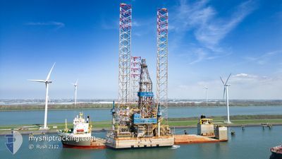
BLACK MARLIN
Heavy Lift Vessel
Current Trip
| Time Travelled | 5 days |
|---|---|
| Remaining Time | 4 mins |
| Distance Travelled | 1379.56 nm |
| Remaining Distance | 3.46 nm |
| AVG Speed | 10 Knots |
| MAX Speed | 11.4 Knots |
| AVG Wind | 14.2 knots |
| MAX Wind | 29.9 knots |
| MIN Temp | 11.7°C / 53.06°F |
| MAX Temp | 21°C / 69.8°F |
| Draught | 8.5 m |
| Position Received | 10 m ago |
Current Position
| Longitude | -15.36886° |
|---|---|
| Latitude | 28.06514° |
| Status | At anchor |
| Speed | 0.2 Knots |
| Course | 22° |
| Area | North Atlantic Ocean |
| Station | T-AIS |
| Position Received | 10 m ago |
Info
Information
The current position of BLACK MARLIN is in North Atlantic Ocean with coordinates 28.06514° / -15.36886° as reported on 2024-04-19 21:22 by AIS to our vessel tracker app. The vessel's current speed is 0.2 Knots and is heading at the port of LAS PALMAS. The estimated time of arrival as calculated by MyShipTracking vessel tracking app is 2024-04-19 21:37 LT
The vessel BLACK MARLIN (IMO: 9186326, MMSI: 248312000) is a Heavy Lift Vessel that was built in 1999 ( 25 years old ). It's sailing under the flag of [MT] Malta.
In this page you can find informations about the vessels current position, last detected port calls, and current voyage information. If the vessels is not in coverage by AIS you will find the latest position.
The current position of BLACK MARLIN is detected by our AIS receivers and we are not responsible for the reliability of the data. The last position was recorded while the vessel was in Coverage by the Ais receivers of our vessel tracking app.
The current draught of BLACK MARLIN as reported by AIS is 8.5 meters
Weather
| Temperature | 20.2°C / 68.36°F |
|---|---|
| Wind Speed | 16 knots |
| Direction | 357° N |
| Pressure | 1017.8 hPa |
| Humidity | 81.6 % |
| Cloud Coverage | 24 % |
Featured Company
Last Port Calls
| Port | Arrival | Departure | Time In Port |
|---|---|---|---|
| 2024-04-12 16:02 | 2024-04-14 06:30 | 1 d | |
| 2024-04-05 11:44 | 2024-04-12 15:37 | 7 d |
Most Visited Ports (Last year)
| Port | Arrivals | |
|---|---|---|
| 3 | ||
| 2 | ||
| 1 | ||
| 1 |
Last Trips
| Origin | Departure | Destination | Arrival | Distance | |
|---|---|---|---|---|---|
| 2024-04-12 17:37 | 2024-04-12 18:02 | 0.72 nm |
Events
| Time | Event | Details | Position / Dest | Info |
|---|---|---|---|---|
| 2024-04-19 21:28 | Status Changed | Default At anchor |
28.06511 / -15.36898
ESLPA
|
Speed: 0.2 kn Course: 22° |
| 2024-04-19 21:19 | Status Changed | At anchor Default |
28.06521 / -15.36905
ESLPA
|
Speed: 0.2 kn Course: 14° |
| 2024-04-19 21:16 | Status Changed | Default At anchor |
28.06515 / -15.36916
ESLPA
|
Speed: 0.3 kn Course: 358° |
| 2024-04-19 21:04 | Status Changed | At anchor Default |
28.06549 / -15.36902
ESLPA
|
Speed: 0.5 kn Course: 335° |
| 2024-04-19 20:58 | Status Changed | Default At anchor |
28.06617 / -15.36888
ESLPA
|
Speed: 0.4 kn Course: 307° |
| 2024-04-19 20:49 | STOP Moving | 4.34 nm, South East of LAS PALMAS |
28.06731 / -15.36926
ESLPA
|
Speed: 0.2 kn Course: 287° |
| 2024-04-19 20:46 | Status Changed | At anchor Under way using engine |
28.06763 / -15.36914
ESLPA
|
Speed: 0.8 kn Course: 270° |
| 2024-04-19 14:06 | ETA Changed | 2024/04/19 18:30 2024/04/19 16:00 |
28.76587 / -15.16779
ESLPA
|
Speed: 10.6 kn Course: 196.9° |
| 2024-04-19 12:49 | Change Sea Area | Spanish (Canary Islands) part of the North Atlantic Ocean Portuguese (Madeira) part of the North Atlantic Ocean |
28.98287 / -15.09546
North Atlantic Ocean
ESLPA
|
Speed: 10.4 kn Course: 194.8° |
| 2024-04-19 12:47 | Status Changed | Under way using engine Default |
28.98849 / -15.09376
ESLPA
|
Speed: 10.5 kn Course: 197° |