
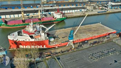
BIGROLL BERING
Cargo
Current Trip
BINTAN
| Time Travelled | 10 days |
|---|---|
| Remaining Time | --- |
| Distance Travelled | 1971.13 nm |
| Remaining Distance | --- |
| AVG Speed | 7.9 Knots |
| MAX Speed | 13.3 Knots |
| AVG Wind | 6.6 knots |
| MAX Wind | 13 knots |
| MIN Temp | 27.3°C / 81.14°F |
| MAX Temp | 30°C / 86°F |
| Draught | 5.3 m |
| Position Received | 52 m ago |
Current Position
| Longitude | 104.25185° |
|---|---|
| Latitude | 1.00375° |
| Status | Under way using engine |
| Speed | 0.3 Knots |
| Course | 102° |
| Area | South China Sea |
| Station | T-AIS |
| Position Received | 52 m ago |
Info
Information
The current position of BIGROLL BERING is in South China Sea with coordinates 1.00375° / 104.25185° as reported on 2024-04-19 04:22 by AIS to our vessel tracker app. The vessel's current speed is 0.3 Knots
The vessel BIGROLL BERING (IMO: 9710476, MMSI: 244830431) is a Cargo It's sailing under the flag of [NL] Netherlands.
In this page you can find informations about the vessels current position, last detected port calls, and current voyage information. If the vessels is not in coverage by AIS you will find the latest position.
The current position of BIGROLL BERING is detected by our AIS receivers and we are not responsible for the reliability of the data. The last position was recorded while the vessel was in Coverage by the Ais receivers of our vessel tracking app.
The current draught of BIGROLL BERING as reported by AIS is 5.3 meters
Weather
| Temperature | 29.2°C / 84.56°F |
|---|---|
| Wind Speed | 5 knots |
| Direction | 186° S |
| Pressure | 1008.8 hPa |
| Humidity | 70.2 % |
| Cloud Coverage | 100 % |
Featured Company
Most Visited Ports (Last year)
| Port | Arrivals | |
|---|---|---|
| 2 | ||
| 2 | ||
| 2 | ||
| 2 | ||
| 1 | ||
| 1 |
Events
| Time | Event | Details | Position / Dest | Info |
|---|---|---|---|---|
| 2024-04-19 03:55 | STOP Moving | 4.36 nm, South East of TANJUNGUBAN |
1.00378 / 104.25196
BINTAN
|
Speed: Course: 106° |
| 2024-04-19 02:10 | Change Sea Area | Indonesian part of the South China Sea Indonesian part of the Singapore Strait |
1.16835 / 104.21007
South China Sea
BINTAN
|
Speed: 12.1 kn Course: 193.7° |
| 2024-04-19 01:43 | Change Sea Area | Indonesian part of the Singapore Strait Malaysian part of the Singapore Strait |
1.25267 / 104.23693
Singapore Strait
BINTAN
|
Speed: 12.5 kn Course: 178.9° |
| 2024-04-19 01:41 | Destination Changed | BINTAN DARWIN |
1.26140 / 104.23655
BINTAN
|
Speed: 12.7 kn Course: 176.2° |
| 2024-04-19 01:41 | ETA Changed | 2024/04/19 03:00 2024/03/19 12:00 |
1.26140 / 104.23655
BINTAN
|
Speed: 12.7 kn Course: 176.2° |
| 2024-04-19 01:41 | Draught Changed | 5.3 5.8 |
1.26140 / 104.23655
BINTAN
|
Speed: 12.7 kn Course: 176.2° |
| 2024-04-19 00:53 | Change Sea Area | Malaysian part of the Singapore Strait Malaysian part of the South China Sea |
1.31880 / 104.34310
Singapore Strait
|
Speed: 12.3 kn Course: 229.5° |
| 2024-04-18 23:59 | Change Sea Area | Malaysian part of the South China Sea Indonesian part of the South China Sea |
1.40525 / 104.49397
South China Sea
|
Speed: 12.4 kn Course: 283.2° |
| 2024-04-18 23:08 | Change Sea Area | Indonesian part of the South China Sea Malaysian part of the Singapore Strait |
1.35718 / 104.66053
South China Sea
|
Speed: 12.3 kn Course: 284.1° |
| 2024-04-18 23:08 | IN Coverage |
1.35718 / 104.66053
South China Sea
|
Speed: 12.3 kn Course: 284.1° |