
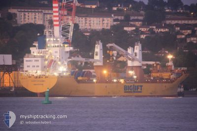
BIGLIFT BAFFIN
Cargo
Current Trip
CHZOS
| Time Travelled | --- |
|---|---|
| Remaining Time | --- |
| Distance Travelled | 2199.29 nm |
| Remaining Distance | --- |
| AVG Speed | 7.7 Knots |
| MAX Speed | 12.9 Knots |
| AVG Wind | 13.1 knots |
| MAX Wind | 32.7 knots |
| MIN Temp | 7.6°C / 45.68°F |
| MAX Temp | 29.4°C / 84.92°F |
| Draught | 5.7 m |
| Position Received | 5 d ago |
Current Position
| Longitude | 120.82197° |
|---|---|
| Latitude | 25.48914° |
| Status | Under way using engine |
| Speed | 8.7 Knots |
| Course | 213.4° |
| Area | Eastern China Sea |
| Station | T-AIS |
| Position Received | 5 d ago |
Info
Information
The current position of BIGLIFT BAFFIN is in Eastern China Sea with coordinates 25.48914° / 120.82197° as reported on 2024-04-17 14:58 by AIS to our vessel tracker app. The vessel's current speed is 8.7 Knots
The vessel BIGLIFT BAFFIN (IMO: 9758557, MMSI: 244830814) is a Cargo It's sailing under the flag of [NL] Netherlands.
In this page you can find informations about the vessels current position, last detected port calls, and current voyage information. If the vessels is not in coverage by AIS you will find the latest position.
The current position of BIGLIFT BAFFIN is detected by our AIS receivers and we are not responsible for the reliability of the data. The last position was recorded while the vessel was in Coverage by the Ais receivers of our vessel tracking app.
The current draught of BIGLIFT BAFFIN as reported by AIS is 5.7 meters
Weather
| Temperature | 29.6°C / 85.28°F |
|---|---|
| Wind Speed | 4 knots |
| Direction | 94° E |
| Pressure | 1006.4 hPa |
| Humidity | 74.8 % |
| Cloud Coverage | 38 % |
Featured Company
Last Port Calls
Most Visited Ports (Last year)
| Port | Arrivals | |
|---|---|---|
| 7 | ||
| 2 | ||
| 1 | ||
| 1 | ||
| 1 | ||
| 1 |
Last Trips
| Origin | Departure | Destination | Arrival | Distance |
|---|
Events
| Time | Event | Details | Position / Dest | Info |
|---|---|---|---|---|
| 2024-04-17 15:00 | Status Changed | Default Under way using engine |
25.48586 / 120.81958
CHZOS
|
Speed: 8.7 kn Course: 213.4° |
| 2024-04-17 14:58 | OUT of Coverage |
25.48914 / 120.82197
Eastern China Sea
|
Speed: 8.7 kn Course: 213.4° |
|
| 2024-04-17 14:57 | Status Changed | Under way using engine Default |
25.49119 / 120.82344
CHZOS
|
Speed: 8.5 kn Course: 212° |
| 2024-04-17 14:36 | Status Changed | Default Under way using engine |
25.53427 / 120.85405
CHZOS
|
Speed: 9.2 kn Course: 214.6° |
| 2024-04-17 14:32 | Status Changed | Under way using engine Default |
25.54194 / 120.85978
CHZOS
|
Speed: 9.5 kn Course: 215° |
| 2024-04-17 14:25 | Status Changed | Default Under way using engine |
25.55776 / 120.87180
CHZOS
|
Speed: 9.4 kn Course: 213.5° |
| 2024-04-17 14:15 | Status Changed | Under way using engine Default |
25.57928 / 120.88778
CHZOS
|
Speed: 8.9 kn Course: 216° |
| 2024-04-17 14:05 | Status Changed | Default Under way using engine |
25.60012 / 120.90334
CHZOS
|
Speed: 8.9 kn Course: 214.8° |
| 2024-04-17 13:58 | Detected in Sea | Taiwanese part of the Eastern China Sea |
25.61379 / 120.91399
Eastern China Sea
|
Speed: 8.8 kn Course: 214.8° |
| 2024-04-17 13:57 | Status Changed | Under way using engine Default |
25.61510 / 120.91501
CHZOS
|
Speed: 8.8 kn Course: 215° |