
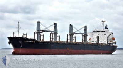
BERGE SNOWDON
Cargo
Current Trip
| Time Travelled | 5 days |
|---|---|
| Remaining Time | 3 h, 41 mins |
| Distance Travelled | 1387.07 nm |
| Remaining Distance | 150.15 nm |
| AVG Speed | 9.8 Knots |
| MAX Speed | 15.3 Knots |
| AVG Wind | 19.6 knots |
| MAX Wind | 35.7 knots |
| MIN Temp | 7.3°C / 45.14°F |
| MAX Temp | 19.5°C / 67.1°F |
| Draught | 9.8 m |
| Position Received | 8 h, 39 m ago |
Current Position
| Longitude | --- |
|---|---|
| Latitude | --- |
| Status | Under way using engine |
| Speed | 13.6 Knots |
| Course | 165.3° |
| Area | North Atlantic Ocean |
| Station | T-AIS |
| Position Received | 8 h, 39 m ago |
Info
Information
The current position of BERGE SNOWDON is in North Atlantic Ocean with coordinates 35.71180° / -9.46978° as reported on 2025-12-06 18:03 by AIS to our vessel tracker app. The vessel's current speed is 13.6 Knots and is heading at the port of JORF LASFAR. The estimated time of arrival as calculated by MyShipTracking vessel tracking app is 2025-12-07 07:23 LT
The vessel BERGE SNOWDON (IMO: 9738882, MMSI: 636021972) is a Cargo It's sailing under the flag of [LR] Liberia.
In this page you can find informations about the vessels current position, last detected port calls, and current voyage information. If the vessels is not in coverage by AIS you will find the latest position.
The current position of BERGE SNOWDON is detected by our AIS receivers and we are not responsible for the reliability of the data. The last position was recorded while the vessel was in Coverage by the Ais receivers of our vessel tracking app.
The current draught of BERGE SNOWDON as reported by AIS is 9.8 meters
Weather
| Temperature | 18.4°C / 65.12°F |
|---|---|
| Wind Speed | 11 knots |
| Direction | 88° E |
| Pressure | 1023.3 hPa |
| Humidity | 78.1 % |
| Cloud Coverage | 100 % |
Featured Company
Last Port Calls
| Port | Arrival | Departure | Time In Port |
|---|---|---|---|
| 2025-11-28 16:55 | 2025-12-01 13:07 | 2 d | |
| 2025-11-27 16:55 | 2025-11-28 16:44 | 23 h | |
| 2025-11-13 15:13 | 2025-11-21 10:31 | 7 d | |
| 2025-10-18 23:05 | 2025-10-20 14:41 | 1 d | |
| 2025-10-04 06:44 |
Most Visited Ports (Last year)
| Port | Arrivals | |
|---|---|---|
| 2 | ||
| 2 | ||
| 1 | ||
| 1 | ||
| 1 | ||
| 1 |
Last Trips
| Origin | Departure | Destination | Arrival | Distance | |
|---|---|---|---|---|---|
| 2025-11-28 16:44 | 2025-11-28 16:55 | 0.46 nm | |||
| 2025-11-21 10:31 | 2025-11-27 16:55 | 1405.88 nm | |||
| 2025-10-20 14:41 | 2025-11-13 15:13 | 5018.01 nm | |||
| 2025-10-04 06:44 | 2025-10-18 23:05 | 1113.10 nm |
Events
| Time | Event | Details | Position / Dest | Info |
|---|---|---|---|---|
| 2025-12-06 18:12 | Status Changed | Default Under way using engine |
35.67858 / -9.45926
MA JFL
|
Speed: 13.6 kn Course: 165.3° |
| 2025-12-06 18:03 | OUT of Coverage |
35.71180 / -9.46978
North Atlantic Ocean
MA JFL
|
Speed: 13.6 kn Course: 165.3° |
|
| 2025-12-06 18:02 | Status Changed | Under way using engine Default |
35.71423 / -9.47054
MA JFL
|
Speed: 13.6 kn Course: 164° |
| 2025-12-06 17:56 | Status Changed | Default Under way using engine |
35.73779 / -9.47767
MA JFL
|
Speed: 13.5 kn Course: 163.1° |
| 2025-12-06 17:44 | Status Changed | Under way using engine Default |
35.77934 / -9.49069
MA JFL
|
Speed: 13.7 kn Course: 166° |
| 2025-12-06 17:07 | Status Changed | Default Under way using engine |
35.91604 / -9.53251
MA JFL
|
Speed: 13.6 kn Course: 167.1° |
| 2025-12-06 17:01 | Status Changed | Under way using engine Default |
35.93909 / -9.53904
MA JFL
|
Speed: 13.3 kn Course: 168° |
| 2025-12-06 16:59 | Status Changed | Default Under way using engine |
35.94600 / -9.54101
MA JFL
|
Speed: 14 kn Course: 166.8° |
| 2025-12-06 16:48 | Status Changed | Under way using engine Default |
35.98776 / -9.55239
MA JFL
|
Speed: 13.5 kn Course: 168° |
| 2025-12-06 16:48 | IN Coverage |
35.98776 / -9.55239
North Atlantic Ocean
MA JFL
|
Speed: 13.5 kn Course: 168.5° |