
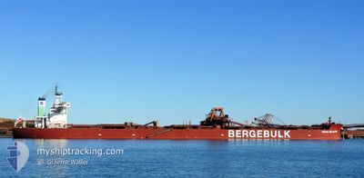
BERGE MULHACEN
Cargo
Current Trip
CNHUH
| Time Travelled | 7 days |
|---|---|
| Remaining Time | --- |
| Distance Travelled | 1750.93 nm |
| Remaining Distance | --- |
| AVG Speed | 10.3 Knots |
| MAX Speed | 13.8 Knots |
| AVG Wind | 9.8 knots |
| MAX Wind | 15.9 knots |
| MIN Temp | 27.5°C / 81.5°F |
| MAX Temp | 29.6°C / 85.28°F |
| Draught | 17.6 m |
| Position Received | 5 d ago |
Current Position
| Longitude | 116.75955° |
|---|---|
| Latitude | -13.23413° |
| Status | Under way using engine |
| Speed | 11.2 Knots |
| Course | 344.1° |
| Area | Indian Ocean |
| Station | T-AIS |
| Position Received | 5 d ago |
Info
Information
The current position of BERGE MULHACEN is in Indian Ocean with coordinates -13.23413° / 116.75955° as reported on 2024-04-18 12:49 by AIS to our vessel tracker app. The vessel's current speed is 11.2 Knots
The vessel BERGE MULHACEN (IMO: 9750945, MMSI: 232007361) is a Cargo It's sailing under the flag of [GB] United Kingdom.
In this page you can find informations about the vessels current position, last detected port calls, and current voyage information. If the vessels is not in coverage by AIS you will find the latest position.
The current position of BERGE MULHACEN is detected by our AIS receivers and we are not responsible for the reliability of the data. The last position was recorded while the vessel was in Coverage by the Ais receivers of our vessel tracking app.
The current draught of BERGE MULHACEN as reported by AIS is 17.6 meters
Weather
| Temperature | 29.4°C / 84.92°F |
|---|---|
| Wind Speed | 9 knots |
| Direction | 82° E |
| Pressure | 1009.7 hPa |
| Humidity | 79.2 % |
| Cloud Coverage | 100 % |
Featured Company
Last Port Calls
| Port | Arrival | Departure | Time In Port |
|---|---|---|---|
| 2024-04-15 15:47 | 2024-04-16 19:38 | 1 d | |
| 2024-03-21 08:34 | 2024-03-25 01:36 | 3 d | |
| 2024-03-08 05:11 | 2024-03-10 09:00 | 2 d | |
| 2024-02-19 06:50 | 2024-02-20 16:54 | 1 d |
Last Trips
| Origin | Departure | Destination | Arrival | Distance | |
|---|---|---|---|---|---|
| 2024-03-25 10:36 | 2024-04-15 23:47 | 3565.93 nm | |||
| 2024-03-10 18:00 | 2024-03-21 17:34 | 780.62 nm | |||
| 2024-02-21 00:54 | 2024-03-08 14:11 | 3712.36 nm | |||
| 2024-01-28 07:05 | 2024-02-19 14:50 | 3119.81 nm |
Events
| Time | Event | Details | Position / Dest | Info |
|---|---|---|---|---|
| 2024-04-18 13:03 | Status Changed | Default Under way using engine |
-13.19028 / 116.74667
CNHUH
|
Speed: 11.2 kn Course: 344.1° |
| 2024-04-18 12:49 | OUT of Coverage |
-13.23413 / 116.75955
Indian Ocean
CNHUH
|
Speed: 11.2 kn Course: 344.1° |
|
| 2024-04-18 11:47 | Detected in Sea | High seas of the Indian Ocean |
-13.41608 / 116.81128
Indian Ocean
CNHUH
|
Speed: 10.8 kn Course: 344.4° |
| 2024-04-18 11:47 | Status Changed | Under way using engine Default |
-13.41608 / 116.81128
CNHUH
|
Speed: 10.8 kn Course: 346° |
| 2024-04-18 11:43 | IN Coverage |
-13.41608 / 116.81128
Indian Ocean
CNHUH
|
Speed: 10.8 kn Course: 344.4° |
|
| 2024-04-17 15:29 | Status Changed | Default Under way using engine |
-17.00761 / 117.72772
CNHUH
|
Speed: 11 kn Course: 345.8° |
| 2024-04-17 15:21 | Status Changed | Under way using engine Default |
-17.03140 / 117.73394
CNHUH
|
Speed: 11 kn Course: 347° |
| 2024-04-17 15:21 | OUT of Coverage |
-17.03140 / 117.73394
Indian Ocean
CNHUH
|
Speed: 11 kn Course: 345.8° |
|
| 2024-04-17 15:14 | Status Changed | Default Under way using engine |
-17.05217 / 117.73949
CNHUH
|
Speed: 10.9 kn Course: 345.1° |
| 2024-04-17 15:10 | Status Changed | Under way using engine Default |
-17.06252 / 117.74220
CNHUH
|
Speed: 10.9 kn Course: 346° |