
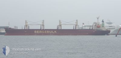
BERGE HAKODATE
Cargo
Current Trip
| Time Travelled | 6 days |
|---|---|
| Remaining Time | --- |
| Distance Travelled | 297.78 nm |
| Remaining Distance | --- |
| AVG Speed | 10 Knots |
| MAX Speed | 13.7 Knots |
| AVG Wind | 13.3 knots |
| MAX Wind | 21.3 knots |
| MIN Temp | 16.9°C / 62.42°F |
| MAX Temp | 23.8°C / 74.84°F |
| Draught | 6.1 m |
| Position Received | 3 m ago |
Current Position
| Longitude | 115.56224° |
|---|---|
| Latitude | -33.26056° |
| Status | At anchor |
| Speed | 0.1 Knots |
| Course | 247° |
| Area | Indian Ocean |
| Station | T-AIS |
| Position Received | 3 m ago |
Info
Information
The current position of BERGE HAKODATE is in Indian Ocean with coordinates -33.26056° / 115.56224° as reported on 2024-04-19 11:33 by AIS to our vessel tracker app. The vessel's current speed is 0.1 Knots
The vessel BERGE HAKODATE (IMO: 9713167, MMSI: 235110509) is a Cargo It's sailing under the flag of [GB] United Kingdom.
In this page you can find informations about the vessels current position, last detected port calls, and current voyage information. If the vessels is not in coverage by AIS you will find the latest position.
The current position of BERGE HAKODATE is detected by our AIS receivers and we are not responsible for the reliability of the data. The last position was recorded while the vessel was in Coverage by the Ais receivers of our vessel tracking app.
The current draught of BERGE HAKODATE as reported by AIS is 6.1 meters
Weather
| Temperature | 21.8°C / 71.24°F |
|---|---|
| Wind Speed | 2 knots |
| Direction | 196° SSW |
| Pressure | 1023.5 hPa |
| Humidity | 66.9 % |
| Cloud Coverage | 1 % |
Featured Company
Last Port Calls
| Port | Arrival | Departure | Time In Port |
|---|---|---|---|
| 2024-04-11 09:42 | 2024-04-13 07:30 | 1 d | |
| 2024-03-23 15:19 | 2024-03-27 08:03 | 3 d | |
| 2024-02-01 05:59 | 2024-02-01 15:14 | 9 h |
Last Trips
| Origin | Departure | Destination | Arrival | Distance | |
|---|---|---|---|---|---|
| 2024-03-27 16:03 | 2024-04-11 17:42 | 279.59 nm | |||
| 2024-01-30 05:54 | 2024-03-23 23:19 | 12255.07 nm | |||
| 2024-01-30 05:54 | 2024-02-01 07:59 | 274.76 nm |
Events
| Time | Event | Details | Position / Dest | Info |
|---|---|---|---|---|
| 2024-04-15 08:36 | Status Changed | At anchor Under way using engine |
-33.26000 / 115.56138
BUNBURY
|
Speed: 0.5 kn Course: 202° |
| 2024-04-15 08:32 | STOP Moving | 5.53 nm, North West of BUNBURY |
-33.26044 / 115.56139
BUNBURY
|
Speed: 0.2 kn Course: 217° |
| 2024-04-15 07:48 | START Moving | 3.47 nm, North West of BUNBURY |
-33.27080 / 115.60682
BUNBURY
|
Speed: 3.2 kn Course: 280° |
| 2024-04-15 07:44 | Status Changed | Under way using engine At anchor |
-33.27090 / 115.60950
BUNBURY
|
Speed: 0.6 kn Course: 252° |
| 2024-04-14 22:46 | Status Changed | At anchor Default |
-33.27076 / 115.60713
BUNBURY
|
Speed: 0.1 kn Course: 104° |
| 2024-04-14 22:43 | Status Changed | Default At anchor |
-33.27069 / 115.60714
BUNBURY
|
Speed: 0.1 kn Course: 109° |
| 2024-04-14 21:34 | Status Changed | At anchor Default |
-33.27002 / 115.60748
BUNBURY
|
Speed: 0.1 kn Course: 129° |
| 2024-04-14 21:31 | Status Changed | Default At anchor |
-33.27006 / 115.60755
BUNBURY
|
Speed: Course: 127° |
| 2024-04-14 19:10 | Status Changed | At anchor Default |
-33.27043 / 115.60722
BUNBURY
|
Speed: Course: 114° |
| 2024-04-14 19:07 | Status Changed | Default At anchor |
-33.27040 / 115.60721
BUNBURY
|
Speed: Course: 112° |