
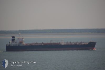
BENTLEY I
Oil/Chemical Tanker
Current Trip
TN BIZ
| Time Travelled | 1 day |
|---|---|
| Remaining Time | --- |
| Distance Travelled | 221.04 nm |
| Remaining Distance | --- |
| AVG Speed | 10.5 Knots |
| MAX Speed | 12.9 Knots |
| AVG Wind | 10 knots |
| MAX Wind | 16 knots |
| MIN Temp | 16.6°C / 61.88°F |
| MAX Temp | 20.3°C / 68.54°F |
| Draught | 9.9 m |
| Position Received | 8 d ago |
Current Position
| Longitude | 9.96848° |
|---|---|
| Latitude | 37.28970° |
| Status | At anchor |
| Speed | 0.1 Knots |
| Course | 288° |
| Area | Mediterranean Sea - Western Basin |
| Station | T-AIS |
| Position Received | 8 d ago |
Info
Information
The current position of BENTLEY I is in Mediterranean Sea - Western Basin with coordinates 37.28970° / 9.96848° as reported on 2024-04-09 15:11 by AIS to our vessel tracker app. The vessel's current speed is 0.1 Knots
The vessel BENTLEY I (IMO: 9253129, MMSI: 373259000) is a Oil/Chemical Tanker that was built in 2004 ( 20 years old ). It's sailing under the flag of [PA] Panama.
In this page you can find informations about the vessels current position, last detected port calls, and current voyage information. If the vessels is not in coverage by AIS you will find the latest position.
The current position of BENTLEY I is detected by our AIS receivers and we are not responsible for the reliability of the data. The last position was recorded while the vessel was in Coverage by the Ais receivers of our vessel tracking app.
The current draught of BENTLEY I as reported by AIS is 9.9 meters
Weather
| Temperature | 16.3°C / 61.34°F |
|---|---|
| Wind Speed | 18 knots |
| Direction | 295° WNW |
| Pressure | 1013.6 hPa |
| Humidity | 68.2 % |
| Cloud Coverage | 1 % |
Featured Company
Last Port Calls
| Port | Arrival | Departure | Time In Port |
|---|---|---|---|
| 2024-04-15 15:23 | 2024-04-16 14:09 | 22 h | |
| 2024-04-11 08:30 | 2024-04-13 13:58 | 2 d | |
| 2024-04-01 07:17 | 2024-04-03 00:41 | 1 d | |
| 2024-03-27 16:52 | 2024-03-29 20:41 | 2 d | |
| 2024-03-22 13:57 | 2024-03-23 19:29 | 1 d | |
| 2024-03-06 13:33 | 2024-03-07 17:37 | 1 d | |
| 2024-02-13 16:02 | 2024-02-15 18:02 | 2 d |
Last Trips
| Origin | Departure | Destination | Arrival | Distance | |
|---|---|---|---|---|---|
| 2024-04-13 14:58 | 2024-04-15 16:23 | 347.56 nm | |||
| 2024-04-03 02:41 | 2024-04-11 09:30 | 363.98 nm | |||
| 2024-03-29 21:41 | 2024-04-01 09:17 | 643.12 nm | |||
| 2024-03-23 20:29 | 2024-03-27 17:52 | 656.16 nm | |||
| 2024-03-07 19:37 | 2024-03-22 14:57 | 1295.04 nm | |||
| 2024-02-15 19:02 | 2024-03-06 15:33 | 1086.59 nm | |||
| 2024-01-26 22:57 | 2024-02-13 17:02 | 28.71 nm |
Events
| Time | Event | Details | Position / Dest | Info |
|---|---|---|---|---|
| 2024-04-17 12:46 | START Moving |
33.93152 / 11.73658
TN BIZ
|
Speed: 10.5 kn Course: 38° |
|
| 2024-04-16 14:09 | PORT DEPARTURE |
|
33.47301 / 11.14799
TN BIZ
|
Speed: Course: 144° |
| 2024-04-15 15:23 | PORT ARRIVAL |
|
33.48049 / 11.12470
[TN] ZARZIS
|
Speed: 6.4 kn Course: 261° |
| 2024-04-14 19:28 | STOP Moving | 9.25 nm, East of ZARZIS |
33.49027 / 11.30560
TN BIZ
|
Speed: 0.3 kn Course: 72° |
| 2024-04-13 13:58 | START Moving | 1.67 nm, North East of BIZERTE |
37.27589 / 9.89273
TN BIZ
|
Speed: 4.9 kn Course: 112° |
| 2024-04-13 13:58 | PORT DEPARTURE |
|
37.27589 / 9.89273
TN BIZ
|
Speed: 3 kn Course: 62° |
| 2024-04-11 09:02 | STOP Moving |
37.27284 / 9.88914
[TN] BIZERTE
|
Speed: 0.2 kn Course: 17° |
|
| 2024-04-11 08:30 | PORT ARRIVAL |
|
37.27561 / 9.88653
[TN] BIZERTE
|
Speed: 4.6 kn Course: 256° |
| 2024-04-11 07:13 | START Moving | 4.75 nm, East of BIZERTE |
37.28713 / 9.95715
TN BIZ
|
Speed: 5.8 kn Course: 239° |
| 2024-04-09 15:11 | OUT of Coverage |
37.28970 / 9.96848
Mediterranean Sea - Western Basin
|
Speed: 0.1 kn Course: 102.8° |