
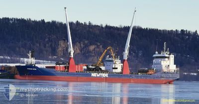
FRISIAN OCTA
General Cargo
Current Trip
| Time Travelled | 3 days |
|---|---|
| Remaining Time | 3 days |
| Distance Travelled | 793.65 nm |
| Remaining Distance | 1004.31 nm |
| AVG Speed | 11.3 Knots |
| MAX Speed | 13.8 Knots |
| AVG Wind | 9.3 knots |
| MAX Wind | 23.4 knots |
| MIN Temp | -2°C / 28.4°F |
| MAX Temp | 6.1°C / 42.98°F |
| Draught | 6.9 m |
| Position Received | 2 m ago |
Current Position
| Longitude | 7.35637° |
|---|---|
| Latitude | 57.77973° |
| Status | Under way using engine |
| Speed | 11.4 Knots |
| Course | 274.5° |
| Area | Skaggerak |
| Station | T-AIS |
| Position Received | 2 m ago |
Info
Information
The current position of FRISIAN OCTA is in Skaggerak with coordinates 57.77973° / 7.35637° as reported on 2024-04-24 12:15 by AIS to our vessel tracker app. The vessel's current speed is 11.4 Knots and is heading at the port of AKUREYRI. The estimated time of arrival as calculated by MyShipTracking vessel tracking app is 2024-04-28 01:49 LT
The vessel FRISIAN OCTA (IMO: 9526095, MMSI: 246596000) is a General Cargo that was built in 2010 ( 14 years old ). It's sailing under the flag of [NL] Netherlands.
In this page you can find informations about the vessels current position, last detected port calls, and current voyage information. If the vessels is not in coverage by AIS you will find the latest position.
The current position of FRISIAN OCTA is detected by our AIS receivers and we are not responsible for the reliability of the data. The last position was recorded while the vessel was in Coverage by the Ais receivers of our vessel tracking app.
The current draught of FRISIAN OCTA as reported by AIS is 6.9 meters
Weather
| Temperature | 6.1°C / 42.98°F |
|---|---|
| Wind Speed | 2 knots |
| Direction | 90° E |
| Pressure | 1009.5 hPa |
| Humidity | 64.1 % |
| Cloud Coverage | 96 % |
Featured Company
Last Port Calls
| Port | Arrival | Departure | Time In Port |
|---|---|---|---|
| 2024-04-20 10:20 | 2024-04-21 04:16 | 17 h | |
| 2024-04-11 18:22 | 2024-04-19 17:48 | 7 d | |
| 2024-04-06 23:33 | 2024-04-09 04:22 | 2 d | |
| 2024-04-04 11:20 | 2024-04-05 00:40 | 13 h | |
| 2024-03-30 14:03 | 2024-03-31 19:45 | 1 d | |
| 2024-03-28 07:41 | 2024-03-29 08:05 | 1 d | |
| 2024-03-25 05:40 | 2024-03-27 03:13 | 1 d | |
| 2024-03-15 05:39 | 2024-03-18 23:17 | 3 d | |
| 2024-03-09 19:05 | 2024-03-12 08:11 | 2 d | |
| 2024-03-09 14:49 |
Most Visited Ports (Last year)
| Port | Arrivals | |
|---|---|---|
| 2 | ||
| 2 | ||
| 2 | ||
| 1 | ||
| 1 | ||
| 1 |
Last Trips
| Origin | Departure | Destination | Arrival | Distance | |
|---|---|---|---|---|---|
| 2024-04-19 20:48 | 2024-04-20 13:20 | 123.18 nm | |||
| 2024-04-09 06:22 | 2024-04-11 21:22 | 624.07 nm | |||
| 2024-04-05 03:40 | 2024-04-07 01:33 | 471.58 nm | |||
| 2024-03-31 21:45 | 2024-04-04 14:20 | 482.27 nm | |||
| 2024-03-29 10:05 | 2024-03-30 15:03 | 320.23 nm | |||
| 2024-03-27 04:13 | 2024-03-28 09:41 | 318.52 nm | |||
| 2024-03-18 23:17 | 2024-03-25 06:40 | 1591.11 nm | |||
| 2024-03-12 08:11 | 2024-03-15 05:39 | 783.38 nm | |||
| 2024-03-09 14:49 | 2024-03-09 19:05 | 17.15 nm |
Events
| Time | Event | Details | Position / Dest | Info |
|---|---|---|---|---|
| 2024-04-24 12:11 | Detected in Sea | Norwegian part of the North Sea |
57.77888 / 7.38206
North Sea
ISAKU
|
Speed: 11.6 kn Course: 273.1° |
| 2024-04-24 07:32 | Detected in Sea | Norwegian part of the Skaggerak |
57.79926 / 9.06135
Skaggerak
ISAKU
|
Speed: 11.2 kn Course: 265.8° |
| 2024-04-24 02:07 | Change Sea Area | Danish part of the Skaggerak Danish part of the Kattegat |
57.81253 / 10.96536
Skaggerak
ISAKU
|
Speed: 12.2 kn Course: 306.8° |
| 2024-04-24 01:43 | Change Sea Area | Danish part of the Kattegat Swedish part of the Kattegat |
57.76475 / 11.08870
Kattegat
ISAKU
|
Speed: 12.2 kn Course: 305.1° |
| 2024-04-23 23:47 | START Moving | 2.8 nm, South West of SANDVIK |
57.60291 / 11.68982
ISAKU
|
Speed: 3.9 kn Course: 236° |
| 2024-04-23 11:18 | STOP Moving | 2.73 nm, West of SANDVIK |
57.60466 / 11.69097
ISAKU
|
Speed: 0.3 kn Course: 239° |
| 2024-04-23 00:53 | Change Sea Area | Swedish part of the Kattegat Danish part of the Kattegat |
55.82184 / 12.72137
Kattegat
ISAKU
|
Speed: 11.5 kn Course: 7.2° |
| 2024-04-22 23:17 | Change Sea Area | Danish part of the Kattegat Swedish part of the Kattegat |
55.52743 / 12.72345
Kattegat
ISAKU
|
Speed: 10.2 kn Course: 354.7° |
| 2024-04-22 22:11 | Change Sea Area | Swedish part of the Kattegat Swedish part of the Baltic Sea |
55.33344 / 12.66591
Kattegat
ISAKU
|
Speed: 11.1 kn Course: 7.4° |
| 2024-04-22 15:26 | Change Sea Area | Swedish part of the Baltic Sea Danish part of the Kattegat |
55.51827 / 14.77091
Baltic Sea
ISAKU
|
Speed: 12 kn Course: 241.2° |