
BBC SONG
Cargo
Current Trip
IDBXT
| Time Travelled | 11 days |
|---|---|
| Remaining Time | --- |
| Distance Travelled | 3546.57 nm |
| Remaining Distance | --- |
| AVG Speed | 13.9 Knots |
| MAX Speed | 17.4 Knots |
| AVG Wind | 10.3 knots |
| MAX Wind | 23 knots |
| MIN Temp | 20.1°C / 68.18°F |
| MAX Temp | 30.2°C / 86.36°F |
| Draught | 6 m |
| Position Received | 1 d ago |
Current Position
| Longitude | 117.17433° |
|---|---|
| Latitude | -1.28336° |
| Status | Under way using engine |
| Speed | 14.5 Knots |
| Course | 68.3° |
| Area | Makassar Strait |
| Station | T-AIS |
| Position Received | 1 d ago |
Info
Information
The current position of BBC SONG is in Makassar Strait with coordinates -1.28336° / 117.17433° as reported on 2024-04-17 21:35 by AIS to our vessel tracker app. The vessel's current speed is 14.5 Knots
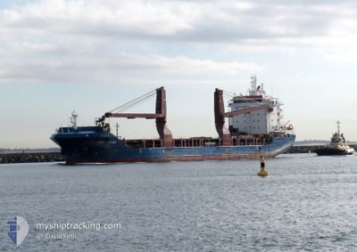
The vessel BBC SONG (IMO: 9750464, MMSI: 255805979) is a Cargo It's sailing under the flag of [PT] Portugal.
In this page you can find informations about the vessels current position, last detected port calls, and current voyage information. If the vessels is not in coverage by AIS you will find the latest position.
The current position of BBC SONG is detected by our AIS receivers and we are not responsible for the reliability of the data. The last position was recorded while the vessel was in Coverage by the Ais receivers of our vessel tracking app.
The current draught of BBC SONG as reported by AIS is 6 meters
Weather
| Temperature | 27.5°C / 81.5°F |
|---|---|
| Wind Speed | 6 knots |
| Direction | 91° E |
| Pressure | 1009.1 hPa |
| Humidity | 83.1 % |
| Cloud Coverage | 24 % |
Featured Company
Last Trips
| Origin | Departure | Destination | Arrival | Distance | |
|---|---|---|---|---|---|
| 2024-03-28 09:52 | 2024-04-03 08:52 | 749.07 nm | |||
| 2024-01-23 08:38 | 2024-03-26 07:28 | 11838.75 nm |
Events
| Time | Event | Details | Position / Dest | Info |
|---|---|---|---|---|
| 2024-04-18 08:02 | STOP Moving |
.17359 / 117.48601
IDBXT
|
Speed: Course: 216° |
|
| 2024-04-17 21:46 | Status Changed | Default Under way using engine |
-1.26667 / 117.21500
IDBXT
|
Speed: 14.5 kn Course: 68.3° |
| 2024-04-17 21:35 | OUT of Coverage |
-1.28336 / 117.17433
Makassar Strait
IDBXT
|
Speed: 14.5 kn Course: 68.3° |
|
| 2024-04-17 20:39 | START Moving | 11.78 nm, South East of BALIKPAPAN |
-1.35555 / 116.98262
IDBXT
|
Speed: 4.6 kn Course: 79° |
| 2024-04-17 20:39 | Status Changed | Under way using engine At anchor |
-1.35578 / 116.98171
IDBXT
|
Speed: 0.1 kn Course: 32° |
| 2024-04-17 17:33 | ETA Changed | 2024/04/18 09:00 2024/04/17 03:00 |
-1.35770 / 116.98007
IDBXT
|
Speed: Course: 58° |
| 2024-04-17 17:29 | Destination Changed | IDBXT IDBPN |
-1.35763 / 116.98007
IDBXT
|
Speed: 0.1 kn Course: 64° |
| 2024-04-17 13:05 | Status Changed | At anchor Default |
-1.35720 / 116.97998
IDBPN
|
Speed: Course: -1° |
| 2024-04-17 13:01 | Status Changed | Default At anchor |
-1.35667 / 116.97833
IDBPN
|
Speed: Course: 76° |
| 2024-04-17 11:05 | Status Changed | At anchor Default |
-1.35721 / 116.97993
IDBPN
|
Speed: Course: -1° |