
BBC LOUISE
Cargo
Current Trip
US M0B
| Time Travelled | 8 days |
|---|---|
| Remaining Time | --- |
| Distance Travelled | 2596.77 nm |
| Remaining Distance | --- |
| AVG Speed | 13.3 Knots |
| MAX Speed | 13.3 Knots |
| AVG Wind | 12.5 knots |
| MAX Wind | 31 knots |
| MIN Temp | 13.7°C / 56.66°F |
| MAX Temp | 21.7°C / 71.06°F |
| Draught | 7.9 m |
| Position Received | 12 h, 14 m ago |
Current Position
| Longitude | -13.75544° |
|---|---|
| Latitude | 36.30322° |
| Status | Under way using engine |
| Speed | 14.4 Knots |
| Course | 273.9° |
| Area | North Atlantic Ocean |
| Station | T-AIS |
| Position Received | 12 h, 14 m ago |
Info
Information
The current position of BBC LOUISE is in North Atlantic Ocean with coordinates 36.30322° / -13.75544° as reported on 2024-04-23 02:28 by AIS to our vessel tracker app. The vessel's current speed is 14.4 Knots
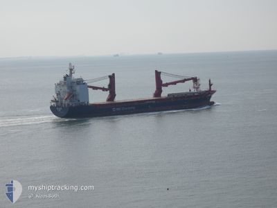
The vessel BBC LOUISE (IMO: 9685097, MMSI: 304617000) is a Cargo It's sailing under the flag of [AG] Antigua Barbuda.
In this page you can find informations about the vessels current position, last detected port calls, and current voyage information. If the vessels is not in coverage by AIS you will find the latest position.
The current position of BBC LOUISE is detected by our AIS receivers and we are not responsible for the reliability of the data. The last position was recorded while the vessel was in Coverage by the Ais receivers of our vessel tracking app.
The current draught of BBC LOUISE as reported by AIS is 7.9 meters
Weather
| Temperature | 16.3°C / 61.34°F |
|---|---|
| Wind Speed | 11 knots |
| Direction | 22° NNE |
| Pressure | 1021.3 hPa |
| Humidity | 79.8 % |
| Cloud Coverage | 100 % |
Featured Company
Last Port Calls
| Port | Arrival | Departure | Time In Port |
|---|---|---|---|
| 2024-04-08 19:13 | 2024-04-14 15:54 | 5 d | |
| 2024-04-05 06:06 | 2024-04-05 14:54 | 8 h | |
| 2024-03-28 09:54 | 2024-04-03 09:23 | 5 d | |
| 2024-03-26 02:36 | 2024-03-26 11:46 | 9 h | |
| 2024-02-27 05:28 | |||
| 2024-02-24 08:41 | 2024-02-26 21:59 | 2 d | |
| 2024-02-21 00:34 | 2024-02-22 22:15 | 1 d | |
| 2024-02-17 17:19 | 2024-02-19 21:22 | 2 d | |
| 2024-02-13 18:46 | 2024-02-14 14:54 | 20 h |
Most Visited Ports (Last year)
| Port | Arrivals | |
|---|---|---|
| 3 | ||
| 2 | ||
| 2 | ||
| 2 | ||
| 2 | ||
| 2 |
Last Trips
| Origin | Departure | Destination | Arrival | Distance | |
|---|---|---|---|---|---|
| 2024-04-03 12:23 | 2024-04-08 22:13 | 1091.49 nm | |||
| 2024-04-03 12:23 | 2024-04-05 08:06 | 629.08 nm | |||
| 2024-02-26 15:59 | 2024-02-26 23:28 | 93.10 nm | |||
| 2024-02-22 16:15 | 2024-02-24 02:41 | 437.64 nm | |||
| 2024-02-19 15:22 | 2024-02-20 18:34 | 320.27 nm | |||
| 2024-02-14 08:54 | 2024-02-17 11:19 | 911.56 nm | |||
| 2024-01-31 06:51 | 2024-02-13 12:46 | 3539.34 nm |
Events
| Time | Event | Details | Position / Dest | Info |
|---|---|---|---|---|
| 2024-04-23 02:36 | Status Changed | Default Under way using engine |
36.30500 / -13.79167
US M0B
|
Speed: 14.4 kn Course: 273.9° |
| 2024-04-23 02:28 | OUT of Coverage |
36.30322 / -13.75544
North Atlantic Ocean
US M0B
|
Speed: 14.4 kn Course: 273.9° |
|
| 2024-04-23 02:08 | Change Sea Area | High seas of the North Atlantic Ocean Portuguese part of the North Atlantic Ocean |
36.29816 / -13.65417
North Atlantic Ocean
US M0B
|
Speed: 14.3 kn Course: 273.7° |
| 2024-04-23 02:06 | Status Changed | Under way using engine Default |
36.29773 / -13.64527
US M0B
|
Speed: 14 kn Course: 274° |
| 2024-04-23 01:57 | IN Coverage |
36.29816 / -13.65417
North Atlantic Ocean
US M0B
|
Speed: 14.3 kn Course: 273.7° |
|
| 2024-04-22 23:58 | Status Changed | Default Under way using engine |
36.26845 / -13.00391
US M0B
|
Speed: 14.5 kn Course: 273.7° |
| 2024-04-22 23:51 | OUT of Coverage |
36.26687 / -12.97360
North Atlantic Ocean
US M0B
|
Speed: 14.5 kn Course: 273.7° |
|
| 2024-04-22 23:43 | Status Changed | Under way using engine Default |
36.26470 / -12.93352
US M0B
|
Speed: 14 kn Course: 276° |
| 2024-04-22 23:12 | Status Changed | Default Under way using engine |
36.24500 / -12.77667
US M0B
|
Speed: 14.2 kn Course: 270.7° |
| 2024-04-22 22:38 | Status Changed | Under way using engine Default |
36.24487 / -12.61126
US M0B
|
Speed: 14.3 kn Course: 270° |