
BBC DART
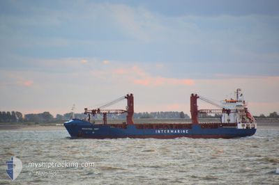
General Cargo
Current Trip
| Time Travelled | 24 days |
|---|---|
| Remaining Time | 1 day |
| Distance Travelled | 4327.23 nm |
| Remaining Distance | 350.24 nm |
| AVG Speed | 12.1 Knots |
| MAX Speed | 17.4 Knots |
| AVG Wind | 11.1 knots |
| MAX Wind | 26 knots |
| MIN Temp | 22.4°C / 72.32°F |
| MAX Temp | 29.6°C / 85.28°F |
| Draught | 5.8 m |
| Position Received | 1 h, 47 m ago |
Current Position
| Longitude | 112.41317° |
|---|---|
| Latitude | -26.86531° |
| Status | Under way using engine |
| Speed | 9.7 Knots |
| Course | 173.3° |
| Area | Indian Ocean |
| Station | T-AIS |
| Position Received | 1 h, 47 m ago |
Info
Information
The current position of BBC DART is in Indian Ocean with coordinates -26.86531° / 112.41317° as reported on 2024-04-18 15:10 by AIS to our vessel tracker app. The vessel's current speed is 9.7 Knots and is heading at the port of FREMANTLE. The estimated time of arrival as calculated by MyShipTracking vessel tracking app is 2024-04-20 02:45 LT
The vessel BBC DART (IMO: 9360207, MMSI: 305187000) is a General Cargo that was built in 2008 ( 16 years old ). It's sailing under the flag of [AG] Antigua Barbuda.
In this page you can find informations about the vessels current position, last detected port calls, and current voyage information. If the vessels is not in coverage by AIS you will find the latest position.
The current position of BBC DART is detected by our AIS receivers and we are not responsible for the reliability of the data. The last position was recorded while the vessel was in Coverage by the Ais receivers of our vessel tracking app.
The current draught of BBC DART as reported by AIS is 5.8 meters
Weather
| Temperature | 27.1°C / 80.78°F |
|---|---|
| Wind Speed | 16 knots |
| Direction | 136° SE |
| Pressure | 1018.5 hPa |
| Humidity | 64.8 % |
| Cloud Coverage | --- |
Featured Company
Last Port Calls
| Port | Arrival | Departure | Time In Port |
|---|---|---|---|
| 2024-03-24 06:53 | 2024-03-25 14:17 | 1 d | |
| 2024-02-12 13:03 | 2024-02-23 11:25 | 10 d |
Last Trips
| Origin | Departure | Destination | Arrival | Distance | |
|---|---|---|---|---|---|
| 2024-02-23 03:25 | 2024-03-24 13:53 | 8604.87 nm | |||
| 2024-01-07 23:33 | 2024-02-12 05:03 | 10048.12 nm |
Events
| Time | Event | Details | Position / Dest | Info |
|---|---|---|---|---|
| 2024-04-18 15:15 | Status Changed | Default Under way using engine |
-26.87913 / 112.41457
FREMANTLE
|
Speed: 9.7 kn Course: 173.3° |
| 2024-04-18 15:10 | OUT of Coverage |
-26.86531 / 112.41317
Indian Ocean
FREMANTLE
|
Speed: 9.7 kn Course: 173.3° |
|
| 2024-04-18 14:54 | ETA Changed | 2024/04/20 05:00 2024/04/19 05:00 |
-26.82025 / 112.40869
FREMANTLE
|
Speed: 9.6 kn Course: 175.7° |
| 2024-04-18 14:15 | Status Changed | Under way using engine Default |
-26.71269 / 112.39751
FREMANTLE
|
Speed: 10 kn Course: 176° |
| 2024-04-18 14:13 | Status Changed | Default Under way using engine |
-26.70756 / 112.39705
FREMANTLE
|
Speed: 10.1 kn Course: 175.2° |
| 2024-04-18 13:48 | Change Sea Area | Australian part of the Indian Ocean Malaysian part of the Singapore Strait |
-26.63950 / 112.39067
Indian Ocean
FREMANTLE
|
Speed: 10.1 kn Course: 175.2° |
| 2024-04-18 13:48 | Status Changed | Under way using engine Default |
-26.63950 / 112.39067
FREMANTLE
|
Speed: 10 kn Course: 176° |
| 2024-04-18 13:34 | IN Coverage |
-26.63950 / 112.39067
Indian Ocean
FREMANTLE
|
Speed: 10.1 kn Course: 175.2° |
|
| 2024-04-12 03:14 | Status Changed | Default Under way using engine |
1.26559 / 104.22408
FREMANTLE
|
Speed: 13 kn Course: 85.4° |
| 2024-04-12 03:09 | OUT of Coverage |
1.26415 / 104.20614
Singapore Strait
FREMANTLE
|
Speed: 13 kn Course: 85.4° |