
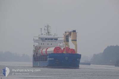
KIMBERLY
General Cargo
Current Trip
| Time Travelled | 3 days |
|---|---|
| Remaining Time | 1 day |
| Distance Travelled | 861.96 nm |
| Remaining Distance | 307.64 nm |
| AVG Speed | 8.3 Knots |
| MAX Speed | 12.4 Knots |
| AVG Wind | 5.7 knots |
| MAX Wind | 19.4 knots |
| MIN Temp | 1.3°C / 34.34°F |
| MAX Temp | 8.5°C / 47.3°F |
| Draught | 5.7 m |
| Position Received | 29 m ago |
Current Position
| Longitude | 8.66421° |
|---|---|
| Latitude | 53.93543° |
| Status | Under way using engine |
| Speed | 9.2 Knots |
| Course | 326.6° |
| Area | North Sea |
| Station | T-AIS |
| Position Received | 29 m ago |
Info
Information
The current position of KIMBERLY is in North Sea with coordinates 53.93543° / 8.66421° as reported on 2024-04-18 07:59 by AIS to our vessel tracker app. The vessel's current speed is 9.2 Knots and is heading at the port of GENT. The estimated time of arrival as calculated by MyShipTracking vessel tracking app is 2024-04-19 20:44 LT
The vessel KIMBERLY (IMO: 9378242, MMSI: 305238000) is a General Cargo that was built in 2008 ( 16 years old ). It's sailing under the flag of [AG] Antigua Barbuda.
In this page you can find informations about the vessels current position, last detected port calls, and current voyage information. If the vessels is not in coverage by AIS you will find the latest position.
The current position of KIMBERLY is detected by our AIS receivers and we are not responsible for the reliability of the data. The last position was recorded while the vessel was in Coverage by the Ais receivers of our vessel tracking app.
The current draught of KIMBERLY as reported by AIS is 5.7 meters
Weather
| Temperature | 7.9°C / 46.22°F |
|---|---|
| Wind Speed | 5 knots |
| Direction | 289° WNW |
| Pressure | 1016.3 hPa |
| Humidity | 73.1 % |
| Cloud Coverage | 6 % |
Featured Company
Last Port Calls
| Port | Arrival | Departure | Time In Port |
|---|---|---|---|
| 2024-04-12 15:42 | 2024-04-14 17:10 | 2 d | |
| 2024-04-04 23:31 | 2024-04-09 15:00 | 4 d | |
| 2024-04-03 08:53 | 2024-04-04 08:52 | 23 h | |
| 2024-03-29 04:56 | 2024-03-31 08:07 | 2 d | |
| 2024-03-25 05:57 | 2024-03-27 00:27 | 1 d | |
| 2024-03-19 09:33 | 2024-03-21 07:40 | 1 d | |
| 2024-03-12 11:20 | 2024-03-15 11:14 | 2 d | |
| 2024-03-08 04:31 | 2024-03-09 09:50 | 1 d | |
| 2024-02-28 05:01 | 2024-03-04 12:16 | 5 d | |
| 2024-02-22 07:47 | 2024-02-24 19:46 | 2 d |
Last Trips
| Origin | Departure | Destination | Arrival | Distance | |
|---|---|---|---|---|---|
| 2024-04-09 17:00 | 2024-04-12 18:42 | 769.12 nm | |||
| 2024-04-04 10:52 | 2024-04-05 01:31 | 158.34 nm | |||
| 2024-03-31 11:07 | 2024-04-03 10:53 | 689.92 nm | |||
| 2024-03-27 01:27 | 2024-03-29 07:56 | 577.72 nm | |||
| 2024-03-21 10:40 | 2024-03-25 06:57 | 556.54 nm | |||
| 2024-03-15 12:14 | 2024-03-19 12:33 | 731.61 nm | |||
| 2024-03-09 12:50 | 2024-03-12 12:20 | 775.80 nm | |||
| 2024-03-04 13:16 | 2024-03-08 07:31 | 764.48 nm | |||
| 2024-02-24 22:46 | 2024-02-28 06:01 | 769.18 nm | |||
| 2024-02-15 20:24 | 2024-02-22 10:47 | 680.34 nm |
Events
| Time | Event | Details | Position / Dest | Info |
|---|---|---|---|---|
| 2024-04-18 08:03 | Status Changed | Default Under way using engine |
53.94291 / 8.65441
BEGNE
|
Speed: 9.2 kn Course: 326.6° |
| 2024-04-18 06:32 | ETA Changed | 2024/04/19 10:00 2024/04/19 16:00 |
53.84969 / 8.94944
BEGNE
|
Speed: 8.4 kn Course: 260.3° |
| 2024-04-18 06:21 | Detected in Sea | German part of the North Sea |
53.85229 / 8.97583
North Sea
BEGNE
|
Speed: 8.3 kn Course: 257.4° |
| 2024-04-18 06:21 | IN Coverage |
53.85229 / 8.97583
North Sea
BEGNE
|
Speed: 8.3 kn Course: 257.4° |
|
| 2024-04-18 04:57 | OUT of Coverage |
53.89771 / 9.15293
Baltic Sea
BEGNE
|
Speed: 3 kn Course: 228.7° |
|
| 2024-04-18 04:52 | Status Changed | Under way using engine Default |
53.90084 / 9.15843
BEGNE
|
Speed: 6.5 kn Course: 218° |
| 2024-04-18 04:21 | Status Changed | Default Under way using engine |
53.94167 / 9.22333
BEGNE
|
Speed: 6.9 kn Course: 219.3° |
| 2024-04-18 03:05 | Status Changed | Under way using engine Default |
54.06813 / 9.31297
BEGNE
|
Speed: 5 kn Course: 194° |
| 2024-04-18 02:48 | Status Changed | Default Under way using engine |
54.09656 / 9.32780
BEGNE
|
Speed: 6.7 kn Course: 191.6° |
| 2024-04-17 22:16 | START Moving | 7.33 nm, West of KIEL |
54.34174 / 9.95150
BEGNE
|
Speed: 3.2 kn Course: 257° |