
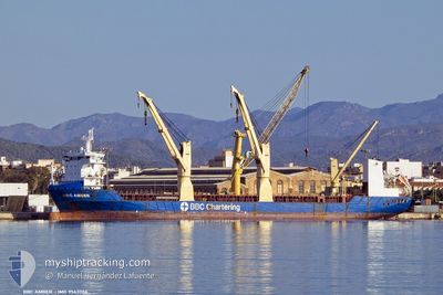
BBC AMBER
General Cargo
Current Trip
| Trip Time | 35 days |
|---|---|
| Trip Distance | 10619.13 nm |
| AVG Speed | 13.4 Knots |
| MAX Speed | 19.5 Knots |
| Draught | 7 m |
| AVG Wind | 13.7 knots |
| MAX Wind | 34 knots |
| MIN Temp | 13.6°C / 56.48°F |
| MAX Temp | 30.8°C / 87.44°F |
| Position Received | 2 d ago |
Current Position
| Longitude | 128.81291° |
|---|---|
| Latitude | 34.97863° |
| Status | Under way using engine |
| Speed | 9.9 Knots |
| Course | 337.8° |
| Area | Japan Sea |
| Station | T-AIS |
| Position Received | 2 d ago |
Info
Information
The current position of BBC AMBER is in Japan Sea with coordinates 34.97863° / 128.81291° as reported on 2024-04-18 00:55 by AIS to our vessel tracker app. The vessel's current speed is 9.9 Knots and is currently inside the port of MASAN.
The vessel BBC AMBER (IMO: 9563706, MMSI: 305717000) is a General Cargo that was built in 2011 ( 13 years old ). It's sailing under the flag of [AG] Antigua Barbuda.
In this page you can find informations about the vessels current position, last detected port calls, and current voyage information. If the vessels is not in coverage by AIS you will find the latest position.
The current position of BBC AMBER is detected by our AIS receivers and we are not responsible for the reliability of the data. The last position was recorded while the vessel was in Coverage by the Ais receivers of our vessel tracking app.
The current draught of BBC AMBER as reported by AIS is 7 meters
Weather
| Temperature | 13.7°C / 56.66°F |
|---|---|
| Wind Speed | 4 knots |
| Direction | 119° ESE |
| Pressure | 1011.4 hPa |
| Humidity | 92.6 % |
| Cloud Coverage | 100 % |
Featured Company
Last Port Calls
| Port | Arrival | Departure | Time In Port |
|---|---|---|---|
| 2024-04-18 02:38 | |||
| 2024-03-09 12:30 | 2024-03-13 12:31 | 4 d | |
| 2024-02-15 04:47 | 2024-02-21 18:41 | 6 d | |
| 2024-02-09 07:37 | 2024-02-12 09:25 | 3 d | |
| 2024-02-01 09:57 | 2024-02-04 16:20 | 3 d |
Most Visited Ports (Last year)
| Port | Arrivals | |
|---|---|---|
| 2 | ||
| 2 | ||
| 2 | ||
| 1 | ||
| 1 | ||
| 1 |
Last Trips
| Origin | Departure | Destination | Arrival | Distance | |
|---|---|---|---|---|---|
| 2024-03-13 13:31 | 2024-04-18 11:38 | 10619.13 nm | |||
| 2024-02-21 18:41 | 2024-03-09 13:30 | 5423.76 nm | |||
| 2024-02-12 10:25 | 2024-02-15 04:47 | 653.47 nm | |||
| 2024-02-04 17:20 | 2024-02-09 08:37 | 599.17 nm | |||
| 2024-01-30 15:03 | 2024-02-01 10:57 | 672.60 nm |
Events
| Time | Event | Details | Position / Dest | Info |
|---|---|---|---|---|
| 2024-04-18 02:39 | STOP Moving |
35.20334 / 128.59666
[KR] MASAN
|
Speed: Course: -1° |
|
| 2024-04-18 02:38 | PORT ARRIVAL |
|
35.20334 / 128.59666
[KR] MASAN
|
Speed: 1 kn Course: -1° |
| 2024-04-18 00:56 | Status Changed | Default Under way using engine |
34.98282 / 128.81084
BINTAN
|
Speed: 9.9 kn Course: 337.8° |
| 2024-04-18 00:55 | OUT of Coverage |
34.97863 / 128.81291
Japan Sea
|
Speed: 9.9 kn Course: 337.8° |
|
| 2024-04-18 00:10 | Status Changed | Under way using engine Default |
34.81863 / 128.82336
BINTAN
|
Speed: 13 kn Course: 357° |
| 2024-04-18 00:03 | Status Changed | Default Under way using engine |
34.79349 / 128.82370
BINTAN
|
Speed: 13.3 kn Course: 356.9° |
| 2024-04-17 23:48 | Status Changed | Under way using engine Default |
34.73655 / 128.82727
BINTAN
|
Speed: 13.2 kn Course: 1° |
| 2024-04-17 23:32 | IN Coverage |
34.73655 / 128.82727
Japan Sea
|
Speed: 13.1 kn Course: 357.7° |
|
| 2024-04-17 21:13 | Status Changed | Default Under way using engine |
34.21709 / 128.65379
BINTAN
|
Speed: 14.6 kn Course: 29.6° |
| 2024-04-17 21:07 | OUT of Coverage |
34.19648 / 128.63852
Japan Sea
|
Speed: 14.6 kn Course: 29.6° |