
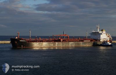
BASILIS L
Oil/Chemical Tanker
Current Trip
| Time Travelled | 2 days |
|---|---|
| Remaining Time | 13 h, 4 mins |
| Distance Travelled | 736.09 nm |
| Remaining Distance | 173.31 nm |
| AVG Speed | 12.7 Knots |
| MAX Speed | 14.1 Knots |
| AVG Wind | 6.9 knots |
| MAX Wind | 25.6 knots |
| MIN Temp | 9.8°C / 49.64°F |
| MAX Temp | 16.9°C / 62.42°F |
| Draught | 7.4 m |
| Position Received | 7 h, 18 m ago |
Current Position
| Longitude | 20.77389° |
|---|---|
| Latitude | 37.21575° |
| Status | Under way using engine |
| Speed | 12.6 Knots |
| Course | 144.3° |
| Area | Ionian Sea |
| Station | T-AIS |
| Position Received | 7 h, 18 m ago |
Info
Information
The current position of BASILIS L is in Ionian Sea with coordinates 37.21575° / 20.77389° as reported on 2024-04-19 10:27 by AIS to our vessel tracker app. The vessel's current speed is 12.6 Knots and is heading at the port of AGIOI THEODORI. The estimated time of arrival as calculated by MyShipTracking vessel tracking app is 2024-04-20 06:49 LT
The vessel BASILIS L (IMO: 9290505, MMSI: 538007627) is a Oil/Chemical Tanker that was built in 2005 ( 19 years old ). It's sailing under the flag of [MH] Marshall Is.
In this page you can find informations about the vessels current position, last detected port calls, and current voyage information. If the vessels is not in coverage by AIS you will find the latest position.
The current position of BASILIS L is detected by our AIS receivers and we are not responsible for the reliability of the data. The last position was recorded while the vessel was in Coverage by the Ais receivers of our vessel tracking app.
The current draught of BASILIS L as reported by AIS is 7.4 meters
Weather
| Temperature | 14.9°C / 58.82°F |
|---|---|
| Wind Speed | 22 knots |
| Direction | 286° WNW |
| Pressure | 1007.1 hPa |
| Humidity | 82 % |
| Cloud Coverage | 66 % |
Featured Company
Events
| Time | Event | Details | Position / Dest | Info |
|---|---|---|---|---|
| 2024-04-19 10:27 | OUT of Coverage |
37.21575 / 20.77389
Ionian Sea
SIKOP=>GRAGT
|
Speed: 12.6 kn Course: 144.3° |
|
| 2024-04-19 09:02 | ETA Changed | 2024/04/20 13:00 2024/04/20 12:00 |
37.49717 / 20.61244
SIKOP=>GRAGT
|
Speed: 13.2 kn Course: 157.7° |
| 2024-04-19 01:41 | Detected in Sea | Greek part of the Ionian Sea |
38.98770 / 19.73494
Ionian Sea
SIKOP=>GRAGT
|
Speed: 13.6 kn Course: 154.1° |
| 2024-04-19 01:41 | IN Coverage |
38.98770 / 19.73494
Ionian Sea
SIKOP=>GRAGT
|
Speed: 13.6 kn Course: 154.1° |
|
| 2024-04-18 20:18 | OUT of Coverage |
40.05056 / 18.99647
Adriatic Sea
SIKOP=>GRAGT
|
Speed: 13.2 kn Course: 140.7° |
|
| 2024-04-18 20:18 | Detected in Sea | Greek part of the Adriatic Sea |
40.05056 / 18.99647
Adriatic Sea
SIKOP=>GRAGT
|
Speed: 13.2 kn Course: 140.7° |
| 2024-04-18 16:56 | Destination Changed | SIKOP=>GRAGT FOR ORDERS |
40.66293 / 18.43011
SIKOP=>GRAGT
|
Speed: 14 kn Course: 130° |
| 2024-04-18 16:56 | ETA Changed | 2024/04/20 12:00 2024/04/20 09:00 |
40.66293 / 18.43011
SIKOP=>GRAGT
|
Speed: 14 kn Course: 130° |
| 2024-04-18 16:20 | IN Coverage |
40.76346 / 18.30848
Adriatic Sea
FOR ORDERS
|
Speed: 13.9 kn Course: 132.9° |
|
| 2024-04-18 08:59 | OUT of Coverage |
41.83078 / 16.71573
Adriatic Sea
FOR ORDERS
|
Speed: 9.5 kn Course: 131.4° |