
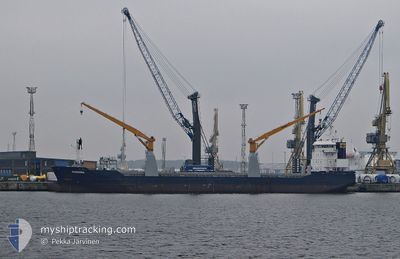
BANDURA
General Cargo
Current Trip
| Time Travelled | 2 days |
|---|---|
| Remaining Time | --- |
| Distance Travelled | 520.06 nm |
| Remaining Distance | --- |
| AVG Speed | 10.3 Knots |
| MAX Speed | 11.1 Knots |
| AVG Wind | 14.3 knots |
| MAX Wind | 17.9 knots |
| MIN Temp | 14.7°C / 58.46°F |
| MAX Temp | 19.7°C / 67.46°F |
| Draught | 7 m |
| Position Received | Now |
Current Position
| Longitude | -11.27698° |
|---|---|
| Latitude | 36.04949° |
| Status | Under way using engine |
| Speed | 10.3 Knots |
| Course | 24° |
| Area | North Atlantic Ocean |
| Station | T-AIS |
| Position Received | Now |
Info
Information
The current position of BANDURA is in North Atlantic Ocean with coordinates 36.04949° / -11.27698° as reported on 2024-04-24 01:22 by AIS to our vessel tracker app. The vessel's current speed is 10.3 Knots and is heading at the port of PASAJES. The estimated time of arrival as calculated by MyShipTracking vessel tracking app is 2024-04-27 07:00 LT
The vessel BANDURA (IMO: 9526071, MMSI: 246733000) is a General Cargo that was built in 2010 ( 14 years old ). It's sailing under the flag of [NL] Netherlands.
In this page you can find informations about the vessels current position, last detected port calls, and current voyage information. If the vessels is not in coverage by AIS you will find the latest position.
The current position of BANDURA is detected by our AIS receivers and we are not responsible for the reliability of the data. The last position was recorded while the vessel was in Coverage by the Ais receivers of our vessel tracking app.
The current draught of BANDURA as reported by AIS is 7 meters
Weather
| Temperature | 17.4°C / 63.32°F |
|---|---|
| Wind Speed | 17 knots |
| Direction | 21° NNE |
| Pressure | 1018.8 hPa |
| Humidity | 74.2 % |
| Cloud Coverage | 84 % |
Featured Company
Last Port Calls
| Port | Arrival | Departure | Time In Port |
|---|---|---|---|
| 2024-04-21 12:02 | 2024-04-21 23:12 | 11 h | |
| 2024-04-10 14:23 | 2024-04-12 04:40 | 1 d | |
| 2024-03-31 09:57 | 2024-04-03 12:24 | 3 d | |
| 2024-03-15 14:38 | 2024-03-19 23:41 | 4 d | |
| 2024-03-02 18:10 | 2024-03-08 02:22 | 5 d | |
| 2024-02-22 17:01 | 2024-02-27 20:20 | 5 d | |
| 2024-02-12 14:56 | 2024-02-15 15:21 | 3 d |
Most Visited Ports (Last year)
| Port | Arrivals | |
|---|---|---|
| 3 | ||
| 2 | ||
| 2 | ||
| 1 | ||
| 1 | ||
| 1 |
Last Trips
| Origin | Departure | Destination | Arrival | Distance | |
|---|---|---|---|---|---|
| 2024-04-12 01:40 | 2024-04-21 13:02 | 2371.09 nm | |||
| 2024-04-03 09:24 | 2024-04-10 11:23 | 306.34 nm | |||
| 2024-03-19 18:41 | 2024-03-31 06:57 | 2737.40 nm | |||
| 2024-03-07 20:22 | 2024-03-15 09:38 | 1788.72 nm | |||
| 2024-02-27 14:20 | 2024-03-02 12:10 | 652.15 nm | |||
| 2024-02-15 10:21 | 2024-02-22 11:01 | 1586.74 nm | |||
| 2024-01-26 18:45 | 2024-02-12 09:56 | 4049.22 nm |
Events
| Time | Event | Details | Position / Dest | Info |
|---|---|---|---|---|
| 2024-04-24 00:59 | Status Changed | Under way using engine Default |
35.98670 / -11.30978
ESPAS
|
Speed: 10.3 kn Course: 23° |
| 2024-04-24 00:32 | Status Changed | Default Under way using engine |
35.91579 / -11.34643
ESPAS
|
Speed: 10.3 kn Course: 22.1° |
| 2024-04-23 22:18 | Status Changed | Under way using engine Default |
35.57184 / -11.52313
ESPAS
|
Speed: 9.7 kn Course: 23° |
| 2024-04-23 21:46 | Status Changed | Default Under way using engine |
35.48913 / -11.56845
ESPAS
|
Speed: 10.4 kn Course: 27.7° |
| 2024-04-23 18:16 | Change Sea Area | Portuguese part of the North Atlantic Ocean Moroccan part of the North Atlantic Ocean |
34.93346 / -11.87161
North Atlantic Ocean
ESPAS
|
Speed: 10.6 kn Course: 23° |
| 2024-04-23 14:02 | Status Changed | Under way using engine Default |
34.24979 / -12.23936
ESPAS
|
Speed: 10.7 kn Course: 23° |
| 2024-04-23 13:58 | IN Coverage |
34.25298 / -12.23772
North Atlantic Ocean
ESPAS
|
Speed: 10.6 kn Course: 24.1° |
|
| 2024-04-23 11:44 | Status Changed | Default Under way using engine |
33.87333 / -12.43333
ESPAS
|
Speed: 10.6 kn Course: 22.9° |
| 2024-04-23 11:39 | OUT of Coverage |
33.86062 / -12.44040
North Atlantic Ocean
ESPAS
|
Speed: 10.6 kn Course: 22.9° |
|
| 2024-04-23 10:46 | Status Changed | Under way using engine Default |
33.71590 / -12.51665
ESPAS
|
Speed: 10.5 kn Course: 24° |