
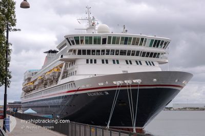
BALMORAL
Passengers Ship
Current Trip
| Time Travelled | 1 day |
|---|---|
| Remaining Time | 13 h, 4 mins |
| Distance Travelled | 717.91 nm |
| Remaining Distance | 227.99 nm |
| AVG Speed | 15.5 Knots |
| MAX Speed | 17 Knots |
| AVG Wind | 14.2 knots |
| MAX Wind | 25.5 knots |
| MIN Temp | 4.9°C / 40.82°F |
| MAX Temp | 8.5°C / 47.3°F |
| Draught | 7.1 m |
| Position Received | 1 d ago |
Current Position
| Longitude | -4.79815° |
|---|---|
| Latitude | 59.17161° |
| Status | Under way using engine |
| Speed | 15.8 Knots |
| Course | 298.8° |
| Area | North Atlantic Ocean |
| Station | T-AIS |
| Position Received | 1 d ago |
Info
Information
The current position of BALMORAL is in North Atlantic Ocean with coordinates 59.17161° / -4.79815° as reported on 2024-04-18 12:29 by AIS to our vessel tracker app. The vessel's current speed is 15.8 Knots and is heading at the port of REYKJAVIK. The estimated time of arrival as calculated by MyShipTracking vessel tracking app is 2024-04-20 04:46 LT
The vessel BALMORAL (IMO: 8506294, MMSI: 308785000) is a Passengers Ship that was built in 1988 ( 36 years old ). It's sailing under the flag of [BS] Bahamas.
In this page you can find informations about the vessels current position, last detected port calls, and current voyage information. If the vessels is not in coverage by AIS you will find the latest position.
The current position of BALMORAL is detected by our AIS receivers and we are not responsible for the reliability of the data. The last position was recorded while the vessel was in Coverage by the Ais receivers of our vessel tracking app.
The current draught of BALMORAL as reported by AIS is 7.1 meters
Weather
| Temperature | 6.3°C / 43.34°F |
|---|---|
| Wind Speed | 9 knots |
| Direction | 216° SW |
| Pressure | 1020.9 hPa |
| Humidity | 67.1 % |
| Cloud Coverage | 100 % |
Featured Company
Last Port Calls
| Port | Arrival | Departure | Time In Port |
|---|---|---|---|
| 2024-04-17 04:20 | 2024-04-17 17:05 | 12 h | |
| 2024-04-13 06:29 | 2024-04-13 13:22 | 6 h | |
| 2024-04-11 06:12 | 2024-04-11 13:27 | 7 h | |
| 2024-04-10 06:06 | 2024-04-10 17:08 | 11 h | |
| 2024-04-09 08:00 | 2024-04-09 19:31 | 11 h | |
| 2024-04-08 07:11 | 2024-04-08 16:31 | 9 h | |
| 2024-04-05 12:52 | 2024-04-05 20:25 | 7 h | |
| 2024-04-02 04:16 | 2024-04-02 17:18 | 13 h | |
| 2024-03-31 04:24 | 2024-03-31 16:46 | 12 h | |
| 2024-03-30 08:47 | 2024-03-30 17:33 | 8 h |
Last Trips
| Origin | Departure | Destination | Arrival | Distance | |
|---|---|---|---|---|---|
| 2024-04-13 14:22 | 2024-04-17 05:20 | 1318.90 nm | |||
| 2024-04-11 14:27 | 2024-04-13 07:29 | 637.98 nm | |||
| 2024-04-10 18:08 | 2024-04-11 07:12 | 157.36 nm | |||
| 2024-04-09 20:31 | 2024-04-10 07:06 | 130.06 nm | |||
| 2024-04-08 17:31 | 2024-04-09 09:00 | 243.94 nm | |||
| 2024-04-05 22:25 | 2024-04-08 08:11 | 813.77 nm | |||
| 2024-04-02 18:18 | 2024-04-05 14:52 | 981.32 nm | |||
| 2024-03-31 18:46 | 2024-04-02 05:16 | 481.29 nm | |||
| 2024-03-30 18:33 | 2024-03-31 06:24 | 162.73 nm | |||
| 2024-03-28 18:32 | 2024-03-30 09:47 | 524.52 nm |
Events
| Time | Event | Details | Position / Dest | Info |
|---|---|---|---|---|
| 2024-04-18 12:57 | Status Changed | Default Under way using engine |
59.22511 / -5.01002
IS REY
|
Speed: 15.8 kn Course: 298.8° |
| 2024-04-18 12:29 | Status Changed | Under way using engine Default |
59.17161 / -4.79815
IS REY
|
Speed: 15.8 kn Course: 299° |
| 2024-04-18 12:29 | OUT of Coverage |
59.17161 / -4.79815
North Atlantic Ocean
IS REY
|
Speed: 15.8 kn Course: 298.8° |
|
| 2024-04-18 12:28 | Status Changed | Default Under way using engine |
59.16997 / -4.79228
IS REY
|
Speed: 15.6 kn Course: 300.4° |
| 2024-04-18 09:17 | Change Sea Area | United Kingdom part of the North Atlantic Ocean United Kingdom part of the North Sea |
58.75865 / -3.43593
North Atlantic Ocean
IS REY
|
Speed: 15.8 kn Course: 285.2° |
| 2024-04-18 06:43 | Status Changed | Under way using engine Default |
58.36185 / -2.49637
IS REY
|
Speed: 15.8 kn Course: 324° |
| 2024-04-18 06:40 | IN Coverage |
58.36604 / -2.50213
North Sea
IS REY
|
Speed: 15.7 kn Course: 324.1° |
|
| 2024-04-18 06:01 | Status Changed | Default Under way using engine |
58.21508 / -2.29496
IS REY
|
Speed: 16.3 kn Course: 321.1° |
| 2024-04-18 05:15 | OUT of Coverage |
58.05088 / -2.06020
North Sea
IS REY
|
Speed: 16.3 kn Course: 321.1° |
|
| 2024-04-18 00:57 | Status Changed | Under way using engine Default |
56.96185 / -1.46330
IS REY
|
Speed: 16 kn Course: 357° |