
BAKKEDAL
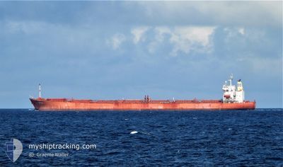
Cabu Carrier
Current Trip
ID BAH
| Time Travelled | 29 days |
|---|---|
| Remaining Time | --- |
| Distance Travelled | 4846.06 nm |
| Remaining Distance | --- |
| AVG Speed | 11.6 Knots |
| MAX Speed | 15.4 Knots |
| AVG Wind | 7.3 knots |
| MAX Wind | 20 knots |
| MIN Temp | 17.4°C / 63.32°F |
| MAX Temp | 30.8°C / 87.44°F |
| Draught | 12.4 m |
| Position Received | 1 d ago |
Current Position
| Longitude | 119.85510° |
|---|---|
| Latitude | 22.82530° |
| Status | Under way using engine |
| Speed | 11 Knots |
| Course | 2° |
| Area | South China Sea |
| Station | T-AIS |
| Position Received | 1 d ago |
Info
Information
The current position of BAKKEDAL is in South China Sea with coordinates 22.82530° / 119.85510° as reported on 2024-04-22 18:00 by AIS to our vessel tracker app. The vessel's current speed is 11 Knots
The vessel BAKKEDAL (IMO: 9308728, MMSI: 538002618) is a Cabu Carrier that was built in 2007 ( 17 years old ). It's sailing under the flag of [MH] Marshall Is.
In this page you can find informations about the vessels current position, last detected port calls, and current voyage information. If the vessels is not in coverage by AIS you will find the latest position.
The current position of BAKKEDAL is detected by our AIS receivers and we are not responsible for the reliability of the data. The last position was recorded while the vessel was in Coverage by the Ais receivers of our vessel tracking app.
The current draught of BAKKEDAL as reported by AIS is 12.4 meters
Weather
| Temperature | 18.1°C / 64.58°F |
|---|---|
| Wind Speed | 10 knots |
| Direction | 78° ENE |
| Pressure | 1014.1 hPa |
| Humidity | 87 % |
| Cloud Coverage | 34 % |
Featured Company
Last Trips
Events
| Time | Event | Details | Position / Dest | Info |
|---|---|---|---|---|
| 2024-04-23 20:46 | STOP Moving |
27.84667 / 121.48486
ID BAH
|
Speed: 0.2 kn Course: 85° |
|
| 2024-04-22 18:05 | Status Changed | Default Under way using engine |
22.84015 / 119.85583
ID BAH
|
Speed: 11 kn Course: 2° |
| 2024-04-22 18:00 | OUT of Coverage |
22.82530 / 119.85510
South China Sea
|
Speed: 11 kn Course: 2° |
|
| 2024-04-22 17:58 | Status Changed | Under way using engine Default |
22.81917 / 119.85488
ID BAH
|
Speed: 11.1 kn Course: 9° |
| 2024-04-22 17:52 | IN Coverage |
22.81917 / 119.85488
South China Sea
|
Speed: 11 kn Course: 2° |
|
| 2024-04-22 07:20 | Status Changed | Default Under way using engine |
20.74095 / 119.72446
ID BAH
|
Speed: 12 kn Course: 1° |
| 2024-04-22 07:20 | OUT of Coverage |
20.74045 / 119.72445
South China Sea
|
Speed: 12 kn Course: 1° |
|
| 2024-04-22 07:06 | Detected in Sea | Taiwanese part of the South China Sea |
20.69378 / 119.72317
South China Sea
|
Speed: 12.2 kn Course: 2° |
| 2024-04-22 07:06 | Status Changed | Under way using engine Default |
20.69378 / 119.72317
ID BAH
|
Speed: 12.2 kn Course: 1° |
| 2024-04-22 07:06 | IN Coverage |
20.69378 / 119.72317
South China Sea
|
Speed: 12.2 kn Course: 2° |