
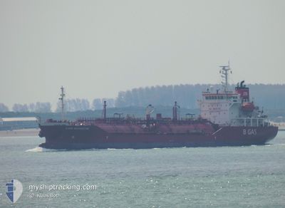
B GAS MARGRETHE
Lpg Tanker
Current Trip
FOR ORDERS
| Time Travelled | 5 days |
|---|---|
| Remaining Time | --- |
| Distance Travelled | 400.03 nm |
| Remaining Distance | --- |
| AVG Speed | 8.3 Knots |
| MAX Speed | 13.2 Knots |
| AVG Wind | 20 knots |
| MAX Wind | 33.9 knots |
| MIN Temp | 6.1°C / 42.98°F |
| MAX Temp | 11°C / 51.8°F |
| Draught | 4.5 m |
| Position Received | 3 h, 31 m ago |
Current Position
| Longitude | 5.80309° |
|---|---|
| Latitude | 55.44122° |
| Status | Under way using engine |
| Speed | 11.3 Knots |
| Course | 45.5° |
| Area | North Sea |
| Station | T-AIS |
| Position Received | 3 h, 31 m ago |
Info
Information
The current position of B GAS MARGRETHE is in North Sea with coordinates 55.44122° / 5.80309° as reported on 2024-04-19 12:53 by AIS to our vessel tracker app. The vessel's current speed is 11.3 Knots
The vessel B GAS MARGRETHE (IMO: 9346407, MMSI: 249810000) is a Lpg Tanker that was built in 2006 ( 18 years old ). It's sailing under the flag of [MT] Malta.
In this page you can find informations about the vessels current position, last detected port calls, and current voyage information. If the vessels is not in coverage by AIS you will find the latest position.
The current position of B GAS MARGRETHE is detected by our AIS receivers and we are not responsible for the reliability of the data. The last position was recorded while the vessel was in Coverage by the Ais receivers of our vessel tracking app.
The current draught of B GAS MARGRETHE as reported by AIS is 4.5 meters
Weather
| Temperature | 6.4°C / 43.52°F |
|---|---|
| Wind Speed | 18 knots |
| Direction | 18° NNE |
| Pressure | 1008.6 hPa |
| Humidity | 64.9 % |
| Cloud Coverage | 58 % |
Featured Company
Last Port Calls
| Port | Arrival | Departure | Time In Port |
|---|---|---|---|
| 2024-04-09 20:02 | 2024-04-14 04:33 | 4 d | |
| 2024-04-06 15:00 | 2024-04-09 15:58 | 3 d | |
| 2024-04-04 14:31 | 2024-04-05 15:19 | 1 d | |
| 2024-04-02 09:12 | 2024-04-03 15:21 | 1 d | |
| 2024-03-29 21:33 | 2024-03-30 14:12 | 16 h | |
| 2024-03-22 14:09 | 2024-03-23 14:47 | 1 d | |
| 2024-03-14 10:52 | 2024-03-15 12:21 | 1 d | |
| 2024-03-11 18:35 | 2024-03-12 19:52 | 1 d | |
| 2024-03-08 01:03 | 2024-03-09 04:44 | 1 d | |
| 2024-03-04 03:52 | 2024-03-05 05:21 | 1 d |
Last Trips
| Origin | Departure | Destination | Arrival | Distance | |
|---|---|---|---|---|---|
| 2024-04-09 17:58 | 2024-04-09 22:02 | 31.36 nm | |||
| 2024-04-05 16:19 | 2024-04-06 17:00 | 267.01 nm | |||
| 2024-04-03 17:21 | 2024-04-04 15:31 | 275.64 nm | |||
| 2024-03-30 15:12 | 2024-04-02 11:12 | 505.90 nm | |||
| 2024-03-23 14:47 | 2024-03-29 22:33 | 1865.04 nm | |||
| 2024-03-15 12:21 | 2024-03-22 14:09 | 1154.14 nm | |||
| 2024-03-12 19:52 | 2024-03-14 10:52 | 145.20 nm | |||
| 2024-03-09 04:44 | 2024-03-11 18:35 | 717.68 nm | |||
| 2024-03-05 06:21 | 2024-03-08 01:03 | 880.94 nm | |||
| 2024-02-29 19:52 | 2024-03-04 04:52 | 878.86 nm |
Events
| Time | Event | Details | Position / Dest | Info |
|---|---|---|---|---|
| 2024-04-19 12:53 | OUT of Coverage |
55.44122 / 5.80309
North Sea
FOR ORDERS
|
Speed: 11.3 kn Course: 45.5° |
|
| 2024-04-19 10:39 | Change Sea Area | German part of the North Sea Dutch part of the North Sea |
55.13907 / 5.31461
North Sea
FOR ORDERS
|
Speed: 10.4 kn Course: 39.9° |
| 2024-04-19 10:38 | IN Coverage |
55.13907 / 5.31461
North Sea
FOR ORDERS
|
Speed: 10.4 kn Course: 39.9° |
|
| 2024-04-19 01:27 | OUT of Coverage |
53.53795 / 4.78733
North Sea
FOR ORDERS
|
Speed: 12.5 kn Course: 23.6° |
|
| 2024-04-18 21:47 | IN Coverage |
52.85044 / 4.21180
North Sea
FOR ORDERS
|
Speed: 12.4 kn Course: 30° |
|
| 2024-04-18 17:04 | OUT of Coverage |
52.11062 / 3.65347
North Sea
FOR ORDERS
|
Speed: 10.5 kn Course: 278.2° |
|
| 2024-04-18 16:52 | ETA Changed | 2024/04/19 17:00 2024/04/14 10:00 |
52.12040 / 3.69275
FOR ORDERS
|
Speed: 5.1 kn Course: 185.6° |
| 2024-04-18 16:46 | IN Coverage |
52.12402 / 3.68767
North Sea
|
Speed: 2.3 kn Course: 53.7° |
|
| 2024-04-18 12:10 | Status Changed | Default At anchor |
52.12271 / 3.68914
FOR ORDERS
|
Speed: 0.2 kn Course: 268° |
| 2024-04-18 11:55 | OUT of Coverage |
52.12278 / 3.68911
North Sea
|
Speed: 0.2 kn Course: 273.4° |