
RONG XIANG
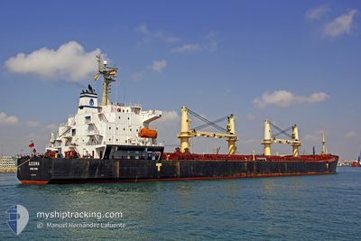
Bulk Carrier
Current Trip
| Time Travelled | 15 days |
|---|---|
| Remaining Time | 2 days |
| Distance Travelled | 3779.82 nm |
| Remaining Distance | 946.89 nm |
| AVG Speed | 10.9 Knots |
| MAX Speed | 15.1 Knots |
| AVG Wind | 13.6 knots |
| MAX Wind | 35 knots |
| MIN Temp | -7.1°C / 19.22°F |
| MAX Temp | 19.9°C / 67.82°F |
| Draught | 12.2 m |
| Position Received | 1 d ago |
Current Position
| Longitude | 14.60414° |
|---|---|
| Latitude | 36.27670° |
| Status | Under way using engine |
| Speed | 11.9 Knots |
| Course | 106.5° |
| Area | Mediterranean Sea - Eastern Basin |
| Station | T-AIS |
| Position Received | 1 d ago |
Info
Information
The current position of RONG XIANG is in Mediterranean Sea - Eastern Basin with coordinates 36.27670° / 14.60414° as reported on 2024-04-18 12:36 by AIS to our vessel tracker app. The vessel's current speed is 11.9 Knots and is heading at the port of SUEZ CANAL. The estimated time of arrival as calculated by MyShipTracking vessel tracking app is 2024-04-21 22:01 LT
The vessel RONG XIANG (IMO: 9294197, MMSI: 538007653) is a Bulk Carrier that was built in 2004 ( 20 years old ). It's sailing under the flag of [MH] Marshall Is.
In this page you can find informations about the vessels current position, last detected port calls, and current voyage information. If the vessels is not in coverage by AIS you will find the latest position.
The current position of RONG XIANG is detected by our AIS receivers and we are not responsible for the reliability of the data. The last position was recorded while the vessel was in Coverage by the Ais receivers of our vessel tracking app.
The current draught of RONG XIANG as reported by AIS is 12.2 meters
Weather
| Temperature | 15.7°C / 60.26°F |
|---|---|
| Wind Speed | 18 knots |
| Direction | 285° WNW |
| Pressure | 1012.9 hPa |
| Humidity | 72.5 % |
| Cloud Coverage | --- |
Featured Company
Most Visited Ports (Last year)
| Port | Arrivals | |
|---|---|---|
| 4 | ||
| 3 | ||
| 3 | ||
| 1 | ||
| 1 | ||
| 1 |
Last Trips
| Origin | Departure | Destination | Arrival | Distance | |
|---|---|---|---|---|---|
| 2024-02-20 07:11 | 2024-02-21 13:54 | 317.90 nm | |||
| 2024-01-26 05:59 | 2024-02-15 12:44 | 5677.41 nm |
Events
| Time | Event | Details | Position / Dest | Info |
|---|---|---|---|---|
| 2024-04-18 13:00 | Status Changed | Default Under way using engine |
36.25328 / 14.69874
SUEZ
|
Speed: 11.9 kn Course: 106.5° |
| 2024-04-18 12:36 | OUT of Coverage |
36.27670 / 14.60414
Mediterranean Sea - Eastern Basin
SUEZ
|
Speed: 11.9 kn Course: 106.5° |
|
| 2024-04-18 10:28 | ETA Changed | 2024/04/21 10:00 2024/04/21 16:00 |
36.40026 / 14.11351
SUEZ
|
Speed: 11.6 kn Course: 113.4° |
| 2024-04-18 10:19 | Detected in Sea | Maltese part of the Mediterranean Sea - Eastern Basin |
36.41088 / 14.08307
Mediterranean Sea - Eastern Basin
SUEZ
|
Speed: 11.6 kn Course: 113.4° |
| 2024-04-18 10:19 | IN Coverage |
36.41088 / 14.08307
Mediterranean Sea - Eastern Basin
SUEZ
|
Speed: 11.6 kn Course: 113.4° |
|
| 2024-04-16 01:51 | Status Changed | Default Under way using engine |
36.79878 / 1.31414
SUEZ
|
Speed: 13 kn Course: 81.7° |
| 2024-04-16 01:46 | OUT of Coverage |
36.79616 / 1.29176
Mediterranean Sea - Western Basin
SUEZ
|
Speed: 13 kn Course: 81.7° |
|
| 2024-04-16 01:13 | Status Changed | Under way using engine Default |
36.77860 / 1.14669
SUEZ
|
Speed: 12.8 kn Course: 81° |
| 2024-04-16 01:11 | IN Coverage |
36.77860 / 1.14669
Mediterranean Sea - Western Basin
SUEZ
|
Speed: 12.8 kn Course: 81.4° |
|
| 2024-04-15 22:45 | OUT of Coverage |
36.70761 / .56384
Mediterranean Sea - Western Basin
SUEZ
|
Speed: 10.8 kn Course: 81.5° |