
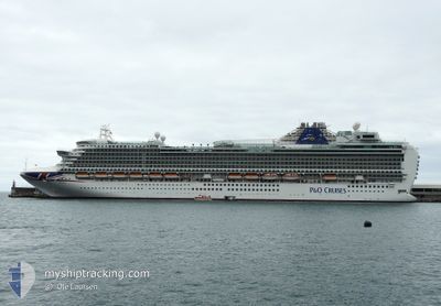
AZURA
Passengers Ship
Current Trip
| Time Travelled | 12 h, 25 mins |
|---|---|
| Remaining Time | 19 h, 31 mins |
| Distance Travelled | 169.72 nm |
| Remaining Distance | 319.59 nm |
| AVG Speed | 14.7 Knots |
| MAX Speed | 17 Knots |
| AVG Wind | 21.5 knots |
| MAX Wind | 31.6 knots |
| MIN Temp | 13.1°C / 55.58°F |
| MAX Temp | 16°C / 60.8°F |
| Draught | 8.7 m |
| Position Received | 1 h, 53 m ago |
Current Position
| Longitude | 11.88071° |
|---|---|
| Latitude | 37.69335° |
| Status | Under way using engine |
| Speed | 13.8 Knots |
| Course | 326.8° |
| Area | Mediterranean Sea - Western Basin |
| Station | T-AIS |
| Position Received | 1 h, 53 m ago |
Info
Information
The current position of AZURA is in Mediterranean Sea - Western Basin with coordinates 37.69335° / 11.88071° as reported on 2024-04-19 05:40 by AIS to our vessel tracker app. The vessel's current speed is 13.8 Knots and is heading at the port of AJACCIO. The estimated time of arrival as calculated by MyShipTracking vessel tracking app is 2024-04-20 03:05 LT
The vessel AZURA (IMO: 9424883, MMSI: 310610000) is a Passengers Ship that was built in 2010 ( 14 years old ). It's sailing under the flag of [BM] Bermuda.
In this page you can find informations about the vessels current position, last detected port calls, and current voyage information. If the vessels is not in coverage by AIS you will find the latest position.
The current position of AZURA is detected by our AIS receivers and we are not responsible for the reliability of the data. The last position was recorded while the vessel was in Coverage by the Ais receivers of our vessel tracking app.
The current draught of AZURA as reported by AIS is 8.7 meters
Weather
| Temperature | 13.9°C / 57.02°F |
|---|---|
| Wind Speed | 32 knots |
| Direction | 287° WNW |
| Pressure | 1012 hPa |
| Humidity | 57.1 % |
| Cloud Coverage | 87 % |
Featured Company
Last Port Calls
| Port | Arrival | Departure | Time In Port |
|---|---|---|---|
| 2024-04-18 03:09 | 2024-04-18 19:09 | 15 h | |
| 2024-04-16 04:31 | 2024-04-16 15:52 | 11 h | |
| 2024-04-15 04:21 | 2024-04-15 15:05 | 10 h | |
| 2024-04-14 04:22 | 2024-04-14 15:04 | 10 h | |
| 2024-04-13 01:51 | 2024-04-13 16:10 | 14 h | |
| 2024-04-11 03:07 | 2024-04-11 19:10 | 16 h | |
| 2024-04-09 05:13 | 2024-04-09 16:09 | 10 h | |
| 2024-04-08 05:33 | 2024-04-08 14:59 | 9 h | |
| 2024-04-07 05:28 | 2024-04-07 18:17 | 12 h | |
| 2024-04-04 03:01 | 2024-04-04 19:03 | 16 h |
Last Trips
| Origin | Departure | Destination | Arrival | Distance | |
|---|---|---|---|---|---|
| 2024-04-16 18:52 | 2024-04-18 05:09 | 532.91 nm | |||
| 2024-04-15 18:05 | 2024-04-16 07:31 | 174.50 nm | |||
| 2024-04-14 18:04 | 2024-04-15 07:21 | 198.31 nm | |||
| 2024-04-13 19:10 | 2024-04-14 07:22 | 204.77 nm | |||
| 2024-04-11 21:10 | 2024-04-13 04:51 | 526.21 nm | |||
| 2024-04-09 18:09 | 2024-04-11 05:07 | 489.10 nm | |||
| 2024-04-08 16:59 | 2024-04-09 07:13 | 247.86 nm | |||
| 2024-04-07 20:17 | 2024-04-08 07:33 | 171.21 nm | |||
| 2024-04-04 21:03 | 2024-04-07 07:28 | 802.91 nm | |||
| 2024-04-02 17:54 | 2024-04-04 05:01 | 488.29 nm |
Events
| Time | Event | Details | Position / Dest | Info |
|---|---|---|---|---|
| 2024-04-19 05:40 | OUT of Coverage |
37.69335 / 11.88071
Mediterranean Sea - Western Basin
AJACCIO
|
Speed: 13.8 kn Course: 326.8° |
|
| 2024-04-19 05:04 | Change Sea Area | Italian part of the Mediterranean Sea - Western Basin Italian part of the Mediterranean Sea - Eastern Basin |
37.57589 / 11.98221
Mediterranean Sea - Western Basin
AJACCIO
|
Speed: 15 kn Course: 326° |
| 2024-04-19 03:19 | Change Sea Area | Italian part of the Mediterranean Sea - Eastern Basin Maltese part of the Mediterranean Sea - Eastern Basin |
37.28050 / 12.42310
Mediterranean Sea - Eastern Basin
AJACCIO
|
Speed: 16 kn Course: 309.3° |
| 2024-04-19 03:18 | IN Coverage |
37.28050 / 12.42310
Mediterranean Sea - Eastern Basin
AJACCIO
|
Speed: 16 kn Course: 309.3° |
|
| 2024-04-18 21:31 | OUT of Coverage |
36.33477 / 14.04792
Mediterranean Sea - Eastern Basin
AJACCIO
|
Speed: 16.8 kn Course: 305.8° |
|
| 2024-04-18 19:37 | Draught Changed | 8.7 8.8 |
35.96420 / 14.51683
AJACCIO
|
Speed: 15.8 kn Course: 316.1° |
| 2024-04-18 19:13 | Draught Changed | 8.8 8.7 |
35.90448 / 14.53889
AJACCIO
|
Speed: 6.6 kn Course: 57.3° |
| 2024-04-18 19:13 | Destination Changed | AJACCIO MTMLA |
35.90448 / 14.53889
AJACCIO
|
Speed: 6.6 kn Course: 57.3° |
| 2024-04-18 19:13 | ETA Changed | 2024/04/20 05:00 2024/04/18 02:45 |
35.90448 / 14.53889
AJACCIO
|
Speed: 6.6 kn Course: 57.3° |
| 2024-04-18 19:09 | PORT DEPARTURE |
|
35.90208 / 14.53066
MTMLA
|
Speed: 5.8 kn Course: 75° |