
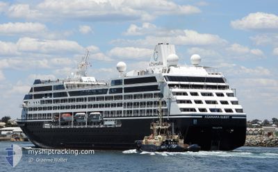
AZAMARA QUEST
Passengers Ship
Current Trip
IT SML
| Time Travelled | 12 h, 59 mins |
|---|---|
| Remaining Time | --- |
| Distance Travelled | 96.94 nm |
| Remaining Distance | --- |
| AVG Speed | 11.6 Knots |
| MAX Speed | 13.9 Knots |
| AVG Wind | 6.6 knots |
| MAX Wind | 16.2 knots |
| MIN Temp | 10.2°C / 50.36°F |
| MAX Temp | 13.8°C / 56.84°F |
| Draught | 5.9 m |
| Position Received | 4 h, 11 m ago |
Current Position
| Longitude | 9.25020° |
|---|---|
| Latitude | 44.31643° |
| Status | Under way using engine |
| Speed | 10.5 Knots |
| Course | 305.9° |
| Area | Ligurian Sea |
| Station | T-AIS |
| Position Received | 4 h, 11 m ago |
Info
Information
The current position of AZAMARA QUEST is in Ligurian Sea with coordinates 44.31643° / 9.25020° as reported on 2024-04-25 05:17 by AIS to our vessel tracker app. The vessel's current speed is 10.5 Knots
The vessel AZAMARA QUEST (IMO: 9210218, MMSI: 256216000) is a Passengers Ship that was built in 2000 ( 24 years old ). It's sailing under the flag of [MT] Malta.
In this page you can find informations about the vessels current position, last detected port calls, and current voyage information. If the vessels is not in coverage by AIS you will find the latest position.
The current position of AZAMARA QUEST is detected by our AIS receivers and we are not responsible for the reliability of the data. The last position was recorded while the vessel was in Coverage by the Ais receivers of our vessel tracking app.
The current draught of AZAMARA QUEST as reported by AIS is 5.9 meters
Weather
| Temperature | 11.4°C / 52.52°F |
|---|---|
| Wind Speed | 7 knots |
| Direction | 283° WNW |
| Pressure | 1008.4 hPa |
| Humidity | 73.2 % |
| Cloud Coverage | 100 % |
Featured Company
Last Port Calls
| Port | Arrival | Departure | Time In Port |
|---|---|---|---|
| 2024-04-24 05:34 | 2024-04-24 20:30 | 14 h | |
| 2024-04-23 06:02 | 2024-04-23 18:07 | 12 h | |
| 2024-04-22 03:17 | 2024-04-22 16:01 | 12 h | |
| 2024-04-21 05:26 | 2024-04-21 15:28 | 10 h | |
| 2024-04-20 05:22 | 2024-04-20 16:02 | 10 h | |
| 2024-04-19 04:55 | 2024-04-19 18:50 | 13 h | |
| 2024-04-18 04:18 | 2024-04-18 20:13 | 15 h | |
| 2024-04-17 05:20 | 2024-04-17 17:59 | 12 h | |
| 2024-04-16 06:47 | 2024-04-16 15:55 | 9 h | |
| 2024-04-14 11:13 | 2024-04-15 17:10 | 1 d |
Last Trips
| Origin | Departure | Destination | Arrival | Distance | |
|---|---|---|---|---|---|
| 2024-04-23 20:07 | 2024-04-24 07:34 | 148.11 nm | |||
| 2024-04-22 18:01 | 2024-04-23 08:02 | 187.23 nm | |||
| 2024-04-21 17:28 | 2024-04-22 05:17 | 166.56 nm | |||
| 2024-04-20 18:02 | 2024-04-21 07:26 | 164.17 nm | |||
| 2024-04-19 20:50 | 2024-04-20 07:22 | 128.12 nm | |||
| 2024-04-18 22:13 | 2024-04-19 06:55 | 100.82 nm | |||
| 2024-04-17 19:59 | 2024-04-18 06:18 | 80.93 nm | |||
| 2024-04-16 16:55 | 2024-04-17 07:20 | 184.58 nm | |||
| 2024-04-15 18:10 | 2024-04-16 07:47 | 156.09 nm | |||
| 2024-04-13 17:04 | 2024-04-14 12:13 | 267.58 nm |
Events
| Time | Event | Details | Position / Dest | Info |
|---|---|---|---|---|
| 2024-04-25 05:36 | STOP Moving | 4.16 nm, South East of RECCO |
44.32855 / 9.22708
IT SML
|
Speed: 0.2 kn Course: 354° |
| 2024-04-25 05:24 | Status Changed | Default Under way using engine |
44.32623 / 9.23093
IT SML
|
Speed: 10.5 kn Course: 305.9° |
| 2024-04-25 05:17 | Status Changed | Under way using engine Default |
44.31643 / 9.25020
IT SML
|
Speed: 10.3 kn Course: 312° |
| 2024-04-25 05:17 | OUT of Coverage |
44.31643 / 9.25020
Ligurian Sea
IT SML
|
Speed: 10.5 kn Course: 305.9° |
|
| 2024-04-25 05:08 | Status Changed | Default Under way using engine |
44.29922 / 9.27807
IT SML
|
Speed: 13 kn Course: 315.7° |
| 2024-04-25 00:57 | Status Changed | Under way using engine Default |
43.88299 / 8.48258
IT SML
|
Speed: 10 kn Course: 61° |
| 2024-04-25 00:52 | IN Coverage |
43.88299 / 8.48258
Ligurian Sea
IT SML
|
Speed: 10.1 kn Course: 60.7° |
|
| 2024-04-24 22:00 | Status Changed | Default Under way using engine |
43.75514 / 7.82505
IT SML
|
Speed: 11.3 kn Course: 77.4° |
| 2024-04-24 21:55 | OUT of Coverage |
43.75210 / 7.80497
Ligurian Sea
IT SML
|
Speed: 11.3 kn Course: 77.4° |
|
| 2024-04-24 21:23 | Change Sea Area | Italian part of the Ligurian Sea Italian part of the Mediterranean Sea - Western Basin |
43.73139 / 7.66473
Ligurian Sea
IT SML
|
Speed: 11.6 kn Course: 77° |