
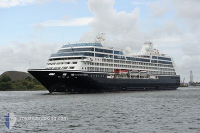
AZAMARA PURSUIT
Passengers Ship
Current Trip
FUSINA, ITALY
| Time Travelled | --- |
|---|---|
| Remaining Time | --- |
| Distance Travelled | --- |
| Remaining Distance | --- |
| AVG Speed | --- |
| MAX Speed | --- |
| AVG Wind | --- |
| MAX Wind | --- |
| MIN Temp | --- |
| MAX Temp | --- |
| Draught | 5.9 m |
| Position Received | 2 m ago |
Current Position
| Longitude | 13.92813° |
|---|---|
| Latitude | 43.91570° |
| Status | Under way using engine |
| Speed | 12.3 Knots |
| Course | 312.7° |
| Area | Adriatic Sea |
| Station | T-AIS |
| Position Received | 2 m ago |
Info
Information
The current position of AZAMARA PURSUIT is in Adriatic Sea with coordinates 43.91570° / 13.92813° as reported on 2024-04-19 17:13 by AIS to our vessel tracker app. The vessel's current speed is 12.3 Knots
The vessel AZAMARA PURSUIT (IMO: 9210220, MMSI: 248762000) is a Passengers Ship that was built in 2001 ( 23 years old ). It's sailing under the flag of [MT] Malta.
In this page you can find informations about the vessels current position, last detected port calls, and current voyage information. If the vessels is not in coverage by AIS you will find the latest position.
The current position of AZAMARA PURSUIT is detected by our AIS receivers and we are not responsible for the reliability of the data. The last position was recorded while the vessel was in Coverage by the Ais receivers of our vessel tracking app.
The current draught of AZAMARA PURSUIT as reported by AIS is 5.9 meters
Weather
| Temperature | 12.8°C / 55.04°F |
|---|---|
| Wind Speed | 8 knots |
| Direction | 306° NW |
| Pressure | 1012.5 hPa |
| Humidity | 50.1 % |
| Cloud Coverage | 70 % |
Featured Company
Last Port Calls
| Port | Arrival | Departure | Time In Port |
|---|---|---|---|
| 2024-04-18 10:27 | |||
| 2024-04-17 06:55 | 2024-04-17 15:38 | 8 h | |
| 2024-04-16 06:21 | 2024-04-16 14:44 | 8 h | |
| 2024-04-13 05:41 | 2024-04-13 11:54 | 6 h | |
| 2024-04-11 05:45 | 2024-04-12 19:56 | 1 d | |
| 2024-04-10 04:25 | 2024-04-10 16:02 | 11 h | |
| 2024-04-07 05:42 | 2024-04-07 19:34 | 13 h | |
| 2024-04-05 05:35 | 2024-04-05 19:51 | 14 h | |
| 2024-04-04 18:34 | 2024-04-04 19:01 | 27 m | |
| 2024-04-03 20:31 | 2024-04-04 16:15 | 19 h |
Most Visited Ports (Last year)
| Port | Arrivals | |
|---|---|---|
| 7 | ||
| 6 | ||
| 6 | ||
| 6 | ||
| 6 | ||
| 5 |
Last Trips
| Origin | Departure | Destination | Arrival | Distance | |
|---|---|---|---|---|---|
| 2024-04-17 17:38 | 2024-04-18 12:27 | 252.62 nm | |||
| 2024-04-16 16:44 | 2024-04-17 08:55 | 233.41 nm | |||
| 2024-04-13 13:54 | 2024-04-16 08:21 | 485.15 nm | |||
| 2024-04-12 21:56 | 2024-04-13 07:41 | 88.66 nm | |||
| 2024-04-10 18:02 | 2024-04-11 07:45 | 125.05 nm | |||
| 2024-04-07 21:34 | 2024-04-10 06:25 | 337.05 nm | |||
| 2024-04-05 21:51 | 2024-04-07 07:42 | 170.39 nm | |||
| 2024-04-04 21:01 | 2024-04-05 07:35 | 79.44 nm | |||
| 2024-04-04 18:15 | 2024-04-04 20:34 | 15.74 nm | |||
| 2024-04-02 18:05 | 2024-04-03 22:31 | 137.48 nm |
Events
| Time | Event | Details | Position / Dest | Info |
|---|---|---|---|---|
| 2024-04-19 17:10 | Detected in Sea | Italian part of the Adriatic Sea |
43.90900 / 13.93808
Adriatic Sea
FUSINA, ITALY
|
Speed: 12.4 kn Course: 312.6° |
| 2024-04-19 17:10 | Status Changed | Under way using engine Default |
43.90900 / 13.93808
FUSINA, ITALY
|
Speed: 12.3 kn Course: 312° |
| 2024-04-19 17:00 | IN Coverage |
43.90900 / 13.93808
Adriatic Sea
FUSINA, ITALY
|
Speed: 12.4 kn Course: 312.6° |
|
| 2024-04-19 10:22 | OUT of Coverage |
42.96448 / 15.34913
Adriatic Sea
FUSINA, ITALY
|
Speed: 12 kn Course: 306.7° |
|
| 2024-04-19 05:19 | Destination Changed | FUSINA, ITALY KOTOR, MONTENEGRO |
42.23482 / 16.33540
FUSINA, ITALY
|
Speed: 12.5 kn Course: 309.5° |
| 2024-04-19 05:19 | ETA Changed | 2024/04/20 02:30 2024/04/18 09:15 |
42.23482 / 16.33540
FUSINA, ITALY
|
Speed: 12.5 kn Course: 309.5° |
| 2024-04-19 05:19 | Change Sea Area | Croatian part of the Adriatic Sea Montenegrin part of the Adriatic Sea |
42.23482 / 16.33540
Adriatic Sea
|
Speed: 12.5 kn Course: 309.5° |
| 2024-04-19 05:19 | IN Coverage |
42.23482 / 16.33540
Adriatic Sea
|
Speed: 12.5 kn Course: 309.5° |
|
| 2024-04-18 17:28 | OUT of Coverage |
42.42583 / 18.76641
Adriatic Sea
[ME] KOTOR
|
Speed: Course: 311.3° |
|
| 2024-04-18 14:37 | IN Coverage |
42.42585 / 18.76643
Adriatic Sea
[ME] KOTOR
|
Speed: Course: 311.3° |