
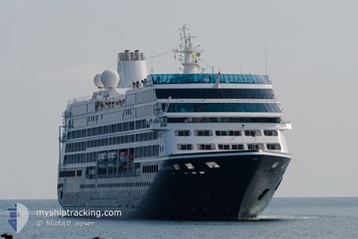
AZAMARA JOURNEY
Passengers Ship
Current Trip
| Time Travelled | 1 day |
|---|---|
| Remaining Time | --- |
| Distance Travelled | 444.67 nm |
| Remaining Distance | 35.10 nm |
| AVG Speed | 15.5 Knots |
| MAX Speed | 18.2 Knots |
| AVG Wind | 9.5 knots |
| MAX Wind | 16 knots |
| MIN Temp | 20.6°C / 69.08°F |
| MAX Temp | 26.6°C / 79.88°F |
| Draught | 5.8 m |
| Position Received | 15 h, 9 m ago |
Current Position
| Longitude | 118.12968° |
|---|---|
| Latitude | 23.46191° |
| Status | Under way using engine |
| Speed | 17.3 Knots |
| Course | 218.1° |
| Area | South China Sea |
| Station | T-AIS |
| Position Received | 15 h, 9 m ago |
Info
Information
The current position of AZAMARA JOURNEY is in South China Sea with coordinates 23.46191° / 118.12968° as reported on 2024-04-25 04:43 by AIS to our vessel tracker app. The vessel's current speed is 17.3 Knots and is heading at the port of HONG KONG. The estimated time of arrival as calculated by MyShipTracking vessel tracking app is 2024-04-25 22:30 LT
The vessel AZAMARA JOURNEY (IMO: 9200940, MMSI: 256204000) is a Passengers Ship that was built in 2000 ( 24 years old ). It's sailing under the flag of [MT] Malta.
In this page you can find informations about the vessels current position, last detected port calls, and current voyage information. If the vessels is not in coverage by AIS you will find the latest position.
The current position of AZAMARA JOURNEY is detected by our AIS receivers and we are not responsible for the reliability of the data. The last position was recorded while the vessel was in Coverage by the Ais receivers of our vessel tracking app.
The current draught of AZAMARA JOURNEY as reported by AIS is 5.8 meters
Weather
| Temperature | 25.9°C / 78.62°F |
|---|---|
| Wind Speed | 11 knots |
| Direction | 176° S |
| Pressure | 1004.2 hPa |
| Humidity | 95.6 % |
| Cloud Coverage | 12 % |
Featured Company
Last Port Calls
| Port | Arrival | Departure | Time In Port |
|---|---|---|---|
| 2024-04-23 23:05 | 2024-04-24 14:00 | 14 h | |
| 2024-04-20 22:23 | 2024-04-21 10:57 | 12 h | |
| 2024-04-19 20:56 | 2024-04-20 12:10 | 15 h | |
| 2024-04-16 21:56 | 2024-04-18 08:16 | 1 d | |
| 2024-04-16 00:32 | 2024-04-16 10:15 | 9 h | |
| 2024-04-13 21:45 | 2024-04-15 04:53 | 1 d | |
| 2024-04-13 03:26 | 2024-04-13 11:30 | 8 h | |
| 2024-04-11 21:50 | 2024-04-12 13:37 | 15 h | |
| 2024-04-09 22:40 | 2024-04-10 13:41 | 15 h | |
| 2024-04-08 21:45 | 2024-04-09 09:05 | 11 h |
Last Trips
| Origin | Departure | Destination | Arrival | Distance | |
|---|---|---|---|---|---|
| 2024-04-21 19:57 | 2024-04-24 07:05 | 808.80 nm | |||
| 2024-04-20 21:10 | 2024-04-21 07:23 | 144.83 nm | |||
| 2024-04-18 17:16 | 2024-04-20 05:56 | 332.56 nm | |||
| 2024-04-16 19:15 | 2024-04-17 06:56 | 133.99 nm | |||
| 2024-04-15 13:53 | 2024-04-16 09:32 | 281.10 nm | |||
| 2024-04-13 20:30 | 2024-04-14 06:45 | 85.34 nm | |||
| 2024-04-12 22:37 | 2024-04-13 12:26 | 115.12 nm | |||
| 2024-04-10 22:41 | 2024-04-12 06:50 | 246.66 nm | |||
| 2024-04-09 18:05 | 2024-04-10 07:40 | 217.35 nm | |||
| 2024-04-06 18:17 | 2024-04-09 06:45 | 490.52 nm |
Events
| Time | Event | Details | Position / Dest | Info |
|---|---|---|---|---|
| 2024-04-25 04:58 | Status Changed | Default Under way using engine |
23.40529 / 118.07541
TW KEL > HK HKG
|
Speed: 17.3 kn Course: 218.1° |
| 2024-04-25 04:43 | Change Sea Area | Chinese part of the South China Sea Taiwanese part of the South China Sea |
23.46191 / 118.12968
South China Sea
TW KEL > HK HKG
|
Speed: 17.3 kn Course: 218.1° |
| 2024-04-25 04:43 | OUT of Coverage |
23.46191 / 118.12968
South China Sea
TW KEL > HK HKG
|
Speed: 17.3 kn Course: 218.1° |
|
| 2024-04-25 04:42 | Status Changed | Under way using engine Default |
23.46417 / 118.13150
TW KEL > HK HKG
|
Speed: 17 kn Course: 246° |
| 2024-04-25 04:29 | IN Coverage |
23.46191 / 118.12968
South China Sea
TW KEL > HK HKG
|
Speed: 17.3 kn Course: 218.1° |
|
| 2024-04-24 16:24 | Status Changed | Default Under way using engine |
25.25204 / 121.17568
TW KEL > HK HKG
|
Speed: 16.7 kn Course: 239.1° |
| 2024-04-24 16:16 | OUT of Coverage |
25.26937 / 121.21111
South China Sea
TW KEL > HK HKG
|
Speed: 16.7 kn Course: 239.1° |
|
| 2024-04-24 16:04 | Change Sea Area | Taiwanese part of the South China Sea Taiwanese part of the Eastern China Sea |
25.29788 / 121.26322
South China Sea
TW KEL > HK HKG
|
Speed: 16.7 kn Course: 238.7° |
| 2024-04-24 16:03 | Status Changed | Under way using engine Default |
25.30074 / 121.26843
TW KEL > HK HKG
|
Speed: 17.3 kn Course: 239° |
| 2024-04-24 15:21 | Status Changed | Default Under way using engine |
25.36822 / 121.48534
TW KEL > HK HKG
|
Speed: 17.7 kn Course: 261.4° |