
AURA SEAWAYS
Passenger B
Current Trip
| Time Travelled | 17 h, 10 mins |
|---|---|
| Remaining Time | 2 h, 33 mins |
| Distance Travelled | 351.50 nm |
| Remaining Distance | 60.50 nm |
| AVG Speed | 20.1 Knots |
| MAX Speed | 21.5 Knots |
| AVG Wind | 9.9 knots |
| MAX Wind | 15.4 knots |
| MIN Temp | 3.5°C / 38.3°F |
| MAX Temp | 7.3°C / 45.14°F |
| Draught | 6.5 m |
| Position Received | Now |
Current Position
| Longitude | 11.41861° |
|---|---|
| Latitude | 54.53903° |
| Status | Under way using engine |
| Speed | 19.6 Knots |
| Course | 299.2° |
| Area | Baltic Sea |
| Station | T-AIS |
| Position Received | Now |
Info
Information
The current position of AURA SEAWAYS is in Baltic Sea with coordinates 54.53903° / 11.41861° as reported on 2024-04-25 12:38 by AIS to our vessel tracker app. The vessel's current speed is 19.6 Knots and is heading at the port of KIEL. The estimated time of arrival as calculated by MyShipTracking vessel tracking app is 2024-04-25 15:12 LT
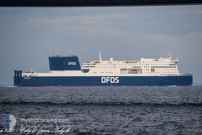
The vessel AURA SEAWAYS (IMO: 9851036, MMSI: 219028116) is a Passenger B It's sailing under the flag of [DK] Denmark.
In this page you can find informations about the vessels current position, last detected port calls, and current voyage information. If the vessels is not in coverage by AIS you will find the latest position.
The current position of AURA SEAWAYS is detected by our AIS receivers and we are not responsible for the reliability of the data. The last position was recorded while the vessel was in Coverage by the Ais receivers of our vessel tracking app.
The current draught of AURA SEAWAYS as reported by AIS is 6.5 meters
Weather
| Temperature | 6.9°C / 44.42°F |
|---|---|
| Wind Speed | 7 knots |
| Direction | 97° E |
| Pressure | 1003.2 hPa |
| Humidity | 72.9 % |
| Cloud Coverage | 83 % |
Featured Company
Last Port Calls
| Port | Arrival | Departure | Time In Port |
|---|---|---|---|
| 2024-04-24 14:45 | 2024-04-24 19:29 | 4 h | |
| 2024-04-23 14:45 | 2024-04-23 19:23 | 4 h | |
| 2024-04-21 17:44 | 2024-04-22 19:17 | 1 d | |
| 2024-04-20 16:29 | 2024-04-20 21:54 | 5 h | |
| 2024-04-19 15:44 | 2024-04-19 20:37 | 4 h | |
| 2024-04-18 15:42 | 2024-04-18 20:35 | 4 h | |
| 2024-04-17 14:47 | 2024-04-17 20:20 | 5 h | |
| 2024-04-16 14:28 | 2024-04-16 19:11 | 4 h | |
| 2024-04-14 17:12 | 2024-04-15 18:17 | 1 d | |
| 2024-04-13 16:31 | 2024-04-13 21:40 | 5 h |
Last Trips
| Origin | Departure | Destination | Arrival | Distance | |
|---|---|---|---|---|---|
| 2024-04-23 21:23 | 2024-04-24 17:45 | 401.67 nm | |||
| 2024-04-22 22:17 | 2024-04-23 16:45 | 402.27 nm | |||
| 2024-04-20 23:54 | 2024-04-21 20:44 | 401.79 nm | |||
| 2024-04-19 23:37 | 2024-04-20 18:29 | 401.98 nm | |||
| 2024-04-18 22:35 | 2024-04-19 18:44 | 400.69 nm | |||
| 2024-04-17 23:20 | 2024-04-18 17:42 | 401.70 nm | |||
| 2024-04-16 21:11 | 2024-04-17 17:47 | 401.53 nm | |||
| 2024-04-15 21:17 | 2024-04-16 16:28 | 402.33 nm | |||
| 2024-04-13 23:40 | 2024-04-14 20:12 | 401.10 nm | |||
| 2024-04-13 00:03 | 2024-04-13 18:31 | 402.12 nm |
Events
| Time | Event | Details | Position / Dest | Info |
|---|---|---|---|---|
| 2024-04-25 10:20 | Change Sea Area | Danish part of the Baltic Sea German part of the Baltic Sea |
54.67679 / 12.42919
Baltic Sea
DEKEL
|
Speed: 19.6 kn Course: 239.1° |
| 2024-04-25 10:14 | Change Sea Area | German part of the Baltic Sea Danish part of the Baltic Sea |
54.69385 / 12.47673
Baltic Sea
DEKEL
|
Speed: 19.5 kn Course: 236.2° |
| 2024-04-25 09:23 | Change Sea Area | Danish part of the Baltic Sea German part of the Baltic Sea |
54.82246 / 12.89833
Baltic Sea
DEKEL
|
Speed: 20 kn Course: 250.1° |
| 2024-04-25 07:23 | Change Sea Area | German part of the Baltic Sea Danish part of the Kattegat |
54.92835 / 14.02280
Baltic Sea
DEKEL
|
Speed: 20.4 kn Course: 266.1° |
| 2024-04-25 04:26 | Change Sea Area | Danish part of the Kattegat Polish part of the Baltic Sea |
55.01815 / 15.73730
Kattegat
DEKEL
|
Speed: 21.3 kn Course: 256.6° |
| 2024-04-25 01:59 | Status Changed | Under way using engine Default |
55.23351 / 17.19618
DEKEL
|
Speed: 21 kn Course: 254° |
| 2024-04-25 01:56 | Status Changed | Default Under way using engine |
55.23707 / 17.21897
DEKEL
|
Speed: 21.1 kn Course: 254.9° |
| 2024-04-25 01:13 | Status Changed | Under way using engine Default |
55.30424 / 17.64852
DEKEL
|
Speed: 21.1 kn Course: 254° |
| 2024-04-25 01:12 | Status Changed | Default Under way using engine |
55.30520 / 17.65441
DEKEL
|
Speed: 21 kn Course: 253.7° |
| 2024-04-25 01:05 | Status Changed | Under way using engine Default |
55.31690 / 17.72302
DEKEL
|
Speed: 21.1 kn Course: 253° |