
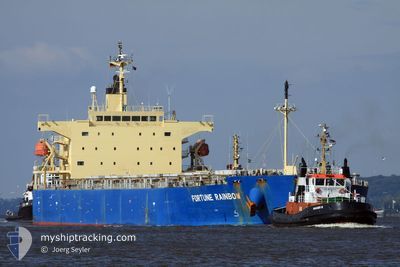
ASL URANUS
Bulk Carrier
Current Trip
CN_GZG
| Time Travelled | 20 days |
|---|---|
| Remaining Time | --- |
| Distance Travelled | 4522.74 nm |
| Remaining Distance | --- |
| AVG Speed | 10.6 Knots |
| MAX Speed | 14.3 Knots |
| AVG Wind | 9.5 knots |
| MAX Wind | 25 knots |
| MIN Temp | 20.1°C / 68.18°F |
| MAX Temp | 29.5°C / 85.1°F |
| Draught | 14.1 m |
| Position Received | 3 d ago |
Current Position
| Longitude | 113.68706° |
|---|---|
| Latitude | 22.67247° |
| Status | Under way using engine |
| Speed | 9 Knots |
| Course | 344.6° |
| Area | South China Sea |
| Station | T-AIS |
| Position Received | 3 d ago |
Info
Information
The current position of ASL URANUS is in South China Sea with coordinates 22.67247° / 113.68706° as reported on 2024-04-21 02:59 by AIS to our vessel tracker app. The vessel's current speed is 9 Knots
The vessel ASL URANUS (IMO: 9317511, MMSI: 636020665) is a Bulk Carrier that was built in 2008 ( 16 years old ). It's sailing under the flag of [LR] Liberia.
In this page you can find informations about the vessels current position, last detected port calls, and current voyage information. If the vessels is not in coverage by AIS you will find the latest position.
The current position of ASL URANUS is detected by our AIS receivers and we are not responsible for the reliability of the data. The last position was recorded while the vessel was in Coverage by the Ais receivers of our vessel tracking app.
The current draught of ASL URANUS as reported by AIS is 14.1 meters
Weather
| Temperature | 26.2°C / 79.16°F |
|---|---|
| Wind Speed | 4 knots |
| Direction | 239° WSW |
| Pressure | 1008 hPa |
| Humidity | 81.9 % |
| Cloud Coverage | 100 % |
Featured Company
Events
| Time | Event | Details | Position / Dest | Info |
|---|---|---|---|---|
| 2024-04-21 03:36 | STOP Moving | 2.86 nm, North of NANSHA |
22.72066 / 113.67969
CN_GZG
|
Speed: 0.1 kn Course: 318° |
| 2024-04-21 03:04 | Status Changed | Default Under way using engine |
22.68447 / 113.68396
CN_GZG
|
Speed: 9 kn Course: 344.6° |
| 2024-04-21 02:59 | OUT of Coverage |
22.67247 / 113.68706
South China Sea
|
Speed: 9 kn Course: 344.6° |
|
| 2024-04-21 02:45 | Status Changed | Under way using engine Default |
22.63813 / 113.69636
CN_GZG
|
Speed: 9.3 kn Course: 340° |
| 2024-04-21 02:28 | Status Changed | Default Under way using engine |
22.59803 / 113.71043
CN_GZG
|
Speed: 9.1 kn Course: 337.1° |
| 2024-04-21 01:26 | Status Changed | Under way using engine Default |
22.43442 / 113.75771
CN_GZG
|
Speed: 10.3 kn Course: 354° |
| 2024-04-21 01:24 | Status Changed | Default Under way using engine |
22.42818 / 113.75853
CN_GZG
|
Speed: 10.3 kn Course: 351.3° |
| 2024-04-21 00:36 | ETA Changed | 2024/04/20 06:00 2024/04/19 14:00 |
22.29239 / 113.80432
CN_GZG
|
Speed: 10.9 kn Course: 349.5° |
| 2024-04-21 00:31 | Status Changed | Under way using engine Default |
22.27941 / 113.80685
CN_GZG
|
Speed: 10.9 kn Course: 346° |
| 2024-04-21 00:08 | Status Changed | Default Under way using engine |
22.21184 / 113.82323
CN_GZG
|
Speed: 10.8 kn Course: 340.5° |