
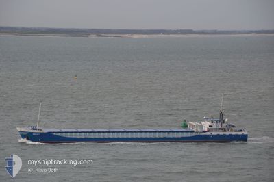
JEKERBORG
General Cargo
Current Trip
| Time Travelled | 1 day |
|---|---|
| Remaining Time | 9 h, 34 mins |
| Distance Travelled | 295.14 nm |
| Remaining Distance | 108.91 nm |
| AVG Speed | 10.1 Knots |
| MAX Speed | 11.7 Knots |
| AVG Wind | 12.9 knots |
| MAX Wind | 25.9 knots |
| MIN Temp | 4.9°C / 40.82°F |
| MAX Temp | 7.9°C / 46.22°F |
| Draught | 4.2 m |
| Position Received | Now |
Current Position
| Longitude | 7.86817° |
|---|---|
| Latitude | 56.22466° |
| Status | Under way using engine |
| Speed | 11.8 Knots |
| Course | 8.3° |
| Area | North Sea |
| Station | T-AIS |
| Position Received | Now |
Info
Information
The current position of JEKERBORG is in North Sea with coordinates 56.22466° / 7.86817° as reported on 2024-04-19 03:22 by AIS to our vessel tracker app. The vessel's current speed is 11.8 Knots and is heading at the port of AALBORG. The estimated time of arrival as calculated by MyShipTracking vessel tracking app is 2024-04-19 12:57 LT
The vessel JEKERBORG (IMO: 9201944, MMSI: 244580000) is a General Cargo that was built in 2000 ( 24 years old ). It's sailing under the flag of [NL] Netherlands.
In this page you can find informations about the vessels current position, last detected port calls, and current voyage information. If the vessels is not in coverage by AIS you will find the latest position.
The current position of JEKERBORG is detected by our AIS receivers and we are not responsible for the reliability of the data. The last position was recorded while the vessel was in Coverage by the Ais receivers of our vessel tracking app.
The current draught of JEKERBORG as reported by AIS is 4.2 meters
Weather
| Temperature | 4.9°C / 40.82°F |
|---|---|
| Wind Speed | 26 knots |
| Direction | 115° ESE |
| Pressure | 999.6 hPa |
| Humidity | 96.6 % |
| Cloud Coverage | 100 % |
Featured Company
Last Port Calls
| Port | Arrival | Departure | Time In Port |
|---|---|---|---|
| 2024-04-16 19:55 | 2024-04-17 22:02 | 1 d | |
| 2024-04-12 21:58 | 2024-04-13 21:15 | 23 h | |
| 2024-04-05 01:47 | 2024-04-06 00:39 | 22 h | |
| 2024-03-31 11:16 | 2024-04-03 15:41 | 3 d | |
| 2024-03-29 02:49 | 2024-03-29 04:43 | 1 h | |
| 2024-03-27 23:54 | 2024-03-28 18:14 | 18 h | |
| 2024-03-26 05:05 | 2024-03-26 18:38 | 13 h | |
| 2024-03-23 08:42 | 2024-03-23 08:50 | 8 m | |
| 2024-03-20 21:06 | 2024-03-21 21:06 | 1 d | |
| 2024-03-15 03:38 | 2024-03-16 15:17 | 1 d |
Most Visited Ports (Last year)
| Port | Arrivals | |
|---|---|---|
| 7 | ||
| 5 | ||
| 5 | ||
| 4 | ||
| 4 | ||
| 3 |
Last Trips
| Origin | Departure | Destination | Arrival | Distance | |
|---|---|---|---|---|---|
| 2024-04-13 22:15 | 2024-04-16 21:55 | 634.84 nm | |||
| 2024-04-06 02:39 | 2024-04-12 22:58 | 906.59 nm | |||
| 2024-04-03 17:41 | 2024-04-05 03:47 | 278.73 nm | |||
| 2024-03-29 05:43 | 2024-03-31 13:16 | 542.11 nm | |||
| 2024-03-28 19:14 | 2024-03-29 03:49 | 82.13 nm | |||
| 2024-03-26 19:38 | 2024-03-28 00:54 | 96.94 nm | |||
| 2024-03-23 08:50 | 2024-03-26 06:05 | 381.59 nm | |||
| 2024-03-21 21:06 | 2024-03-23 08:42 | 338.07 nm | |||
| 2024-03-16 16:17 | 2024-03-20 21:06 | 922.90 nm | |||
| 2024-03-14 14:19 | 2024-03-15 04:38 | 119.66 nm |
Events
| Time | Event | Details | Position / Dest | Info |
|---|---|---|---|---|
| 2024-04-18 22:14 | Detected in Sea | Danish part of the North Sea |
55.45437 / 6.93017
North Sea
AALBORG
|
Speed: 10.3 kn Course: 37.2° |
| 2024-04-18 22:14 | IN Coverage |
55.45437 / 6.93017
North Sea
AALBORG
|
Speed: 10.3 kn Course: 37.2° |
|
| 2024-04-18 08:32 | OUT of Coverage |
53.54012 / 4.78988
North Sea
AALBORG
|
Speed: 9.1 kn Course: 19.5° |
|
| 2024-04-18 06:48 | IN Coverage |
53.29554 / 4.64652
North Sea
AALBORG
|
Speed: 8.6 kn Course: 18.1° |
|
| 2024-04-18 05:34 | OUT of Coverage |
53.12212 / 4.55920
North Sea
AALBORG
|
Speed: 8.8 kn Course: 5.2° |
|
| 2024-04-17 22:02 | PORT DEPARTURE |
|
51.96224 / 4.08233
AALBORG
|
Speed: 7.8 kn Course: 72.9° |
| 2024-04-17 21:54 | START Moving |
51.96094 / 4.05584
[NL] MAASVLAKTE - ROTTERDAM
|
Speed: 3.2 kn Course: 85° |
|
| 2024-04-17 21:31 | Status Changed | Under way using engine Moored |
51.96376 / 4.05251
[NL] MAASVLAKTE - ROTTERDAM
|
Speed: Course: 180° |
| 2024-04-17 21:07 | Draught Changed | 4.2 3.2 |
51.96372 / 4.05251
[NL] MAASVLAKTE - ROTTERDAM
|
Speed: Course: 511° |
| 2024-04-17 21:01 | Destination Changed | AALBORG ROTTERDAM |
51.96363 / 4.05240
[NL] MAASVLAKTE - ROTTERDAM
|
Speed: Course: 180° |