
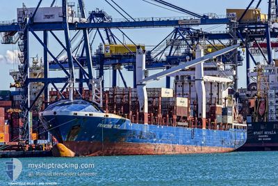
AS FRANZISKA
Container Ship
Current Trip
| Time Travelled | 2 h, 38 mins |
|---|---|
| Remaining Time | --- |
| Distance Travelled | 16.83 nm |
| Remaining Distance | --- |
| AVG Speed | 8.4 Knots |
| MAX Speed | 11.3 Knots |
| AVG Wind | 20.8 knots |
| MAX Wind | 23.8 knots |
| MIN Temp | 5.9°C / 42.62°F |
| MAX Temp | 7.9°C / 46.22°F |
| Draught | 8.8 m |
| Position Received | 36 m ago |
Current Position
| Longitude | 8.11064° |
|---|---|
| Latitude | 53.82045° |
| Status | Under way using engine |
| Speed | 11.5 Knots |
| Course | 323.4° |
| Area | North Sea |
| Station | T-AIS |
| Position Received | 36 m ago |
Info
Information
The current position of AS FRANZISKA is in North Sea with coordinates 53.82045° / 8.11064° as reported on 2024-04-19 22:17 by AIS to our vessel tracker app. The vessel's current speed is 11.5 Knots and is heading at the port of TANGER MED. The estimated time of arrival as calculated by MyShipTracking vessel tracking app is 2024-04-28 07:00 LT
The vessel AS FRANZISKA (IMO: 9295517, MMSI: 305213000) is a Container Ship that was built in 2005 ( 19 years old ). It's sailing under the flag of [AG] Antigua Barbuda.
In this page you can find informations about the vessels current position, last detected port calls, and current voyage information. If the vessels is not in coverage by AIS you will find the latest position.
The current position of AS FRANZISKA is detected by our AIS receivers and we are not responsible for the reliability of the data. The last position was recorded while the vessel was in Coverage by the Ais receivers of our vessel tracking app.
The current draught of AS FRANZISKA as reported by AIS is 8.8 meters
Weather
| Temperature | 7.1°C / 44.78°F |
|---|---|
| Wind Speed | 20 knots |
| Direction | --- N |
| Pressure | 1010.5 hPa |
| Humidity | 62.2 % |
| Cloud Coverage | 92 % |
Featured Company
Last Port Calls
| Port | Arrival | Departure | Time In Port |
|---|---|---|---|
| 2024-04-18 14:06 | 2024-04-19 20:16 | 1 d | |
| 2024-04-12 05:19 | 2024-04-12 20:24 | 15 h | |
| 2024-04-03 20:23 | 2024-04-04 03:34 | 7 h | |
| 2024-03-28 00:26 | 2024-03-28 10:03 | 9 h | |
| 2024-03-19 11:29 | |||
| 2024-03-07 16:17 | |||
| 2024-02-12 11:28 | 2024-02-13 03:20 | 15 h | |
| 2024-02-06 19:46 | 2024-02-08 12:24 | 1 d |
Most Visited Ports (Last year)
| Port | Arrivals | |
|---|---|---|
| 12 | ||
| 6 | ||
| 6 | ||
| 3 | ||
| 2 | ||
| 2 |
Last Trips
| Origin | Departure | Destination | Arrival | Distance | |
|---|---|---|---|---|---|
| 2024-04-12 22:24 | 2024-04-18 16:06 | 1655.59 nm | |||
| 2024-04-04 03:34 | 2024-04-12 07:19 | 663.15 nm | |||
| 2024-03-28 11:03 | 2024-04-03 20:23 | 454.68 nm | |||
| 2024-03-19 11:29 | 2024-03-28 01:26 | 1555.75 nm | |||
| 2024-02-08 12:24 | 2024-02-12 11:28 | 239.07 nm | |||
| 2024-01-17 10:17 | 2024-02-06 19:46 | 3139.90 nm |
Events
| Time | Event | Details | Position / Dest | Info |
|---|---|---|---|---|
| 2024-04-19 22:20 | Status Changed | Default Under way using engine |
53.82664 / 8.09929
MAPTM
|
Speed: 11.5 kn Course: 323.4° |
| 2024-04-19 22:17 | Status Changed | Under way using engine Default |
53.82045 / 8.11064
MAPTM
|
Speed: 11.5 kn Course: 323° |
| 2024-04-19 22:16 | Status Changed | Default Under way using engine |
53.81743 / 8.11446
MAPTM
|
Speed: 11.2 kn Course: 322.9° |
| 2024-04-19 22:09 | Status Changed | Under way using engine Default |
53.80007 / 8.13605
MAPTM
|
Speed: 11.3 kn Course: 323° |
| 2024-04-19 22:04 | Status Changed | Default Under way using engine |
53.78791 / 8.15119
MAPTM
|
Speed: 11.2 kn Course: 322° |
| 2024-04-19 21:34 | ETA Changed | 2024/04/28 07:00 2024/04/25 13:00 |
53.72520 / 8.26671
MAPTM
|
Speed: 10.4 kn Course: 301.9° |
| 2024-04-19 20:16 | PORT DEPARTURE |
|
53.60510 / 8.49980
MAPTM
|
Speed: 5 kn Course: 330° |
| 2024-04-19 20:10 | START Moving |
53.60116 / 8.50877
[DE] BREMERHAVEN
|
Speed: 3.1 kn Course: 313° |
|
| 2024-04-19 20:02 | Draught Changed | 8.8 9.5 |
53.60050 / 8.51197
[DE] BREMERHAVEN
|
Speed: Course: 323° |
| 2024-04-19 20:02 | Destination Changed | MAPTM DEBRV |
53.60050 / 8.51197
[DE] BREMERHAVEN
|
Speed: Course: 323° |