
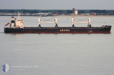
ARUNA ISMAIL
Bulk Carrier
Current Trip
NG LOS
| Time Travelled | 8 h, 59 mins |
|---|---|
| Remaining Time | --- |
| Distance Travelled | 100.41 nm |
| Remaining Distance | --- |
| AVG Speed | 11.3 Knots |
| MAX Speed | 13 Knots |
| AVG Wind | 7.3 knots |
| MAX Wind | 9.9 knots |
| MIN Temp | 23.1°C / 73.58°F |
| MAX Temp | 25.3°C / 77.54°F |
| Draught | 12.6 m |
| Position Received | 17 d ago |
Current Position
| Longitude | 3.35967° |
|---|---|
| Latitude | 6.43163° |
| Status | Moored |
| Speed | |
| Course | 275° |
| Area | North Atlantic Ocean |
| Station | T-AIS |
| Position Received | 17 d ago |
Info
Information
The current position of ARUNA ISMAIL is in North Atlantic Ocean with coordinates 6.43163° / 3.35967° as reported on 2024-03-29 17:04 by AIS to our vessel tracker app. The vessel's current speed is 0 Knots
The vessel ARUNA ISMAIL (IMO: 9637296, MMSI: 538004999) is a Bulk Carrier that was built in 2013 ( 11 years old ). It's sailing under the flag of [MH] Marshall Is.
In this page you can find informations about the vessels current position, last detected port calls, and current voyage information. If the vessels is not in coverage by AIS you will find the latest position.
The current position of ARUNA ISMAIL is detected by our AIS receivers and we are not responsible for the reliability of the data. The last position was recorded while the vessel was in Coverage by the Ais receivers of our vessel tracking app.
The current draught of ARUNA ISMAIL as reported by AIS is 12.6 meters
Weather
| Temperature | 23.1°C / 73.58°F |
|---|---|
| Wind Speed | 6 knots |
| Direction | 264° W |
| Pressure | 1011.7 hPa |
| Humidity | 85.4 % |
| Cloud Coverage | --- |
Featured Company
Last Port Calls
| Port | Arrival | Departure | Time In Port |
|---|---|---|---|
| 2024-04-14 11:23 | 2024-04-15 23:52 | 1 d | |
| 2024-03-31 14:32 | 2024-04-08 08:00 | 7 d | |
| 2024-03-19 10:48 | 2024-03-30 18:44 | 11 d | |
| 2024-02-20 12:31 | 2024-02-27 09:02 | 6 d | |
| 2024-02-11 15:20 | 2024-02-12 15:37 | 1 d | |
| 2024-02-04 17:20 | 2024-02-08 12:25 | 3 d |
Most Visited Ports (Last year)
| Port | Arrivals | |
|---|---|---|
| 2 | ||
| 1 | ||
| 1 | ||
| 1 | ||
| 1 | ||
| 1 |
Last Trips
| Origin | Departure | Destination | Arrival | Distance | |
|---|---|---|---|---|---|
| 2024-04-08 09:00 | 2024-04-14 11:23 | 1496.50 nm | |||
| 2024-03-30 19:44 | 2024-03-31 15:32 | 184.36 nm | |||
| 2024-02-27 11:02 | 2024-03-19 11:48 | 5259.54 nm | |||
| 2024-02-12 16:37 | 2024-02-20 14:31 | 2342.50 nm | |||
| 2024-02-08 13:25 | 2024-02-11 16:20 | 139.37 nm | |||
| 2024-01-12 14:54 | 2024-02-04 18:20 | 5310.34 nm |
Events
| Time | Event | Details | Position / Dest | Info |
|---|---|---|---|---|
| 2024-04-15 23:52 | PORT DEPARTURE |
|
10.62663 / -14.63602
NG LOS
|
Speed: 5.2 kn Course: 198° |
| 2024-04-15 23:44 | START Moving |
10.63745 / -14.63253
[GN] KAMSAR
|
Speed: 3.7 kn Course: 200° |
|
| 2024-04-14 11:23 | PORT ARRIVAL |
|
10.64174 / -14.62920
[GN] KAMSAR
|
Speed: 1 kn Course: 200° |
| 2024-04-13 15:05 | STOP Moving | 0.49 nm, West of KAMSAR |
10.63493 / -14.63606
NG LOS
|
Speed: 0.1 kn Course: 25° |
| 2024-04-13 11:55 | START Moving |
10.28477 / -14.81475
NG LOS
|
Speed: 4.3 kn Course: 115° |
|
| 2024-04-13 10:39 | STOP Moving |
10.28901 / -14.81620
NG LOS
|
Speed: 0.1 kn Course: 180° |
|
| 2024-04-08 18:03 | START Moving | 16.7 nm, South West of ESCRAVOS |
5.40771 / 5.00608
NG LOS
|
Speed: 3.4 kn Course: 227° |
| 2024-04-08 16:28 | STOP Moving | 17.11 nm, South West of ESCRAVOS |
5.39211 / 5.01273
NG LOS
|
Speed: 0.2 kn Course: 253° |
| 2024-04-08 08:00 | START Moving | 0.88 nm, West of WARRI |
5.51882 / 5.71058
NG LOS
|
Speed: 6.5 kn Course: 326° |
| 2024-04-08 08:00 | PORT DEPARTURE |
|
5.51882 / 5.71058
NG LOS
|
Speed: 1.1 kn Course: 316° |