
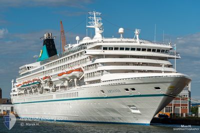
ARTANIA
Passengers Ship
Current Trip
AE DJF
| Time Travelled | --- |
|---|---|
| Remaining Time | --- |
| Distance Travelled | --- |
| Remaining Distance | --- |
| AVG Speed | --- |
| MAX Speed | --- |
| AVG Wind | --- |
| MAX Wind | --- |
| MIN Temp | --- |
| MAX Temp | --- |
| Draught | 8 m |
| Position Received | 1 h, 58 m ago |
Current Position
| Longitude | 56.83250° |
|---|---|
| Latitude | 25.89798° |
| Status | Under way using engine |
| Speed | 19.5 Knots |
| Course | 337.7° |
| Area | Gulf of Oman |
| Station | T-AIS |
| Position Received | 1 h, 58 m ago |
Info
Information
The current position of ARTANIA is in Gulf of Oman with coordinates 25.89798° / 56.83250° as reported on 2024-04-19 18:06 by AIS to our vessel tracker app. The vessel's current speed is 19.5 Knots
The vessel ARTANIA (IMO: 8201480, MMSI: 311000608) is a Passengers Ship that was built in 1984 ( 40 years old ). It's sailing under the flag of [BS] Bahamas.
In this page you can find informations about the vessels current position, last detected port calls, and current voyage information. If the vessels is not in coverage by AIS you will find the latest position.
The current position of ARTANIA is detected by our AIS receivers and we are not responsible for the reliability of the data. The last position was recorded while the vessel was in Coverage by the Ais receivers of our vessel tracking app.
The current draught of ARTANIA as reported by AIS is 8 meters
Weather
| Temperature | 24.8°C / 76.64°F |
|---|---|
| Wind Speed | 2 knots |
| Direction | 333° NNW |
| Pressure | 1008.7 hPa |
| Humidity | 73 % |
| Cloud Coverage | --- |
Featured Company
Last Port Calls
| Port | Arrival | Departure | Time In Port |
|---|---|---|---|
| 2024-04-18 08:09 | |||
| 2024-04-12 00:58 | 2024-04-12 18:10 | 17 h | |
| 2024-04-11 02:10 | 2024-04-11 14:31 | 12 h | |
| 2024-04-05 21:02 | 2024-04-06 09:53 | 12 h | |
| 2024-04-03 22:31 | 2024-04-05 06:14 | 1 d | |
| 2024-03-31 23:53 | 2024-04-01 12:55 | 13 h | |
| 2024-03-25 22:33 | 2024-03-28 11:05 | 2 d | |
| 2024-03-24 00:04 | 2024-03-24 14:13 | 14 h | |
| 2024-03-16 21:58 | 2024-03-17 11:25 | 13 h | |
| 2024-03-12 20:48 | 2024-03-14 11:12 | 1 d |
Last Trips
| Origin | Departure | Destination | Arrival | Distance | |
|---|---|---|---|---|---|
| 2024-04-12 23:40 | 2024-04-18 12:09 | 1902.58 nm | |||
| 2024-04-11 20:01 | 2024-04-12 06:28 | 144.63 nm | |||
| 2024-04-06 17:53 | 2024-04-11 07:40 | 1442.98 nm | |||
| 2024-04-05 14:14 | 2024-04-06 05:02 | 203.86 nm | |||
| 2024-04-01 19:55 | 2024-04-04 06:31 | 686.73 nm | |||
| 2024-03-28 19:05 | 2024-04-01 06:53 | 1058.83 nm | |||
| 2024-03-24 22:13 | 2024-03-26 06:33 | 501.76 nm | |||
| 2024-03-17 20:25 | 2024-03-24 08:04 | 1311.02 nm | |||
| 2024-03-14 20:12 | 2024-03-17 06:58 | 511.72 nm | |||
| 2024-03-11 18:13 | 2024-03-13 05:48 | 309.59 nm |
Events
| Time | Event | Details | Position / Dest | Info |
|---|---|---|---|---|
| 2024-04-19 18:09 | Status Changed | Default Under way using engine |
25.91260 / 56.82581
AE DJF
|
Speed: 19.5 kn Course: 337.7° |
| 2024-04-19 18:06 | OUT of Coverage |
25.89798 / 56.83250
Gulf of Oman
AE DJF
|
Speed: 19.5 kn Course: 337.7° |
|
| 2024-04-19 17:59 | Change Sea Area | Omani part of the Gulf of Oman Iranian part of the Gulf of Oman |
25.85939 / 56.84389
Gulf of Oman
AE DJF
|
Speed: 19.7 kn Course: 348° |
| 2024-04-19 15:11 | Destination Changed | AE DJF MY PKG |
25.09494 / 57.33754
AE DJF
|
Speed: 18.6 kn Course: 322.7° |
| 2024-04-19 15:11 | ETA Changed | 2024/04/20 05:00 2024/04/05 20:30 |
25.09494 / 57.33754
AE DJF
|
Speed: 18.6 kn Course: 322.7° |
| 2024-04-19 15:10 | Detected in Sea | Iranian part of the Gulf of Oman |
25.09494 / 57.33754
Gulf of Oman
|
Speed: 18.6 kn Course: 322.7° |
| 2024-04-19 15:09 | IN Coverage |
25.09494 / 57.33754
Gulf of Oman
|
Speed: 18.6 kn Course: 322.7° |
|
| 2024-04-18 08:09 | PORT ARRIVAL |
|
23.62667 / 58.56667
[OM] SULTAN QABOOS
|
Speed: 4.3 kn Course: 238° |
| 2024-04-14 12:26 | START Moving |
4.19597 / 73.50701
MY PKG
|
Speed: 8.3 kn Course: 6° |
|
| 2024-04-14 02:26 | STOP Moving |
4.19061 / 73.50912
MY PKG
|
Speed: 0.2 kn Course: 280° |